Acknowledgments:
The compiling of this information
would have been impossible without the
generous help of many friends and
classmates from Wellston High.
Ownership
of The Land:
The "Seven-Mile House occupied land
within present day Wellston, St. Louis
County, Missouri. Ownership of the
land can be traced back to Peter
Saffray's Land Grant Survey 2684
of the early1800s, which
covered most of the present city of
Wellston north of the Road to St.
Charles, (later the St. Charles
Rock Road).
Prior to
1868. Charles
Salzman purchased a portion of Survey
2684, that can be described as "location,
location, location".. He had it
all. Farm, truck garden, grocery
store, water, and "Dram Shop" on the
first good rest stop west of St. Louis.
This was when "Trails West" meant
using the Overland Trail or the National
Road to go West. The St. Louis and
St. Louis County part of the National
Road was Franklin Avenue to Easton Avenue
to St.
Charles Rock Road. Up to 40
wagons a day were going west to St.
Charles. This location had two horse
drawn street car
lines stopping at the Seven mile house.
Eden Seminary was across the
street on the west and an Ice House and
later a Allhoff Feed Store on the south.
Two large cemeteries also drew customers
to Salzman's store and tavern.
Below is an 1868
Atlas Map of interest to Wellston Alumni
Marked in yellow
is Chas. Salzman's Seven-Mile House &
Geo Rinkel's Six-Mile House. Just west
of Rinkel's
property is the Kienlen Family,
about 79 Acres, now divided showing Mary
L Kienlen name (widow) and the other
four names, which are son-in-law surnames.
On the South side of St. Charles Rock
Road is the E. F Hutchinson property.
This land will include Evergreen, Ridge,
Barnes (Wells), and part of Ogden.
Wellston High School, and Grace Lutheran
Church are on this land. (see
1878 sale adv. on page 2)
The John Watson extended family owned
most of Wellston south of this area.

 1893
Advertisment St. Louis, Co., MO
Directory 1893
Advertisment St. Louis, Co., MO
Directory
The Salzman property was divided and 1.7
Acres was sold to Ernst and Mina Eckert.
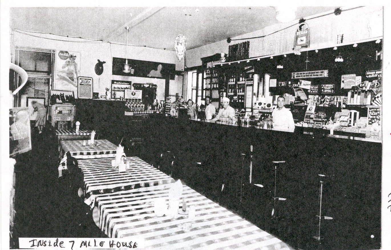
They ran the
store, restaurant and tavern as the
Seven-Mile House.
Later they rented the
business to the August Kissner Family. In 1938, Charles and Margaret Schuchmann and family first rented the
Grocery store, then later both of the attached
stores, and lived upstairs over the
restaurant/tavern and store.
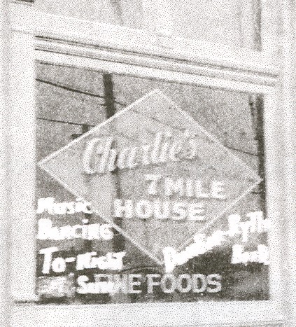
It was known as Charlie's Seven Mile
House. The Grocery store and the tavern
were combined, and the entire first
floor was now a tavern and restaurant.
It became a popular place for dancing
with a three piece band performing seven
nights a week.
In 1943
the business was purchased by John
Vitale and renamed "Johnnie's Seven mile
House. In 1956 the Seven Mile
House was razed and replaced by a Gas
Station. That was the end of 100 years of history for the Seven Mile House.

The
retail business opportunities for this
area changed quickly after WWII.
Factories closed or moved.
Interstate highways greatly reduced the
use of St Charles Rock Road. The peak
of population for Wellston was 1950. It
then dropped rapidly as returning
veterans moved to outlying
subdivisions. The older buildings of the
early 1900s were not a good investment
to improve or replace. Businesses
moved westward to the Strip malls and
Shopping Centers. Urban blight
began slowly at first, then rapidly. Soon
the area was an Urban "Ghost town".
By the 1960s the town was cycling back
to open spaces and the population
continued a downward spiral as residents
and employment were migrating westward away
from St. Louis.

ca 1934-1950 Map, Click to enlargeMore Information of
The Historical St. Charles Rock Road
http://www.cityofstjohn.org/history.html
http://www.breckenridge-hills.mo.us/History2.htm
What does the old "Seven Mile House"
location look like in 2008?
See below.

See Part Two, More Photos and News
clippings! Click Here
|