TOYAH
Reeves County, TX
By
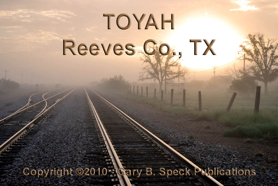
FINDING TOYAH, TEXAS was a true moment of serendipity. I was heading home from my 10-day Texas ghost
town tour and the weather was hot and extremely humid. So much so, that heavy ground fog greeted me
about a half mile east of I-20’s EXIT 22, some 20 miles west of Pecos. I had TOYAH marked on my map as a town of
100, and did no research prior to visiting as I had not planned to visit
it. But when I saw the exit I needed to
get off the Interstate. I didn’t feel
safe driving 80 MPH in the fog, nor going slower for
fear of being rear-ended. Therefore,
when I saw the exit, I bailed – right into The
Twilight Zone!
Remember
that old TV show? That’s about how I
felt when the first
ruins loomed out of the fog. What
I saw in TOYAH made my little old ghost towner’s
heart go pitty pat.
This place is a true gem. In a
little over an hour, I shot 110 photos (gotta love
digital!) in the lifting fog. After
doing some research when I got home, I’m happy I did get to stop. I really would have liked to visit here a
decade ago, but…
Woulda-shoulda-couldas are like hindsight – 20-20. (There’s a
lesson there!) Maybe this is the reason
I’ve become so passionate about photographing and preserving the stories of
these old towns. They are disappearing
way too fast.
Officially
in 2010, Toyah had a population of 90.
Where they all were at the time of my visit, I have no idea. Only a few of the houses looked occupied. In 2000, only 47 of the 72 housing units were
occupied, a 65% occupancy rating. In
2010 there were only 44 occupied out of 51.
21 housing units have “disappeared” off the census bureau listing. Population trends for Toyah are truly
telling:
·
1910 –
771
·
1920 –
1100 (est)
·
1931 –
553
·
1940 –
464
·
1970 –
245
·
1980 –
165
·
1990 –
115
·
2000 –
100
·
2010 –
90.
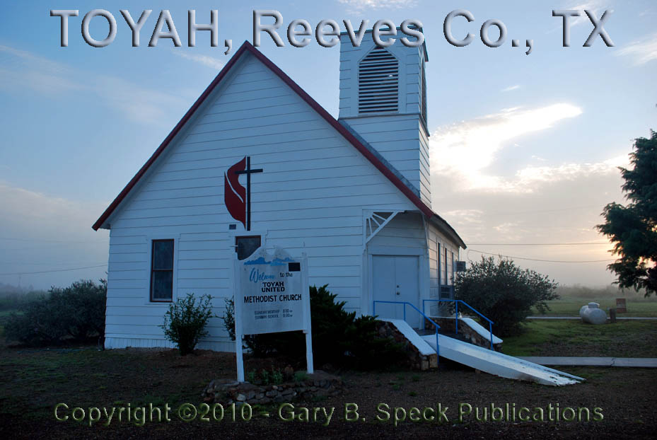
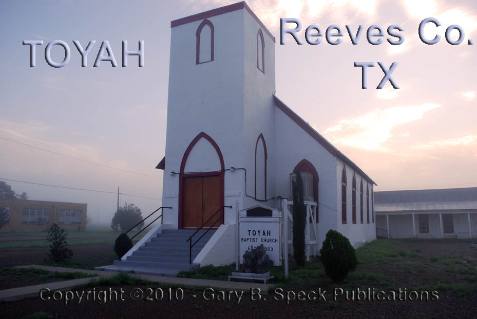
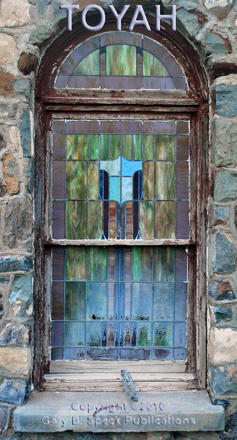
There are
three churches in town that appear to be still active: United
Methodist, Catholic
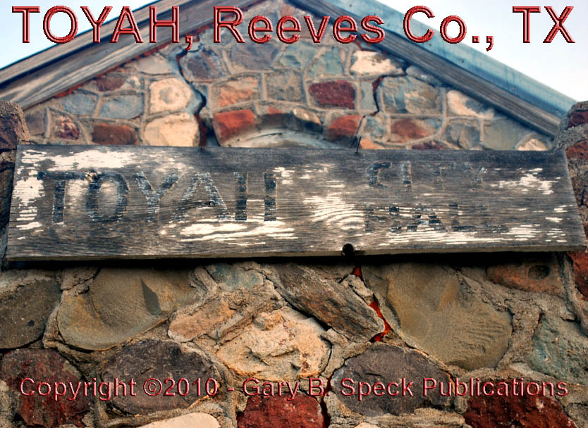
and a Baptist (built in 1903). There is also a City Hall that appears like it might still be active, although it
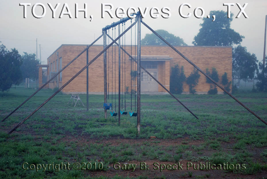
was closed at the time of my EARLY Sunday morning visit. The City Hall occupies a former grammar
school, complete with a tennis
court and some playground
equipment.
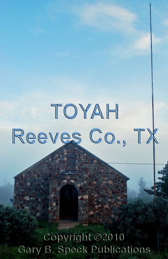
Nearby is an abandoned
City Hall that was housed in the former Toyah
Christian Church. In 1991, this building also served as the
Community Center.
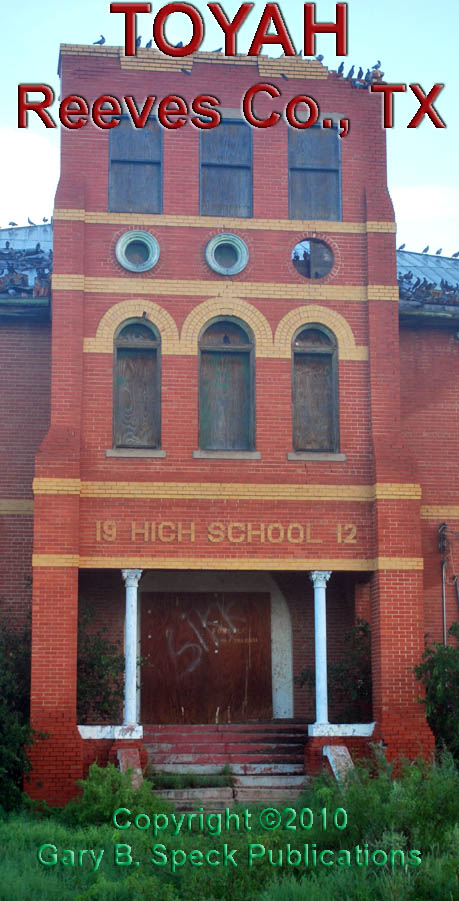
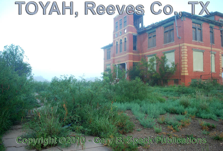
Standing
guard over the entire town is the hulking, empty high
school building, now home only to hundreds of flying rats
(pigeons)! To the east, across the
street from the high school is the “Old” cemetery, which I didn’t see due to
the fog and high weeds. Even if I would
have seen it, I more than likely would not have ventured in unless there was a open path to it, as I felt a strong lack of desire to wander
through prickly, wet weeds in my shorts.
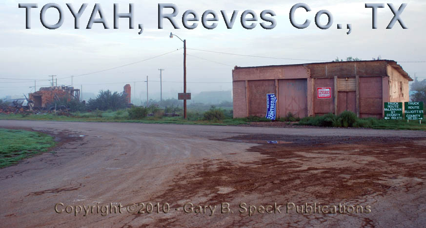
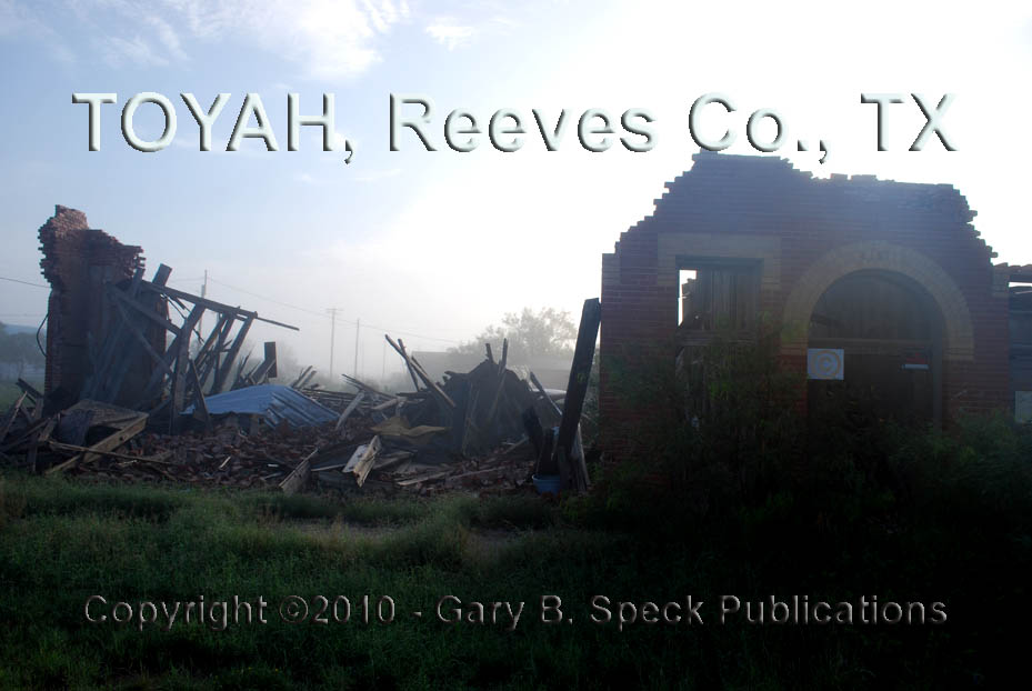
In
“Downtown Toyah”, the majestic brick buildings that still grace some websites
are gone. A couple
were demolished between 2000 and 2003, while another was seriously
“remodeled” by a tornado in 2004. Where
the hotel and store buildings were, is now a vacant, weed-strewn lot. Across the street, to the east, the
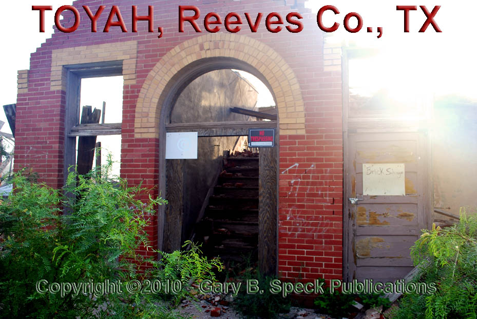
tornado-damaged bank isn’t much more than stubby
walls, a pile of bricks for sale and a stairwell
to nowhere. An antique
car sits near the rubble,
unmoved by the damage caused when the twister slammed the former downtown
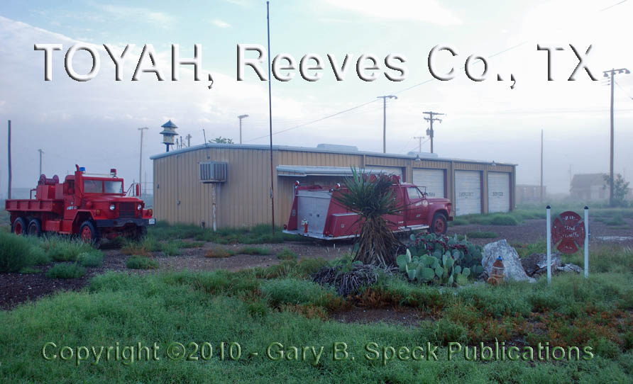
core. The nearby fire
station has a couple of fire trucks sitting outside. They look like they might be operable, but
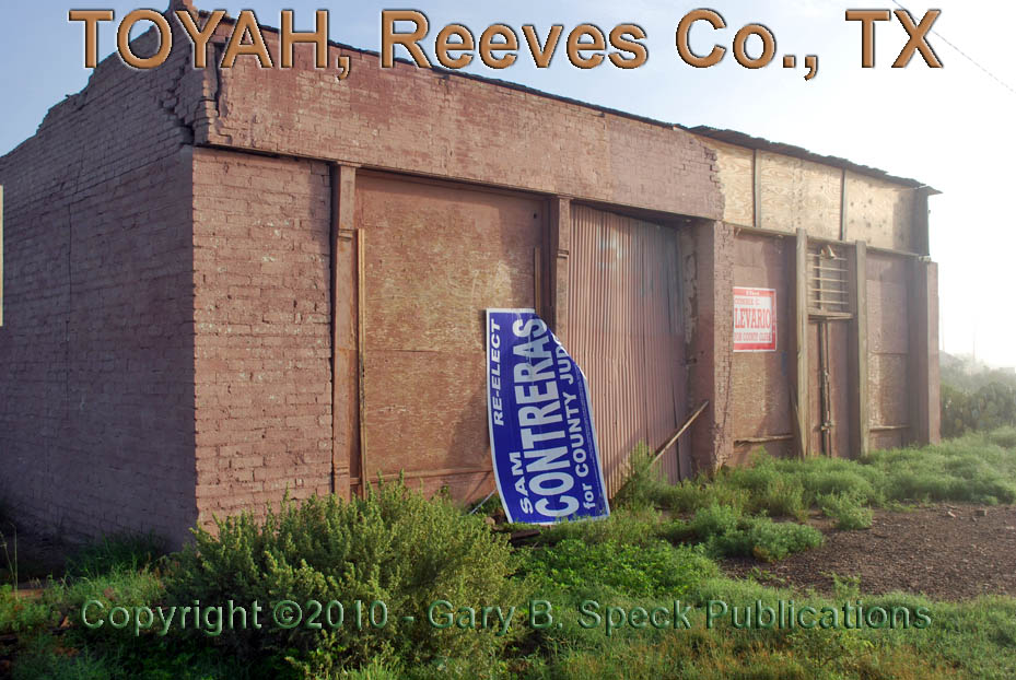
are not currently registered. A couple
other unidentified structures look like they may have been stores
and an automobile repair
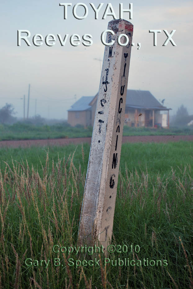
garage. Sidewalks
are being enveloped by the encroaching greenery, three cemeteries are
nearly forgotten, the street names are fading from concrete street
posts, while scads of old houses mostly sit abandoned, now home only to
the ever-present pigeons.
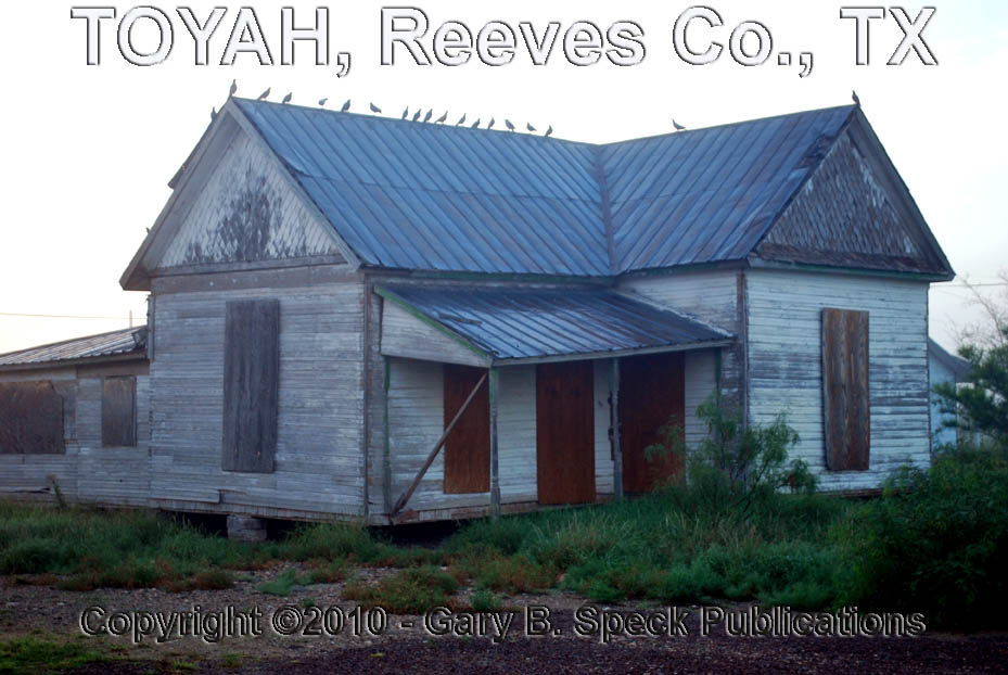
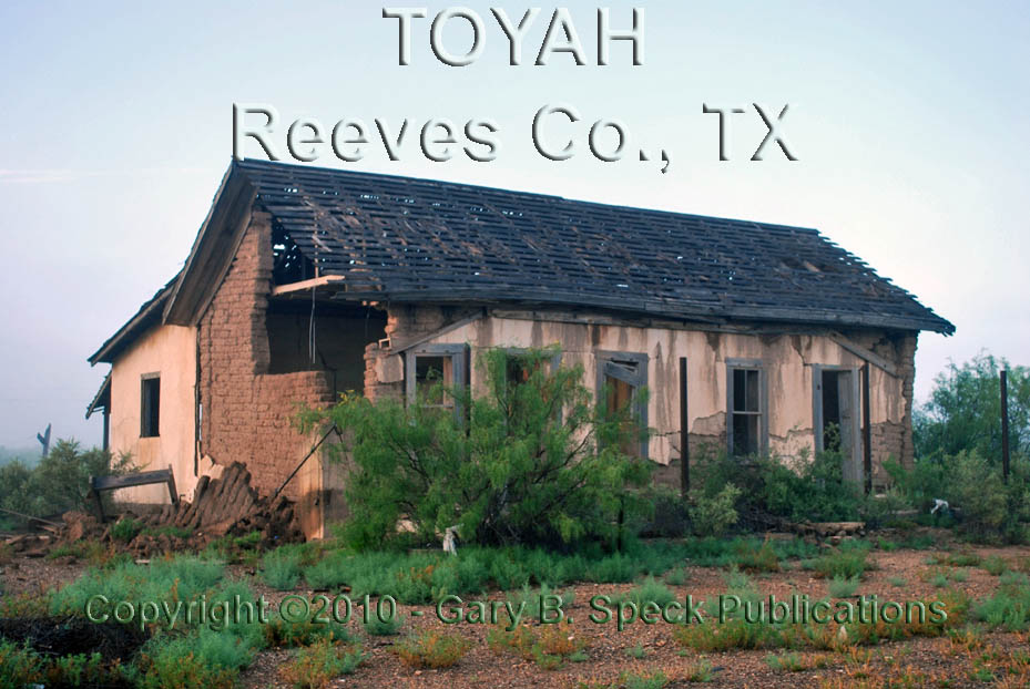
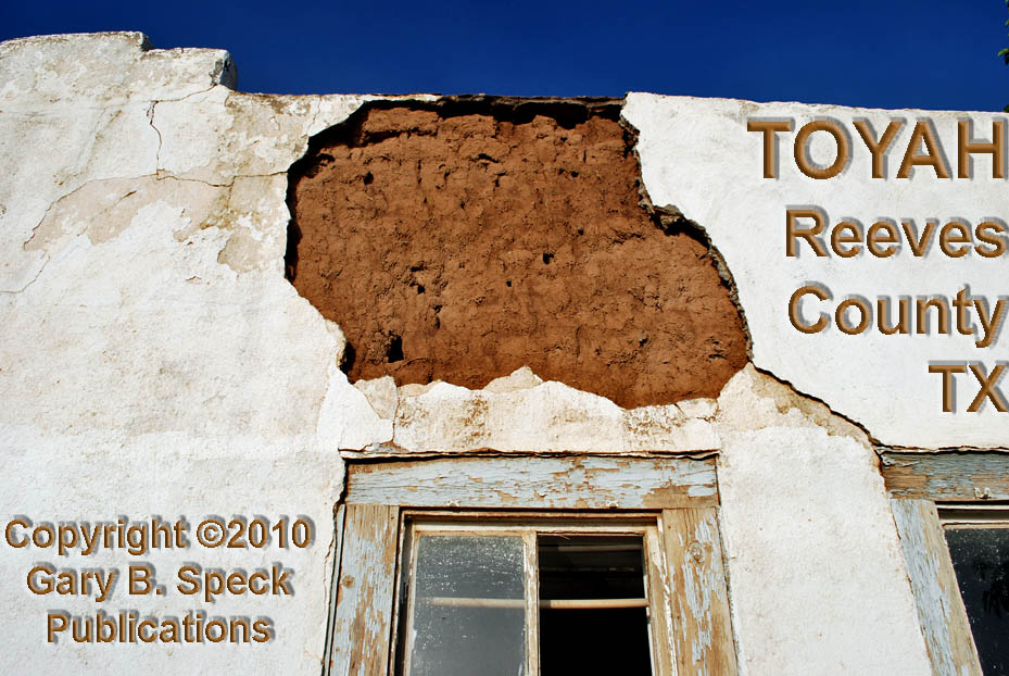
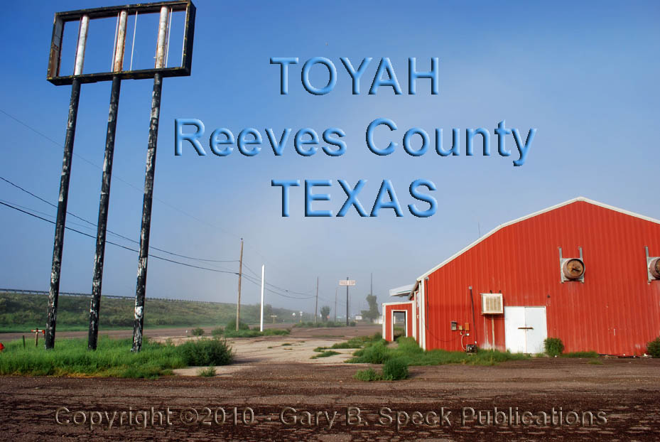
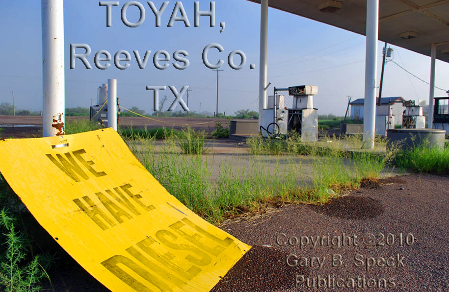
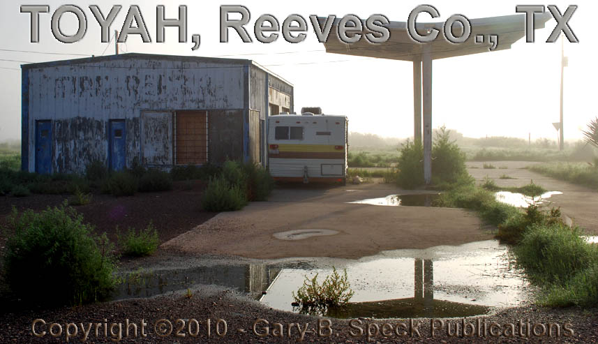
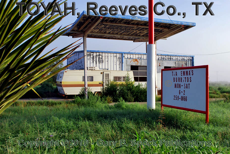
Throughout the rest of town, a general air of decay prevails, illustrated graphically by dead houses, dead stores, and dead signs. Adjacent to the Interstate, more abandoned buildings cluster, once attracting commerce from the Superslab. Crouching behind chain link fencing, an old adobe structure sits quietly, white-washed plaster peeling from the adobe block walls. Across the street to the east, a truck stop/garage and a restaurant/gas station gather only weeds and memories. Just to the east of that, a former gas station/garage now is home to a small trailer with a sign out front advertising “TiA
This
was our Ghost Town of the
Month for August 2010
Latitude:
31.3125058 / 31° 18’ 45” N
Longitude: -103.7946100 / 103° 47’ 41” W
Visit
Ghost Town USA’s Texas Ghost Town Pages
Home Page | Site Map | Ghost Town Listings | On The Road Again | Photo Gallery | Treasure Legends
CURRENT Ghost Town of the Month | PAST Ghost Towns of the Month
Ghost
Towner's Code of Ethics | Publications | Genealogy
| License
Plate Collecting
A
few LINKS to outside webpages:
Ghost
Towns | Treasure
Hunting | License
Plate Collecting | Genealogy
