KENT
Sherman County, OR
By
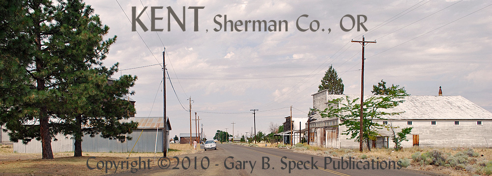
KENT SITS RIGHT ALONG the narrow, two-lane asphalt
ribbon known as US Highway 97, yet most travelers heading south on the road are
not thinking about this wonderful little ghost’s charms, but about their
ultimate destination of SHANIKO. Yet Kent has all the charm, and none of
the commercialization of its larger, more publicized neighbor. This little class D community is well worth a stop because it is
what a ghost town is supposed to be.
Just be sure to get off the highway and see the interesting old false-fronted
buildings lining the back streets of town east of
the highway. It lies about 42 miles south of
Biggs and 13 south of Grass Valley and is not a big presence online or in
print. Before visiting in July 2009, I
had done a little research and found very little useful information online, OR
in all my Oregon resources. I felt this
place would be a prime stop, and I was NOT disappointed. I also had the advantage of visiting a new
(to me) ghost town unbiased, unhindered and unbrainwashed
by other visitors’ impressions and expectations.
The town is only home to about 20 or so
people, and the post office was the only business I saw operating. Unfortunately it is housed in a newer,
non-descript structure. I didn’t stop in
and talk to the postmaster, but now realize I should have. The history of this town is tied to the
railroad and agriculture, and dates back possibly as far as January 1887, when
the post office is SAID to have been established. I have NOT proven that point yea or nay, yet. The name of the town is said to have been
drawn from a hat and Milton H. Bennett was the first postmaster. In conjunction with the boom in nearby Shaniko, the Columbia Southern Railroad built its Biggs-Shaniko Railroad line through the area around 1900. Here the dates differ, but I feel with the early
development at Cross Hollows/Shaniko it is very
possible the community could have developed prior to the railroad as it is rich
agricultural land. But the best
possibility is that Kent developed around the railroad, especially since the
old steam engines of that day needed stops every 6-10 miles, which would have
been perfect. In any case, the railroad
opened and Kent boomed. In the mid
1920s, US Highway 97 was built along the western edge of the town bringing
traffic and road-related businesses. All was well until the 1930s. The Union Pacific Railroad bought out the
Columbia Southern and as rail traffic decreased, closed the Kent to Shaniko
portion of the road, leaving Kent the southern terminus. Somewhere after 1943, the rails were pulled
all the way to Grass Valley. Kent lost
its rail connection, withered and has nearly died.
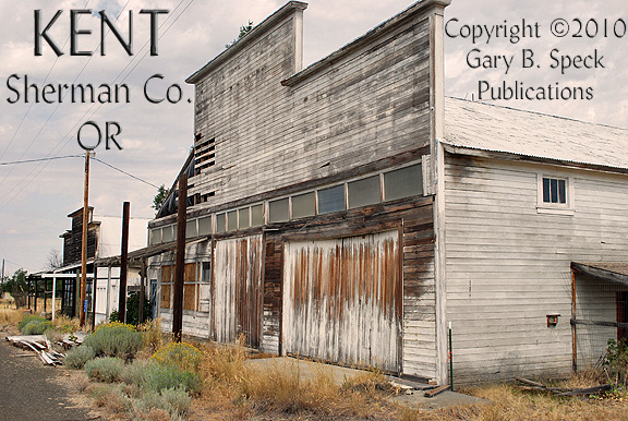
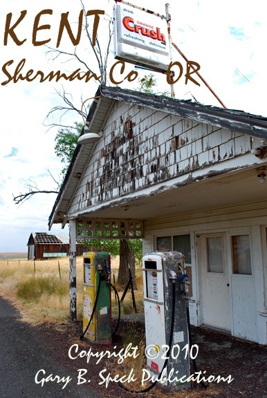
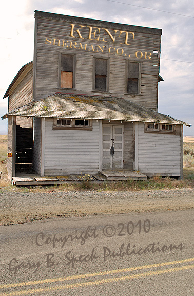
As mentioned above, Kent is well worth a
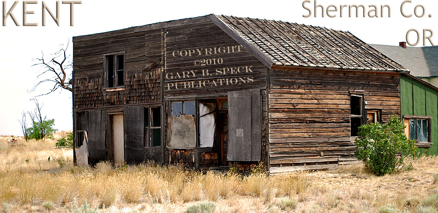
stop. It has a colorful collection of
old buildings, and is very
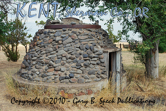
photogenic. Some of the buildings include: houses, a
small rock-domed
structure that
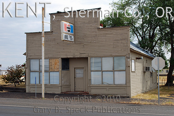
once housed the town’s electrical generator, a dead gas
station/café,
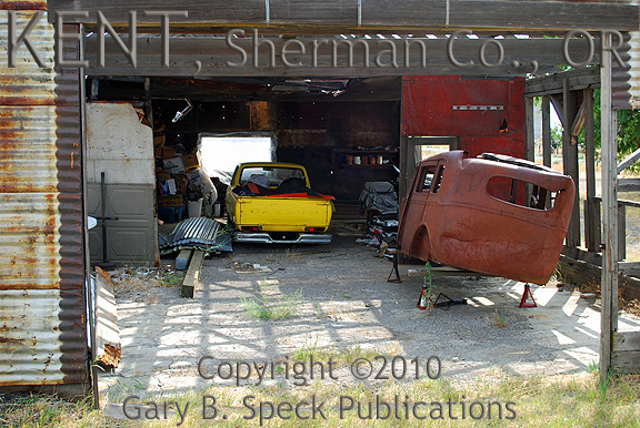
a crumbling garage, a former automobile repair shop, another roofless
garage with
several abandoned cars and a closed restaurant.
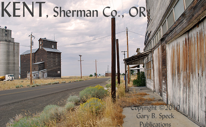
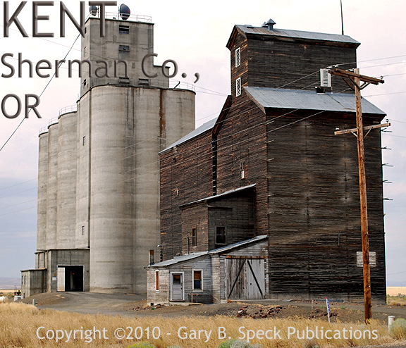
From the restaurant, follow the side road east into the heart
of old Kent. The former railroad grade is still highly
visible and marked by a pair of massive grain
elevators. Lining the road are dead, forgotten
businesses. Most of the desiccated
buildings are falling victim to the elements.
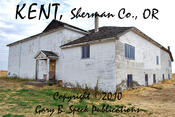
Some of the buildings here include: what appears to be an old lodge
hall sitting
across the street from the post office, the old school
building,
an active Baptist Church and the aforementioned grain elevators. The concrete one is owned and operated by
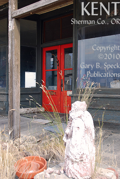
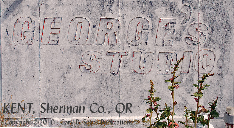
Mid-Columbia Grain Growers, and the wooden one is no longer in use. A couple of the old buildings have been used
as art
studios or
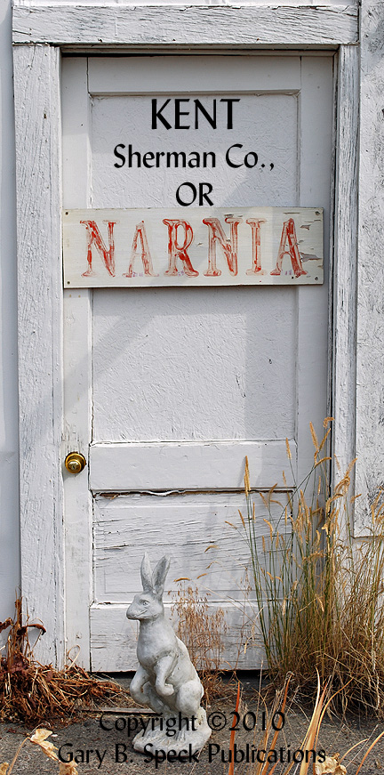
galleries, but even that use seems to have been forgotten. Faded signs for George’s
Studio and
Narnia
decorate the dead buildings. A few
homes round out the community. Some are
vacant, some occupied. The long abandoned railroad grade zips past the
elevators to a “Y” turnaround and arrows south towards Shaniko.
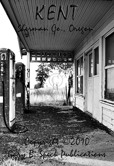
Time has not been kind to the economics of Kent,
as the garages are abandoned, the gas
station/store
long closed and the restaurant
probably
shut down, although from the outside it still looks useable. The old
lodge building also
appears usable. The few remaining
residents keep a sharp eye on the town, helping it to avoid the fate of
vandalism suffered by so many other fading and ghosted towns. Today, only ghosts flit about the empty
stores, sit
on the porch
of the gas station waiting for non-existent customers and enjoy some of the
artistic touches inside and outside.
As always,
please abide by any sign postings and respect the rights of the building and
land owners.
This was our Ghost
Town of the Month for December
2010.
LOCATION:
·
NE¼
Sec 28, T4S, R17E, Willamette Base Line
& Meridian
·
Latitude: 45.1951258 / 45° 11’ 42” N
·
Longitude: -120.6942154 / 120° 41’ 39” W
***************
Visit Ghost Town USA’s OREGON
Ghost Town Pages
Also visit: Ghost Town USA’s
Home
Page | Site Map | Ghost Town Listings
| On The Road Again | Photo Gallery
| Treasure
Legends
CURRENT Ghost Town of the
Month | PAST Ghost Towns
of the Month
Ghost Towner's
Code of Ethics | Publications | Genealogy
| License
Plate Collecting
A few LINKS to outside webpages:
Ghost
Towns | Treasure
Hunting
| License
Plate Collecting | Genealogy
***

***
THIS PAGE
FIRST POSTED: December 06,
2010
LAST UPDATED: January 09, 2011
**************
This
website and all information posted here-in is
copyright
© 1998-2015
by Gary B Speck Publications
ALL rights reserved