DEER CREEK
Grant
Co., OKLAHOMA
by
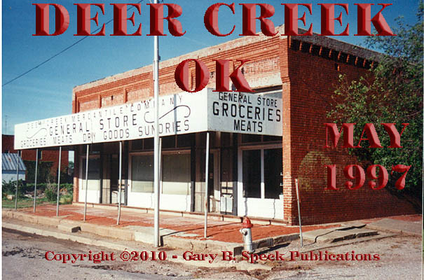
THE HOT OKLAHOMA SUN beats
down on the battered, sagging, wooden canopy in front of the long-closed Deer
Creek General Store. Weeds and grass overrun brick sidewalks
underneath sagging
canopies.
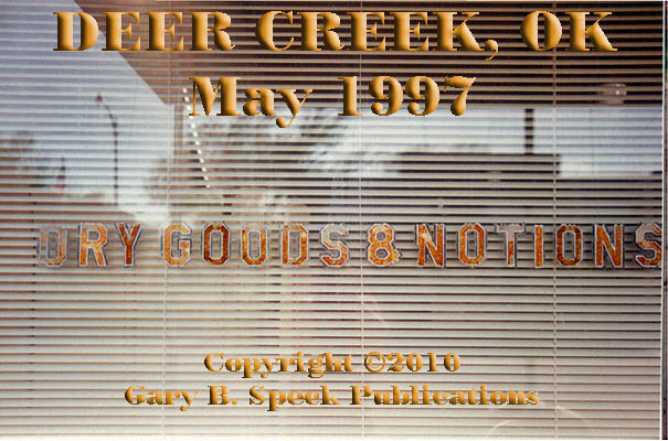
Unreadable advertisements flake off of weathered brick walls and still
glitter on windows
on empty buildings lining Deer Creek’s Main
Street. Only a few birds and the flapping of the
Post Office flag break the ghostly silence.
When founded in 1894, the wheat-farming town of
In 1930 the
town’s population peaked at 312. Since
then it has steadily decreased, to 147 in 2000, and about 128 folks now. Half
of those are members of the still-active
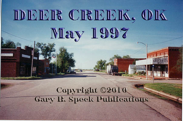
The business district is located about a
half mile south of the state highway and stretches a couple blocks. It is composed of a collection of unoccupied
buildings, vacant spaces and the still operating post office, three churches,
school, Deer Creek Town Hall & Fire Department and the Clyde Co-Op Deer
Creek Elevator. Remains of the “good-ole
days” include: another church, and along the west
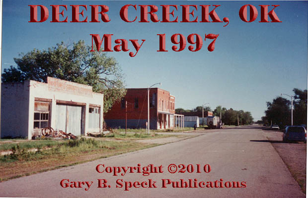
side of
Main Street: the solid brick automobile garage/dealership,
a pair of joined two-story brick
structures (one of which looks like it may have been a
hotel), the Deer Creek Mercantile Company
General Store (purveyors of groceries, meats, dry goods, and
sundries), a small red false-fronted clothing
store, the dark, brown brick Trust Worthy
Hardware store and an unidentified, saggy-roofed wooden false-front sleeping
under the shade of a huge tree. About half the
homes are vacant, and the only activity seems to center around an
automobile repair garage/gas station on the state highway.
Today, silence
reigns in Deer Creek, another slowly fading class D agricultural
town in
It is located
13 miles south of the Oklahoma-Kansas state line, ten miles west
of I-35 and 13.5 miles west of Blackwell, 1.8 miles east of the junction of SH 11/74. A few
buildings line SH 11, but the bulk of the town lies about 0.3 miles south of
the highway.
LOCATION:
·
Latitude: 36.8058631 / 36° 48’ 21” N
·
Longitude:
-97.5194922 / 97° 31’
10” W
This
was our Ghost Town of the
Month for February 2010.
***************
Visit Ghost Town USA’s OKLAHOMA
Ghost Town Pages
Also visit: Ghost Town
Home
Page | Site Map | Ghost Town Listings
| On The Road Again | Photo Gallery
| Treasure
Legends
CURRENT Ghost Town of the
Month | PAST Ghost Towns
of the Month
Ghost Towner's
Code of Ethics | Publications | Genealogy
| License Plate
Collecting
A few LINKS to outside webpages:
Ghost
Towns | Treasure
Hunting | License
Plate Collecting | Genealogy
***

***
THIS
PAGE
FIRST
POSTED: February
02, 2010
LAST
UPDATED: March 01, 2010
**************
This
website and all information posted here-in is
copyright
© 1998-2015
by Gary B Speck Publications
ALL rights reserved