A
Magic Mining City - TONOPAH, Nevada
By
Gary B. Speck
TONOPAH!
That word rings of silver, silver and more silver. Tonopah was one of the magic mining cities
that exploded into being almost overnight across the southern Nevada Desert
during the first decade of the 20th Century. Ever since the Comstock Lode and its main
support town of VIRGINIA CITY burst into the
Nation’s news in the latter half of the 19th Century, almost every
silver boom town compared itself to The Comstock! Tonopah probably came
the closest to being the second Comstock with around $150 MILLION in silver
being pried from the desert soil – the second richest silver mining town in the
state.
Tonopah’s beginning started almost in the
stereotypical way.
There was the desert prospector and his
partners.
There was the burro.
There were skeptics, and optimists.
The discovery of silver at Tonopah followed
the West’s most typical pattern. ALL except for two.
1. The
date of discovery IS well known.
2. The
prospectors didn’t give away their claim in some drunken stupor. They held on and profited mightily.
It all began with a BELMONT
area rancher named Jim Butler. He was
not down-on-his-luck, but just enjoyed prospecting. He was down in the Tonopah area when one of
his burros wandered off. At least the gist of the most popular story of the discovery. Anyway, when he found the critter, he also
discovered a rich outcropping of silver.
He took several samples, and headed over to a nearby mining camp to show
the samples to some miners and verify if they appeared valuable. They all agreed the samples were worthless
iron ore, so Butler headed back to his ranch.
He contacted Tasker Oddie,
a friend and local attorney. Despite the
nay-saying miners who earlier saw the samples, Oddie
and Butler both agreed the samples were worth assaying, but neither had the
cash available for the work. They knew
Walter Gayhart, a teacher and part-time assayer in
Austin. Gayhart
agreed to do the assay, becoming the third partner, taking a quarter of Oddie’s quarter share.
When the results came back, all three knew
this was a bonanza - 640 ounces of silver and $206 of gold per ton of ore.
The three partners all returned to the
discovery site and staked claims. Due to
the distance from civilization, start-up costs were high, and the three
partners needed capital to begin development of their mines. But, money was tough, so they added a fourth
minor partner, Wilse Brougher,
who was able to loan them a wagon for hauling ore. The four men sacked up a load of ore and
shipped it to a mill in Utah. When the
check for the ore came back, word spread, and the grapevine went into
overdrive. They were quickly surrounded
by other miners and prospectors, all staking claims to try and grab a little
piece of the action. However, in the end
the four partner’s claims were the richest.
In January, 1901, the small mining camp of Butler had 40 men,
and it was soon destined to grow FAST! On April 10, 1901, the Butler Post Office
opened its doors and by summer some 650 folks had arrived. Butler and his three partners decided to
lease out the mines, rather than spend their own limited funds on them. One source calls Butler “the laziest mining tycoon of all time” because he made the original
discovery, then traded partial ownership to his partners and leased out the
property rather than do the physical work himself. Lazy? Or smart?
They had the richest vein, and were smart
enough to know that since development money was not forthcoming, leasing out
the mines for a 25% royalty this was the fastest and easiest method to get to
the businesses of extracting ore without expending large sums of money – AND
still make money. A year after the discovery,
the four men had 130 active leases on their properties!
In October 1901, money came, and the
partners were offered $336,000 for their claims. As the leases were still active, they agreed,
providing the sale would finalize when the leases expired on December 31. That was agreed to, and the sale
consummated. It is said that the leases
produced $4 million the first year, so that plus the sales price, set the
partners up for life! Lazy? I don’t think so! Smart?
You betcha!
Jim Butler’s May 19, 1900 discovery was the
impetus to kick-start Nevada’s fading silver mining industry. In January 1902, the million-dollar Tonopah
Mining Company was incorporated, and mining of Butler and his partners’ former
claims began in earnest. This new mining
company was the impetus for development, and people streamed in by the
thousands. On March 3, 1905, the Post
Office changed its name to reflect the commonly used name of TONOPAH. This boom was the beginning of the last wild
decade of frontier mining, coming on the bootstraps of the general demise of
the Comstock and the die-off of excitement in the Alaska-Yukon gold rush.
Shortly after Tonopah burst onto the scene more rich discoveries rocked Southern
Nevada, each creating instant, modern mining cities where a year previously was
barren desert. GOLDFIELD
followed in 1903, and RHYOLITE
in 1905. T.H. Watkins, in his book, Gold
and Silver in the West, says:
“They (Tonopah, Goldfield & Rhyolite)
were almost reflexive booms – the last twitches
of life in a dream that had
survived more than three hundred years on the North American continent,
but had finally come to its
ending in the deserts of Nevada. The dream was born in myth, and while
it flourished, it caught and
held the imagination of its time and storied our history with the muscular
legends
of a romance unmatched in
American life.”
Even though the mining industry continued
to survive, it was under a much different set of rules, regulations, corporate
entities and the resultant litigation. The old ways and the Old West were dead,
replaced by “civilized” modern ways of doing things. This last gasp, was the
Old West dying with its boots firmly still on its feet!
Tonopah and Goldfield
survived their first decade, and both are much less active and smaller; yet are
still living, breathing towns, and the county seats of their respective
counties. Rhyolite, however, is
a dead husk, a magnificent ghost town filled with picturesque memories.
Under corporate leadership, the TONOPAH mines kicked into high gear,
pumping out millions in silver each year.
The town quickly grew into a booming, modern mining city with brick,
rock and concrete buildings lining the main street. Railroads arrived, and the number of
businesses skyrocketed. Off to the west,
MILLERS
developed into TONOPAH’s milling
center with dozens of mills and hundreds of stamps pounding the ore into
submission. The ore was then shipped out
on railroad lines that spiderwebbed across the
desert.
By the time of the 1910 census, the
excitement level had subsided somewhat and the city’s population had dropped
from an estimated 10,000 people, stabilizing around 3900. Mining companies began erecting mills at TONOPAH, which doomed MILLERS. As production continued to rise, Tonopah
gained importance and as the county seat since 1905, had become the largest
city in southern Nevada.
The mines produced well through the 1920s,
but decline set in during the Depression years of the 1930s. However, in 1942,
they closed for the war effort. Even so,
TONOPAH still had around 2500
people, but something else happened. The
United States Army built an airfield east of town (SEE TONOPAH
ARMY AIR FIELD) and TONOPAH’s
population trebled to some 7500 when around 5000 soldiers arrived to staff the
air field. After the war ended, the
military abandoned the air field, and TONOPAH
faded. It woke up briefly in the 1950s,
housing thousands of military personnel when the Air Force established a secret
nuclear testing base to the south. Once Nellis Air Force Base and the testing ranges became
self-sufficient, the troops that stayed in TONOPAH
moved on-post. TONOPAH again began
to snooze in the warm Nevada sunshine.
It stirred briefly in the early 1980s when the Anaconda Company worked a
huge molybdenum mine off to the north, but the mine closed in 1986. The official census numbers reflect TONOPAH’s ups and downs: 1930 – 2115,
1980 – 1951, 1990 -
3616, 2000 - 2627.
Because of its location at the eastern
junction of a pair of US highways (US 6 & 95) midway between Las Vegas and
Reno, and its significance as County Seat, TONOPAH
has never totally faded. This
magnificent relic of past mining days is a prime example of a class E
town, retaining much of its charm, many empty buildings (including several
multi-story ones), AND a friendly population that relishes the community’s
importance to the state’s history. It is
still the Nye County seat and the largest town in that part of Nevada. The
Chamber of Commerce calls it the “Queen of the Silver Camps,” and that
description still rings true. However,
today’s silver comes from the pockets of those who stop and spend a little time
in this faded queen rather than from deep in the surrounding hills.
I truly enjoyed my visit to this historic
town, walking the nearly deserted main street and visiting the foundations of
once-magnificent mills
to the east.
What’s left to see?
A LOT!
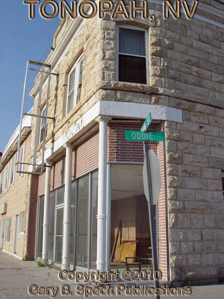
TONOPAH
is privileged to have most of the buildings listed on the National Register of
Historic Places. During the time of my visit on an early Sunday morning, I
pretty much had Main
Street to myself.
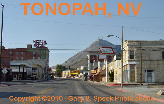
The rising sun warmly illuminated the west
side of Main Street, highlighting chipped
bricks, gouged mortar joints and reflecting off dirty
windows. Utter silence reigned. Faded signs glowed warmly, and even in the
shadows, the ghosts stirred at a long-closed Chevrolet
dealership.
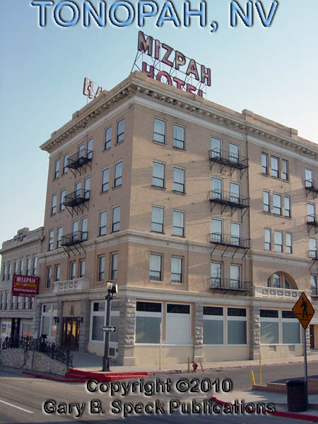
The Mizpah Hotel, built in
1907-1908, and opened in November 1908 to great fanfare is now closed, its
decorative railing still proudly proclaiming the name. The old Masonic
Hall, multi-story apartment
building and Tonopah Liquor Company
buildings sucked up the warm sunshine.
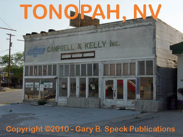
Other unnamed businesses some of which are still open all share a piece
of the past.
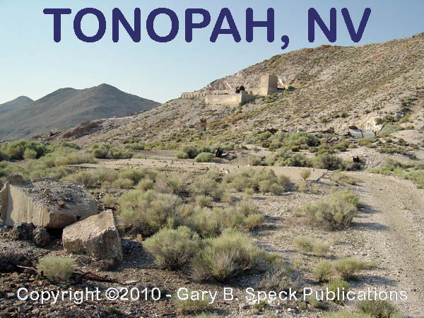
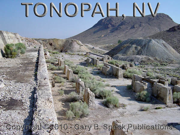
After wandering around downtown, I headed
to the massive foundations of the old Belmont Mill on the east side of the hill
and north of US 6. I’d spotted the ruins
the previous evening on my return trip from Belmont and wanted to explore them
on my way out of town in the morning. This is not a hike for those who are not
at least half-way in shape. Despite the
seemingly minor height of the hills around TONOPAH,
don’t forget that the elevation is over 6000’!
If you’re out of shape, you WILL know it QUICKLY! (Voice
of experience.) If you are able,
hike to the top of Rushton Hill (behind the
mill). TONOPAH lies spread
out at your feet to the southwest, while the
concrete foundations of the Belmont
Mill lie to the east. Unfortunately at the time I was there in
early July 2008, the massive wildfires in California’s Sierra Nevada Mountains
and the normal westerly winds created a pall of eye-watering, lung-burning
smoke throughout the area, which affected the photo opportunities AND my
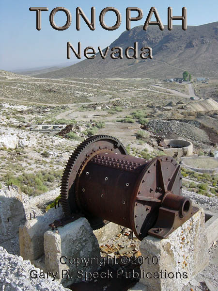
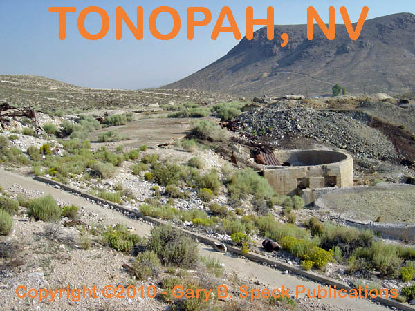
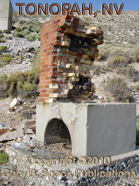
lungs. At the mill are numerous relics
of the old days including an explosives
bunker, winch,
settling
tanks, oven
or kiln, and many foundations
and slabs from the actual mill building.
Despite the smoky skies, it was a very
enjoyable day. The people I ran into
were friendly and open about their love for the town - even the police officer
who kept an eye on me while I was wandering about taking pictures. Every building, every back street, every ruin
exudes history.
|
SITE NAME |
ELEV. |
LATITUDE |
LONGITUDE |
TOWNSHIP/RANGE |
|
Belmont
Mine – milling complex Tonopah |
Approx.
6280’ |
38.070410 |
-117.215677 |
SW¼ Sec 36, T3N, R42E, Mount Diablo
Baseline & Meridian (CA) |
|
Mizpah Hotel – Tonopah |
|
38.068264 |
-117.230676 |
|
|
Rushton Hill – Tonopah |
6365’ |
38.070389 |
-117.217603 |
SW¼ Sec 36, T3N, R42E, MDM |
|
Tonopah - Town Center |
6030’ |
38.0671553 / 38° 04’ 02” N |
-117.2300825 / 117° 13’ 48” W |
S½ Sec 35, T3N, R42E, MDM / N½ Sec 2,
T2N, R42E, MDM |
|
Tonopah - Junction US 6/95 |
6120’ |
38.063103 |
-117.223263 |
NE¼ Sec 2, T2N, R42E, MDM |
This
was our Ghost Town of the
Month for March 2010.
***************
Visit Ghost Town USA’s NEVADA Ghost
Town Pages
Also visit: Ghost Town
Home
Page | Site Map | Ghost Town Listings
| On The Road Again | Photo Gallery
| Treasure
Legends
CURRENT Ghost Town of the
Month | PAST Ghost Towns
of the Month
Ghost Towner's
Code of Ethics | Publications | Genealogy
| License Plate
Collecting
A few LINKS to outside webpages:
Ghost
Towns | Treasure
Hunting | License
Plate Collecting | Genealogy
***

***
THIS
PAGE
FIRST
POSTED: March
01, 2010
LAST
UPDATED: March 31, 2010
**************
This
website and all information posted here-in is
copyright
© 1998-2015
by Gary B Speck Publications
ALL rights reserved