Clark Co., KANSAS
“The Veritable New
by
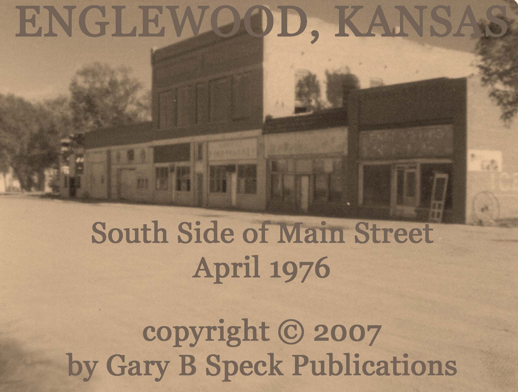
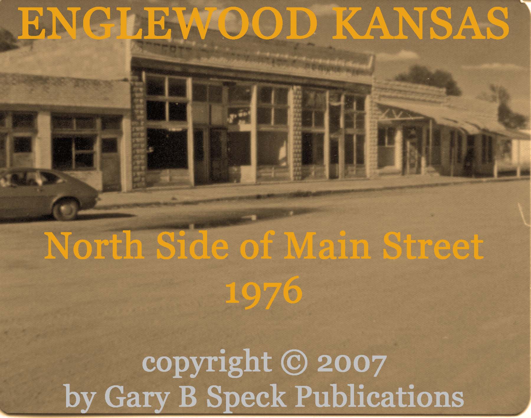
It was a cool April morning in 1976. We were driving north on U.S. 283 from
Surprise! It was (and still is) a small farming
town, BUT the downtown business district was something else!
Running
east of the highway, the 100-foot wide, dirt Main
Street was
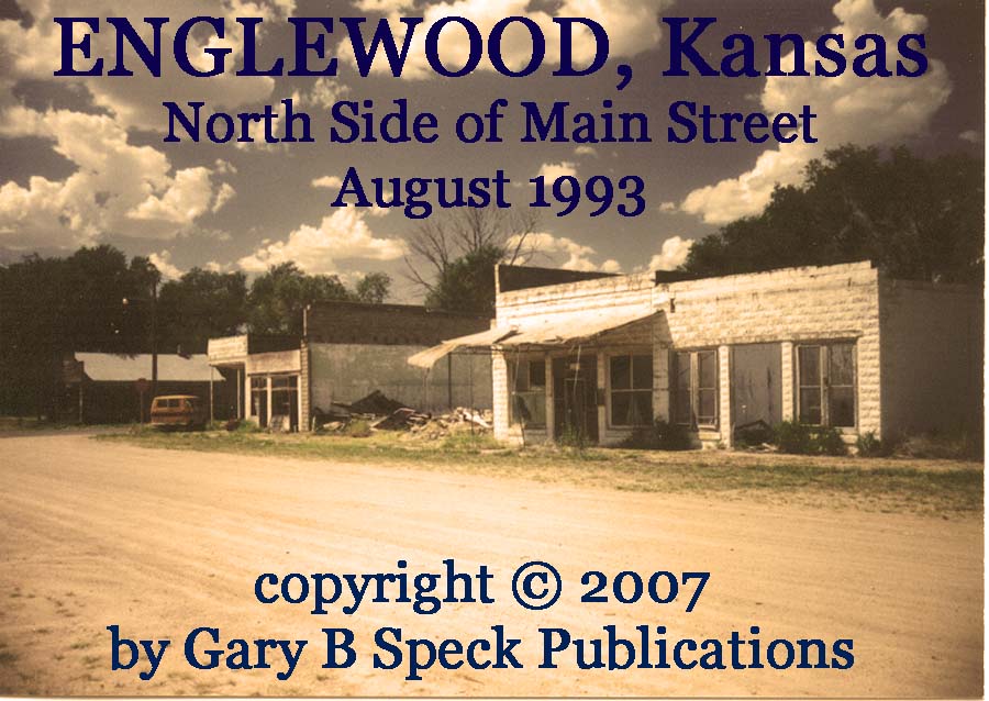
lined nearly solid for two blocks with buildings on both sides of the street.
Nothing unusual, except they were all vacant! Natural brick stores soldiered
along the south
side,
while silver painted masonry stores lined the north
side.
Vacant windows stared out into the cool morning stillness. Here on the southwestern
At that time the town sites were made available to
the public with the following announcement:
"We hereby deed &
convey to the public for public (purposes) use,
all the Streets &
Alleys as
shown or exhibited in the above Plat and
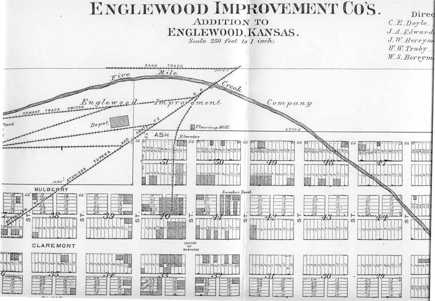
the town shall be known as
the town of
The name
Promotion was heavy, even prior to establishment
of any source of income for its potential citizens. Cattle raising and farming
were developed, and
Throughout its early growth period in l885-l886,
talk of railroads passing through created a lot of outside interest.
In early February, 1886 with the town only a year
old, the Chief reported the following businesses in operation:
·
two
hotels-the Cattle King, and the Englewood House
·
four
dry goods/grocery stores
·
three
drug stores
·
two
lumber yards
·
a
newspaper (first issue April 1885)
·
a
restaurant
·
the
Post office was established Feb 04, 1885
·
many other businesses also listed.
There were also plans to build a church and a
school.
1887 was the peak year for this first boom. Some
5000 residents were counted in the entire county.
There was a prohibition on liquor, and cider was
the hardest drink legally obtainable. There is also no record as to what was
served to the drivers on the road to
In May of 1887, civilization, in the form of a
combination skating rink/opera hall came. It was 50 feet by 20 feet in size,
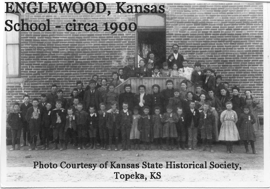
and was available for "any legitimate purpose." The brick school was up at this time, and the
first church building was almost completed.
By
September the railroad was completed and
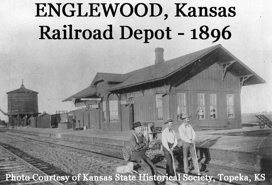
Then a depression began, drought caused
agricultural problems and a general disillusionment and malaise set in. Many
homeowners and smaller farms sold out, or were forced into bankruptcy by virtue
of not being able to make mortgage payments. Many of those unable to meet their
financial obligations just packed up and left. The banks then foreclosed on
these properties. Then many of the banks went under. Land titles became muddied and confused. Many parcels of land were just abandoned,
untitled, or without clear titles. I
have a copy of a plat map that shows many lots and even some blocks of lots, as
"vacated." This land problem coupled with a generally dim economic
outlook caused a mass exodus. Three years previously, people couldn't get to
The
entire county suffered the same fate, and by 1897 only 1140 people remained in
the entire county! Despite the economic downturn, the original 1885 school
was
remodeled in 1897. Then in 1902 another
room was added. In 1910 a new school was built, the old one being converted
into a sanitarium. In 1911 it was
converted again, this time into a residence.
Then in 1934 the 1885 era school, cum sanitarium, cum residence, was
torn down, and the bricks used for the pool area of the city park by the WPA,
an early-day example of recycling! The
1910 school continued in use until 1969, when it closed its doors for the last
time.
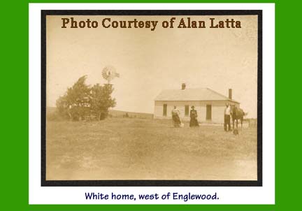
In
1899, bad weather and drought had pretty well wiped out the remaining cattle
and by 1906 most of the big cattle ranches were gone. Colonel Perry still
continued to operate his ranch, and he offered to sell his clear-titled land to
the town to relocate to.
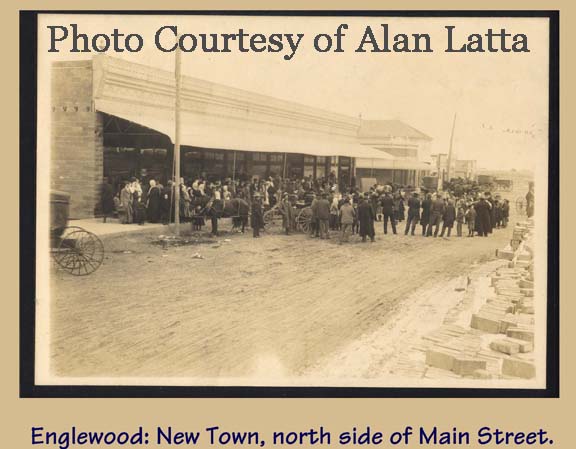
Shortly after selling to the developers of
"New Englewood," Colonel Perry left
Colonel Perry's legacy,
Unfortunately,
many of the residents
of the
original town site did not relocate.
“New”
At
this same time, Samuel (Lehman’s brother?) ran a shoe
repair business
in a single-story storefront on Main Street, adjacent to a couple other stores
such as Peter Schuttler’s Wagons and the H.C Power
& Company two-story store which sold hardware and furniture, and also
offered undertaking! On either side of
the post office, which was located on
A high school was built in 1924-1925, and it
operated until 1966, when it was closed and moved to
In 1959, the last passenger train loaded at
In 1970, the Methodist church closed its doors,
and today, only the Christian Church still has services. It only has about 30
members now!
In
1984 I was researching for a major article on
We
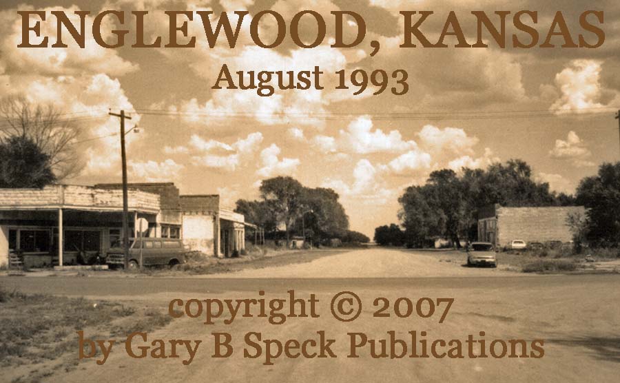
returned in August 1993, while enroute to an
In 2000,
In December 2010 I received an E-mail and photo
from Jim Spencer with some additional information.
“Attached is a photo of Englewood's main street
(Claremont, I believe) taken November
10, 2006, looking east on Claremont across highway 283. The photo is a compilation of two shots taken
seconds apart to get the panorama. When
I was there in the summer of 1958, the area within the red trapezoid was Main
Street USA. I can't remember all of the businesses there,
but there was a bustling café. In fact,
there were two cafés. At any rate, the
block was filled with buildings on both sides of the street.”
(Contributed by Jim Spencer December 10,
2010)
In my 1976 shot above, there are still some
remnants of that once busy street. It’s sad
to see the fading of this once-magnificent town, and I hope this page will help
preserve not only the history of this old town, but share what it has been like
for hundreds if not thousands of other now-badly faded farm towns scattered
across America’s Heartland. What is
still there is often only a tiny piece of the entire story. There's no telling what treasures lie buried
in the dust of the Kansas prairie here, but one thing is certain. This
magnificent ghost from Kansas' past is still standing, albeit only a fragile
shell and tiny portion of the former boom town that it once was.
Today,
ENGLEWOOD is one of the 80
or so towns featured in my newest book, GHOST
TOWNS: Yesterday & TodayTM.
Location:
·
S½ Sec 36, T34S, R25W / N½
Sec 1, T35S, R25W, 6th Principal Meridian and 40° Base Line,
Englewood Twp.
·
Latitude: 37.0355032 / 37° 02’ 08” N
·
Longitude: -99.9863643 / 99° 59’ 11” W
Population figures for
·
1910 - 518
·
1920 - 466
·
1930 - 477
·
1940 - 377
·
1950 – 312 (341)
·
1960 – 262 (243)
·
1970 – 158
·
1980 - 114
·
1990 - 96
·
2000 – 109
·
2010 – 77
·
(1910-1940, and 1950/60 in
parenthesis contributed by Jim Spencer)
SOURCES:
·
W5a
(pg 590)
Many
thanks go to Alan Latta and Jim Spencer for
contributing information and photographs for this article.
Also,
thank you to Alan for contributing a photo for my book: GHOST
TOWNS: Yesterday & TodayTM..
The original, much shorter version of this
article was our GHOST TOWN OF THE MONTH for June 2001.
This completely revised version was
reposted as our Ghost Town of the Month for February 2008.
.
***************
Visit Ghost Town USA’s KANSAS Ghost
Town Pages
Also visit: Ghost Town
Home
Page | Site Map | Ghost Town Listings
| On The Road Again | Photo Gallery
| Treasure
Legends
CURRENT Ghost Town of the
Month | PAST Ghost Towns
of the Month
Ghost Towner's
Code of Ethics | Publications | Genealogy
| License Plate
Collecting
A few LINKS to outside webpages:
Ghost
Towns | Treasure
Hunting | License
Plate Collecting | Genealogy
***

***
THIS
PAGE
FIRST
POSTED: June
01, 2001
LAST
UPDATED: January 26, 2013
**************
This
website and all information posted here-in is
copyright
© 1984-2015
by Gary B Speck Publications
ALL rights reserved