Ghost Town
Guide to
the Ghost Towns, Mining Camps,
and Other
Formerly Inhabited Places in
Locations
beginning with P, Q
PACIFIC MINE
This hard rock gold mine was located in
Hells Hollow, 2.8 miles south of Bagby and 2.9 miles
north of
PADDY McCANN
MINE
This
gold mine was an extension of the Diltz Mine, which
was in the Whitlock
Mining District .
PEA RIDGE SCHOOL
This one-room school was located on
PENDOLA GARDEN MINE
A hard rock gold mine that was located
directly on the Mother Lode vein system.
Location not determined, but it possibly was at or near the
PENDOLA GARDENS
0.8 miles north of the junction of the “Old
Toll Road”/Pendola Gardens Road, 3.5 miles west of
Mt. Bullion, 3.5miles south of Bear Valley.
PEÑON BLANCO
AKA – Pino
Blanco, Pinon Blanco
This pioneering gold camp was located in the Coulterville
Mining District, a couple miles northwest of Coulterville and west of the
junction of SH 49/
Some of the mines located here included:
·
ORO
RICO MINE …SEE Peñon Blanco Mine
·
PEÑON
BLANCO MINE …SEE below
PEÑON BLANCO MINE
AKA
– Oro Rico Mine
Located at Peñon Blanco (SEE
above) in the Coulterville Mining District,
this hard rock gold mine operated between the 1860s and 1912. It also had a 20-stamp mill on site. It was also reported to be the 1st
patented mining claim in the State of California
Actual location not determined.
PERMIT MINE
This hard rock gold mine was located
directly on the East Belt vein system in the Sherlock-Whitlock
area. It was on Whitlock Creek, about
four miles north of Mariposa, south of the Nutmeg Mine and a mile west of the Diltz-Oro Grande Mine, and adjoining the Milburn Mine on the
north. The mill was located 3.2 mile
west of the junction of Sherlock/Whitlock roads, which is 7.9 miles north of
the junction of
PHILLIPS SPEECH GULCH
Listed in CHAMBERLAIN’s The
Call of Gold as one of the unique place names in the
Coulterville-Yosemite Road region. No location is given. I assume it would be somewhere between
Coulterville and
PIEDRA de GOZA MINE
AKA – Roma Mine (#1)
First worked originally by
Spanish-Californians, this 1850s-1860s era gold mine was later known as the
Roma Mine. It was located at Bear
Creek #1, 1.5 miles southeast of Briceburg.
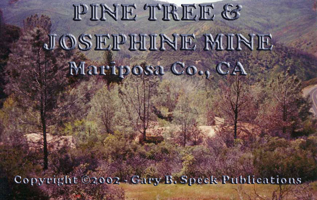
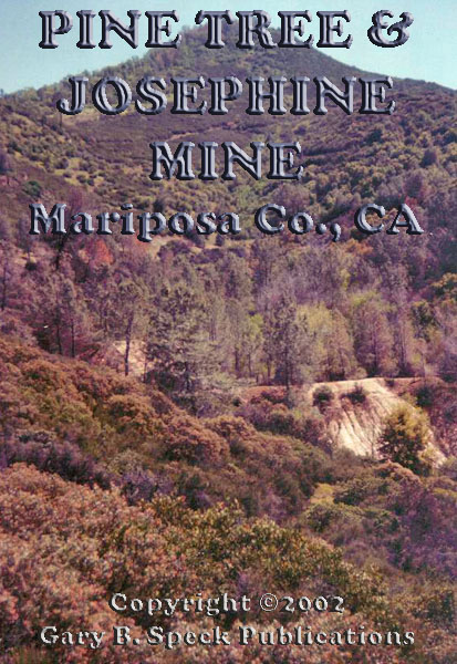
PINE TREE & JOSEPHINE MINE PHOTO#1! PHOTO#2!
This famous mine was
located in the Bagby Mining District in Hell’s Hollow (the canyon
between
This mining complex was
a centerpiece in John FREMONT’s mining empire and was the
site of the
famed
claim jumping siege and counter siege (not
repeated here). The workings
consist of adits (horizontal
tunnels)
and winzes (small “shafts” joining the various adits). Some of the adits
are 1200’ long. It was very
active
during the late 1940s, and up to WW II.
Combined production is estimated to have been between
$2.7
and $4.0 million in gold through 1942.
On April 10, 2002
there were no remains of the mine except tailing piles and disturbed soil. No structures or ruins remained.
PINE TREE MINE
…SEE
Pine Tree & Josephine Mine
PINEY CREEK
Now under Lake
McClure, this early 1850s placer gold mining camp was located on Piney
Creek, just above its confluence with the
PINO BLANCO
...SEE
Peñon Blanco
PINON BLANCO
...SEE
Peñon Blanco
PIONEER MINE
This hard rock gold mine was located
directly on the East Belt vein system in the Sherlock-Whitlock
area. Actual location not
determined.
PLEASANT VALLEY
An
1850s gold mining camp located along the
PLUMBAR
A name mentioned by COOK in passing with other interesting names in
the county. No location is listed.
POCAHONTAS MINE
This copper mine was discovered by Jack HARLISS and Steve WILCOX. In 1981, a couple of shacks remained.
Information edited from a December 10, 2000
posting to the Mariposa List by Don Rose.
This copper mine was located in the West
Westfall Copper Mines area, 1.4 AIR miles east-southeast of the
Great Northern Mine, 1.7 AIR miles northwest of the junction of White Rock/West
Westfall roads, and 6.3 AIR miles south-southeast of Cathey’s
Valley.
(These two are probably the
same location…GBS)
POISON SPRINGS
Listed in CHAMBERLAIN’s The
Call of Gold as one of the unique place names in the
Coulterville-Yosemite Road region. No location is given. I assume it would be somewhere between
Coulterville and
POKERVILLE
Listed in CHAMBERLAIN’s The
Call of Gold as one of the unique place names in the Coulterville-Yosemite
Road region. No
location is given. I assume it would be
somewhere between Coulterville and
POOLE MINE
Originally worked in 1872, closing about 1909. Had an eight-stamp mill.
Location not determined.
POTOSI
Listed in CHAMBERLAIN’s The
Call of Gold as one of the unique place names in the
Coulterville-Yosemite Road region. No location is given. I assume it would be somewhere between
Coulterville and
POTOSI
Located
in the Coulterville
Mining District, about a mile west of Coulterville. Consolidated into the Malvina Group.
It operated from 1852-1942, and produced over $1,000,000 in gold. Possibly
the same location as Potosi (above). (GBS)
POVERTY FLAT
AKA –
...SEE
individual listing for Agua
Fria
PRESCOTT
…SEE
Badger
Mine
…SEE Hornitos
for a listing of the mines in that area.
PRESTON RANCH
Located just off
PRESTONS
Possibly the same location Preston
Ranch?
PRINCETON
...SEE
Mount
Bullion
PRINCETON MINE
The Princeton Mine was discovered in 1852,
and produced over $4.4 million in gold.
Its main period of activity ended in 1915, but it was operated
intermittently up until about 1942. In
1860 a 24-stamp mill was built at the mine.
For most of its life it was the largest gold producer in the
county. Its main shaft is 1660 feet long
and inclined at a 45-60º angle. Its
vertical depth is over 1350’. It is
located in the Mount
Bullion Mining District, about a quarter mile south of
PYRAMID
MINE
A $200,000 gold mine located in
…SEE Hunter
Valley for a listing of mines in that area.
-Q-
QUAIL MINE
This gold mine was located at Indian
Gulch (#2) about seven miles southeast of Coulterville, off the
QUARTZ MOUNTAIN MINE
In
1885 this Hornitos
Mining District gold mine was active, but its location is not determined.
QUARTZBURG(H)
This 1848-early 1850s era mining camp was
located where Burns Creek crosses the Hornitos-Bear Valley Road (CR-J16), about
three miles northeast of Hornitos. In
1949, the remains included the adobe-walled/brick-fronted THORNE Store built in 1852. When the road was relocated, the remains of
the town were bulldozed. Only the
QUARTZBURG SCHOOL
This old one-room school was located on
CR-J16 1.4 miles northeast of the junction of that road/Jenny Lind Road, about
a half mile from Quartzburg. It was established in 1870, and closed in the
early 1950s.
QUEEN LOUIS MINE
Location
not determined.
QUEEN SAXON MINE
...SEE Schroeder
Mine.
…also SEE the
Whitlock
Mining District for a list of the mines in that mining district.
QUEEN SPECIMEN MINE
Located in the Bagby Mining District. Actual location not determined.
QUICK RANCH
…SEE
Ben Hur
* * *
Return to the GTs of
Mariposa Co., CA Index Page
Mariposa County
A | B | C | D | E | F | G | H | I | J | K | L | M | N | O | PQ | R | S |TUV
| W | XYZ
Detailed information on individual
locations:
AGUA
FRIA | BAGBY | BEAR
VALLEY | COULTERVILLE
| HORNITOS | MARIPOSA
| MOUNT
BULLION
Also visit:
Ghost Town USA’s Ghost Towns of
California
Also visit: Ghost Town
Home
Page | Site Map | Ghost Town Listings
| On
the Road Again | Photo Gallery
| Treasure
Legends
CURRENT Ghost Town of the
Month | PAST Ghost Towns
of the Month
Ghost Towner's
Code of Ethics | Publications | Genealogy
| License Plate
Collecting
A few LINKS to outside webpages:
Ghost
Towns | Treasure
Hunting | License
Plate Collecting | Genealogy
First
Posted: December 10, 2001
Last
Updated: March 19, 2005

This
website and all information posted here-in is
copyright
© 1998-2015
by Gary B Speck Publications
ALL rights reserved