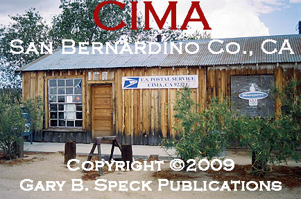
KELSO
by
Sitting smack-dab in the heart of the
Kelso’s story begins in 1905 when the San Pedro,
No matter how the name came about, a depot;
single-story, wooden lunchroom; five-stall, concrete roundhouse and repair
facilities were built and a small town developed around the facilities. This was a railroad town, plain and
simple. In 1916, the railroad dropped
the San Pedro portion of its name, becoming known as the Los Angeles & Salt
Lake Railroad, but that name change did not affect operation of the line or the
stations. On April 27, 1921 the
LA&SLRR sold the line to the Union Pacific, and the little support town
continued to thrive.
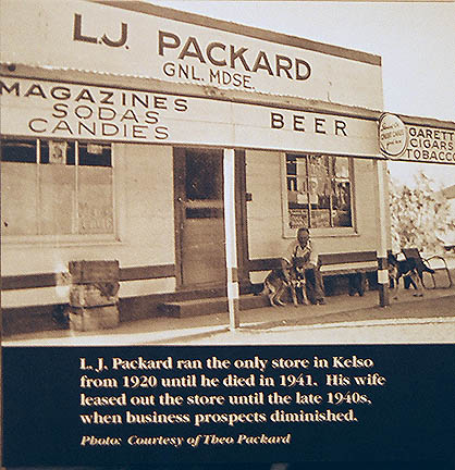
In 1920,
L.J. Packard opened up a small, concrete, general
store, into which the post office moved. He operated the store and post office until
1941, when he died. His wife then leased
the store
out, and it continued to operate until the late 1940s.
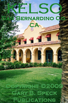
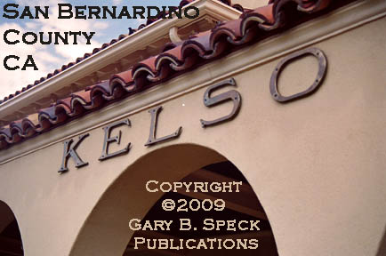
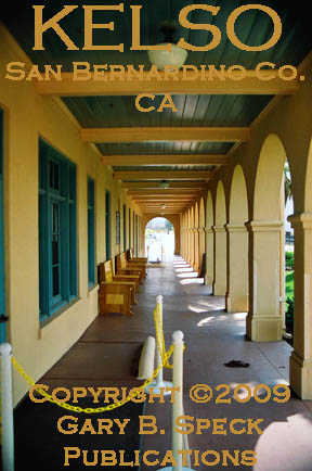
In 1923 the two-story depot building was
built. It replaced the original
lunchroom, which burned in 1922. The
Union Pacific built it in a grand style to provide direct competition to the
Santa Fe Railroad and their famous Harvey House depots. The railroads were in major competition with
each other to woo
riders and loyalty, so the depots were usually the first
thing most potential customers saw.
Good food, good service, and good
facilities kept them. So, this
modern gem was built, the fourth of six Spanish Mission Revival Style depots on
the Union Pacific’s
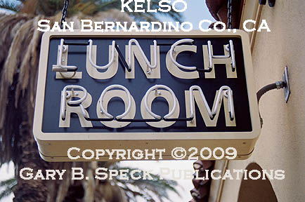
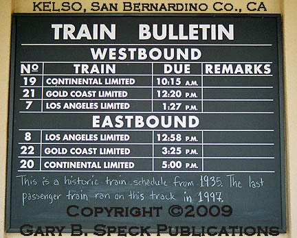
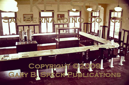
The beanery was a popular spot for the locals to
eat, and functioned 24 hours a day, seven days a week, keeping its 12-14
employees bustling. Two of the trains
that stopped here each day stopped to provide meals for the
passengers. One stopped in the morning
for breakfast and the other disgorged 40-50 passengers in the late
afternoon. The beanery
only seated a maximum of 33 people along its “U”-shaped counter, so that
afternoon stop sounds like it could have been a bit hectic! After the war ended, it was remodeled and
made much smaller, seating only 12. Even
in its sunset days, the beanery was busy.
During the 1959-1964 period it averaged 97
meals a day. Due to declining use, in
1969, the night shift was eliminated, and the café only operated from 0500-2100
(5 am-9 pm). By 1972, it served only
employees, and in 1985 it closed along with the depot.
During the World War II years, Kaiser’s Vulcan
Iron Mine was active in the hills about nine miles southeast of town. Some sources claim this activity pushed
Kelso’s population upwards to the 1500-2000 range. I personally question this number, but it
seems to have grown roots. IF any of you readers have concrete proof of that number, please let
me know. In 1938, there were 87
registered voters in the Kelso District.
The Vulcan Mine was the Kaiser Corporation’s foray
into iron mining. The Vulcan deposits
were originally discovered in 1908, and purchased by Kaiser between 1940 and
1942 to provide the necessary iron ore to process into plate steel. Kaiser was one of the largest Liberty Ship
builders during the war and as a result needed copious amounts of iron ore to
feed to its brand-new (built in 1942), massive steel mill in
The Vulcan Mine was located on the west side of
When World War II ended, most of the railroads
were switching to diesel-powered engines, so the need for water stops, helper
engines and repair facilities diminished.
As a result, Kelso began to fade. In 1959, the last helper engine left, and
Kelso’s heyday was fading. On August 14,
1964, the last Kelso-obtained, ticked passenger climbed on board the train at
the depot, and the west half of the depot shut down. On May 1, 1971, AMTRAK took over passenger
service on the line, but its trains did not stop at Kelso.
By 1979, the depot was falling into disrepair, so
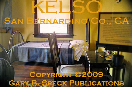
the station master and his family moved out.
In 1985, it was finally closed and boarded up and the Union Pacific
wanted to demolish the station building.
Public support, intervention by local Congressional representatives and
a grass-roots organization called the Kelso Depot Fund, all rallied to save the
depot, collecting public sympathy to save it as a valued historic relic. It was one of the few remaining historic
depots in the country. The Union Pacific
agreed, and transferred title to the Kelso Depot Fund.
In 1992, the Bureau of Land Management (BLM) took
control of the site in 1992, and in 1994 the Mojave National Preserve was established. The building sat vacant until around 2002
when restoration of the depot began. It
was accurately restored back to what it looked like during its glory
years of 1924-1945. Restoration
was completed and the building reopened to the public on March 25, 2006. It currently serves as a museum and visitor
center, both for Kelso and for the Mojave National Preserve. In April 2009, the beanery reopened, serving
light meals to the public during the 0900-1700 (9 am-5 pm) timeframe.
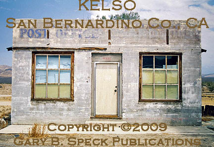
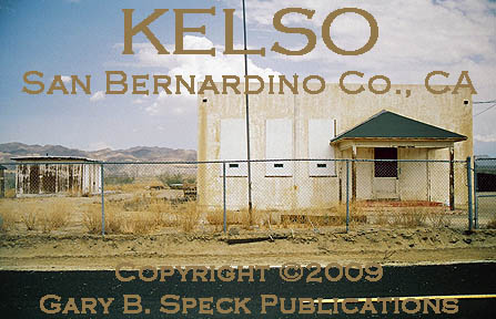
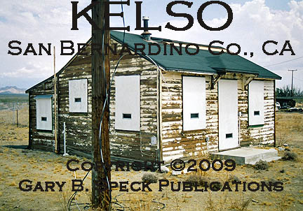
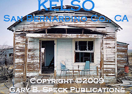
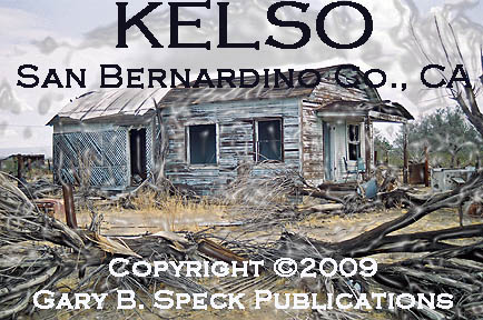
Some of Kelso’s remaining buildings, structures
and items of interest include the depot (see details above), the LJ Packard
Store (which on many websites is misnamed the Post Office), the jail, water
tower, along with numerous other unidentified
buildings and small
homes. One of my favorites is a
round-roofed
house that looks different
than most houses in ghost towns.
The jail
is a two-cell metal cage that was brought to Kelso in 1944, replacing an out-of-service
refrigerator car that originally served as the town’s original lock-up. The cage jail was especially unpopular as it
was not inside a building, and most folks tried to avoid having the town
constable escort them into the facility!
Both being exposed to passing folks and to the unmerciful sun in the summer, or blustery cold in the winter. Most of its occupants were miners or workers
at the Kaiser mine that came into town and had a little too much to drink. The little jail truly enforced sobriety! Sometime after Kelso faded, the jail
structure was taken to
One of Kelso’s claims to fame is the fact it was
one of the last towns in the state to finally get television reception – in the
late 1970s!
Kelso
is a fascinating little ghost town to visit, and well worth the jaunt.
Population
figures:
·
1970
– 75, 1980 – 75, 1990 – 30, 2000 - 30
Location:
·
NE
¼ Sec 25, T11N, R12E, San Bernardino Meridian
·
Latitude:
35.0124884 / 35° 00’ 45” N
·
Longitude:
-115.6536072 / 115° 39’ 13” W
This was our Ghost Town of the Month for
Sep 2009.
***************
Visit Ghost Town USA’s CALIFORNIA Ghost Town Pages
***************
Also visit: Ghost Town
Home
Page | Site Map | Ghost Town Listings
| On
the Road Again | Photo Gallery
| Treasure
Legends
CURRENT Ghost Town of the
Month | PAST Ghost Towns
of the Month
Ghost Towner's
Code of Ethics | Publications | Genealogy
| License Plate
Collecting
A few LINKS to outside webpages:
Ghost
Towns | Treasure
Hunting | License
Plate Collecting | Genealogy

THIS PAGE
FIRST POSTED: September 03,
2009
LAST UPDATED: October 02, 2009
This website and all
information posted here-in is
copyright
© 1998-2015
by Gary B Speck Publications
ALL rights reserved