In the Center of the Desert
DESERT CENTER, Riverside Co., CA
By
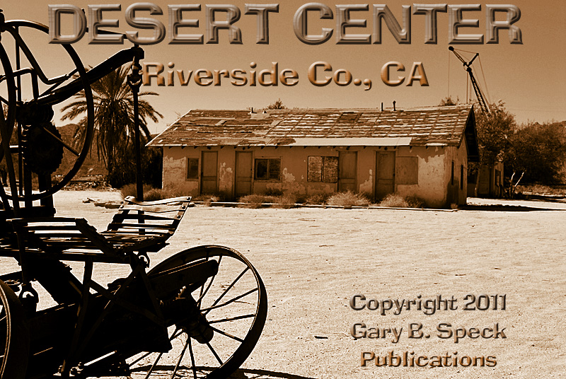
DESERT CENTER
is a sun-blasted,
decaying road
town plopped in the center of the desert in the shadow of the massive Eagle
Mountains to the west and the Chuckwalla Mountains to the south. The picturesque
remains of this old town are slowly fading into the past despite the
efforts of the town’s owner, the granddaughter of the original founder, Desert
Steve Ragsdale. I visited here on July
15, 2011 and spoke with several people about the town and all seemed to be in
agreement that it is barely hanging on.
Even though the official 2010 census figure indicates a population of
204, that also includes the Lake
Tamarisk development located about a mile and a half north of town
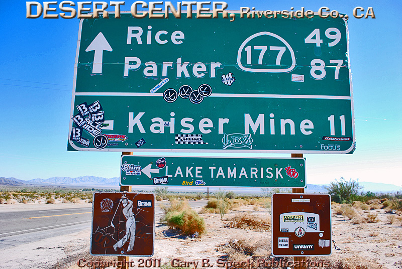
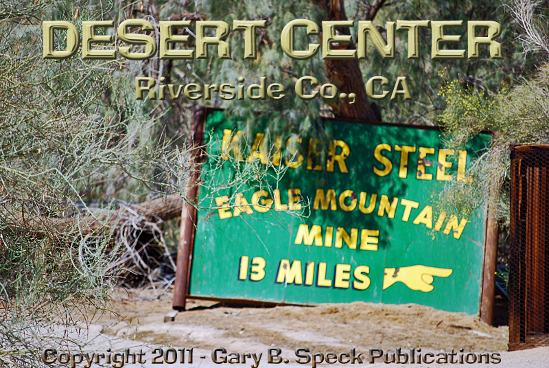
along the Kaiser Road (CR 2). A sign
directs people to it. Lake Tamarisk was
originally developed as a housing area on a lake and surrounded by a golf
course by the Kaiser Mine folks. It
showed up the first time on a 1971 Automobile Club of Southern California
(ACSC) Riverside County map that I have in my collection. It is NOT shown on the 1967 map. (I don’t have the 1968 -
1970 maps). However, today the
development consists of about 50 custom homes, most of which are small. There is also a packed RV park that appears
to be mostly weekender/vacation occupied. What is most telling is the occupancy
rate. According to the Census Bureau,
there are 85 occupied and 55 vacant housing units in the whole CDP (Census
Designated Place). In the “town” proper,
the vacancy rate is much higher. There
are two mobile home parks in “town”. A
small one is at the west end and appears to be for the employees of the
Caltrans equipment yard. A well-worn
one is located on the east end adjacent to several homes that also
appear vacant.
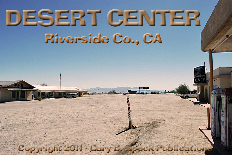
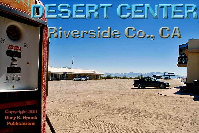
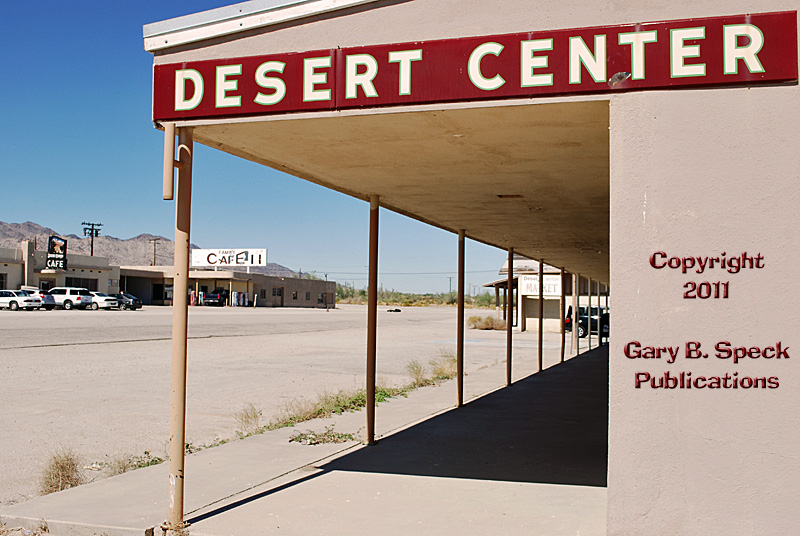
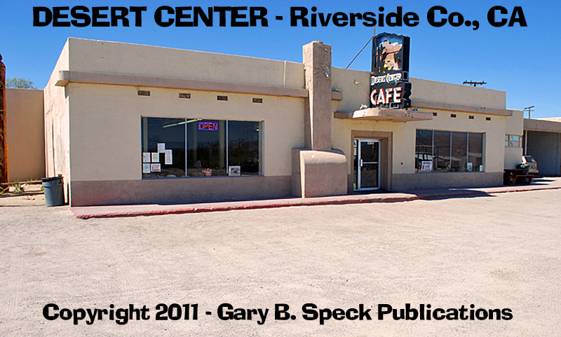
Desert
Center has one operating
business, the Desert
Center Cafe, which was doing a pretty lively trade during the time I
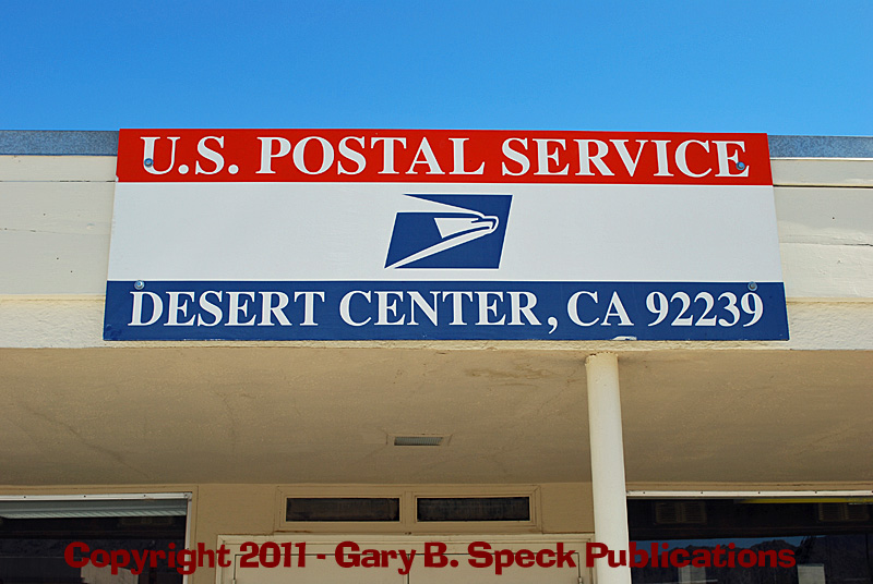
was in town photographing the community. There is also an operating post office from which the town’s
residents all obtain their mail via post office boxes. The buildings making up the “downtown core”
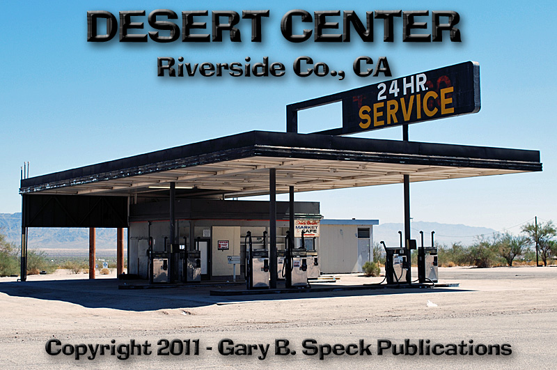
were built in the 1921 era about the time the highway (designated as US 60 in
1926) was built. During its road town
years, Desert Center had gas
stations, restaurants
and what appears to have been an old
motel across from the strip
center where the post office is located, served desert travelers. This was an important stopping place between
Blythe (50 miles east) and Indio (50 miles west.) During WW II it became a bustling town with
massive army
training facilities located nearby.
It is said that General
George Patton even ate in the café.
After the war ended and with the birth of the Kaiser
Steel’s Iron Mine at nearby Eagle Mountain, the
town was again active. Once Interstate
10 was built around 1972, the town was isolated, although it was served by an offramp from each direction and is a crossroad for traffic
heading north on SH 177 towards Rice (another ghost town) and Parker, AZ.
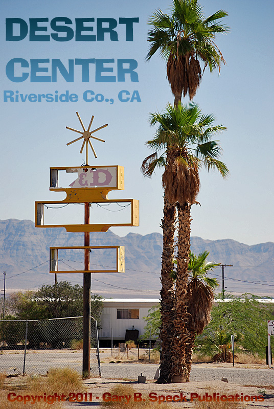
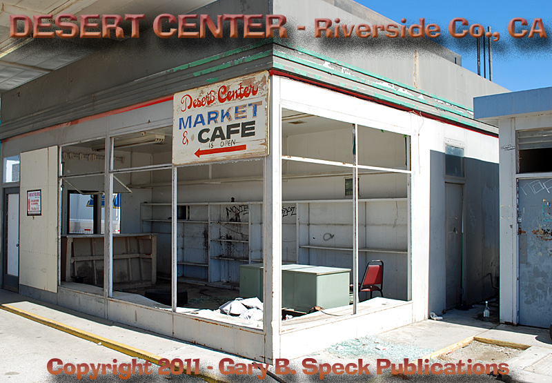
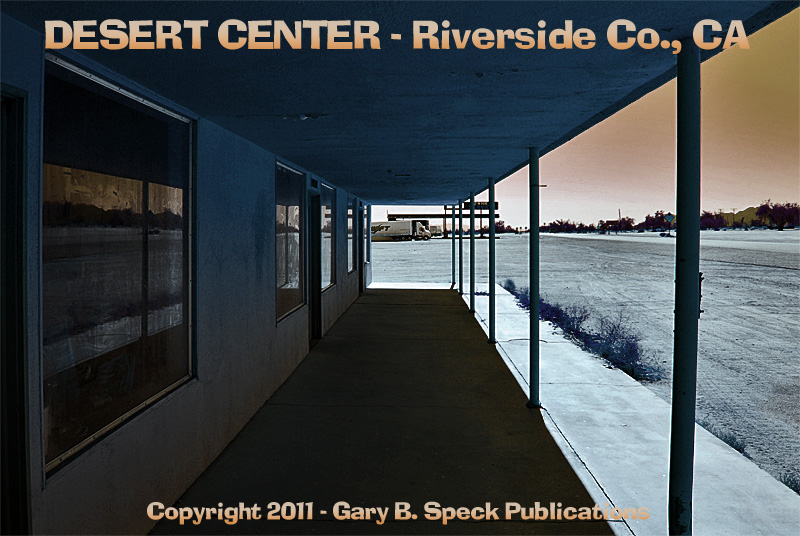
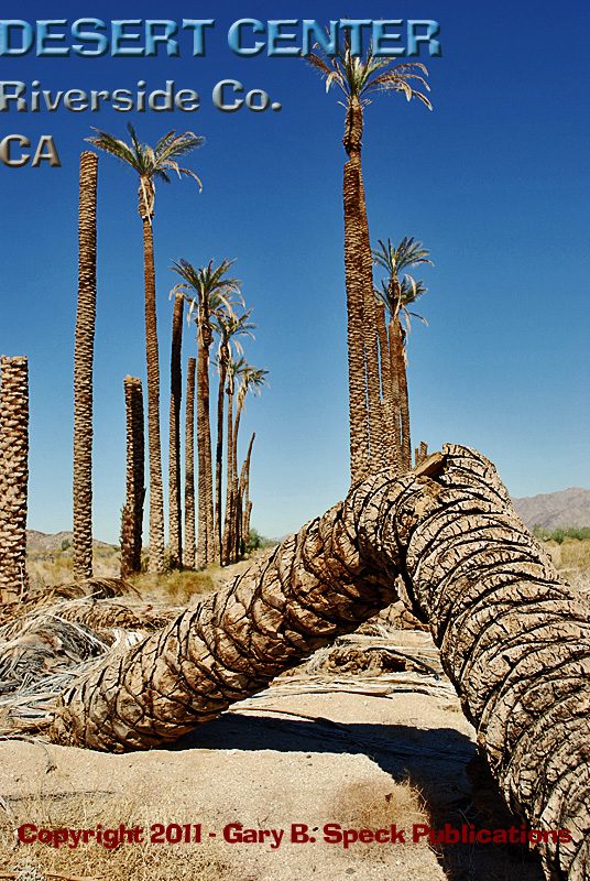
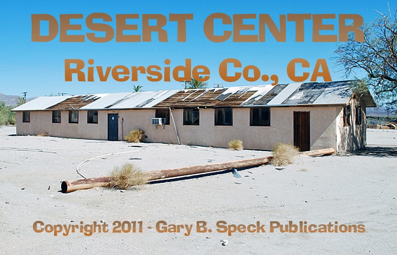
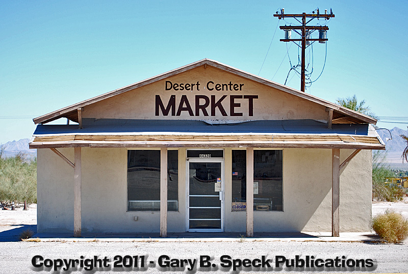
Some of the remaining amenities include the
aforementioned trailer park at the east end, some palm
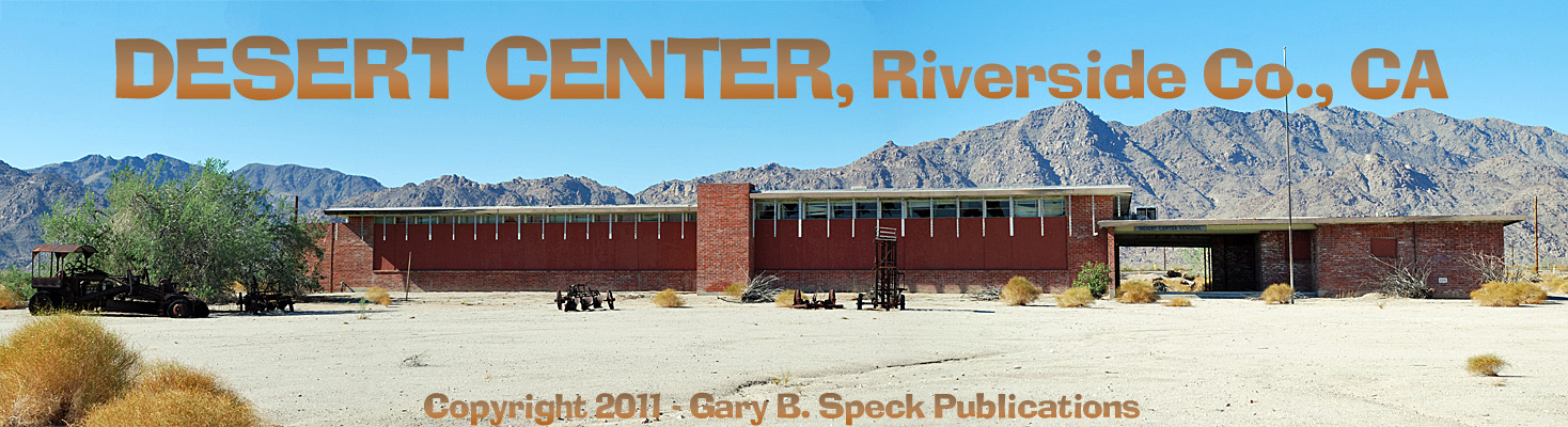
trees planted in fanciful patterns in the 1990s and now dying, the old
Desert Center School (which closed in the 1960s), and a batch of
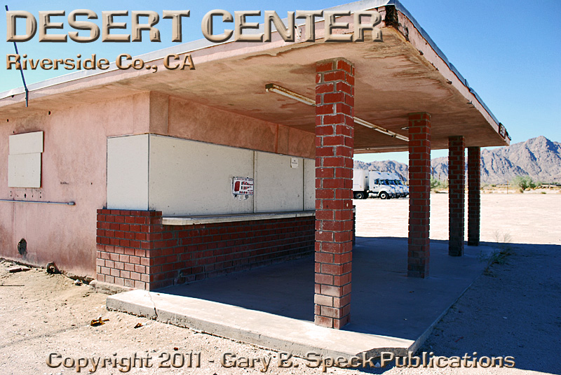
businesses that closed about 3-4 years ago, including a hamburger
stand, Texaco
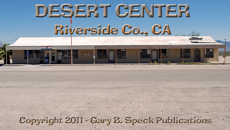
gas station, a small strip center with four tenant spaces and what
appears to be offices
in the rear, an old motel, the post office housed in the west end of the strip
center, the Desert
Center Market, an active Caltrans yard, a cluster
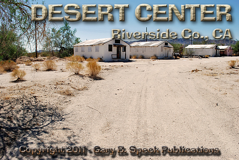
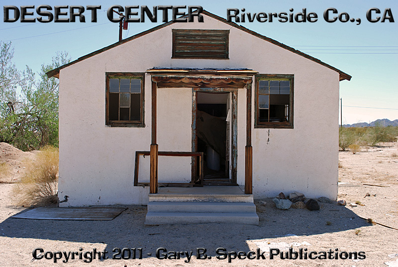
of seven cabins,
the main complex of buildings housing a couple old repair garages, vintage
Chevron gas station, Family
Café and the Desert
Center Cafe. Just east of the DC
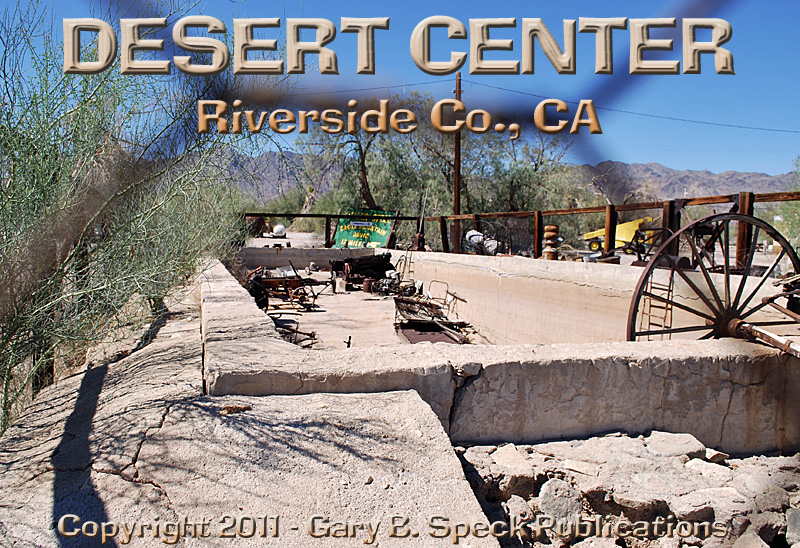
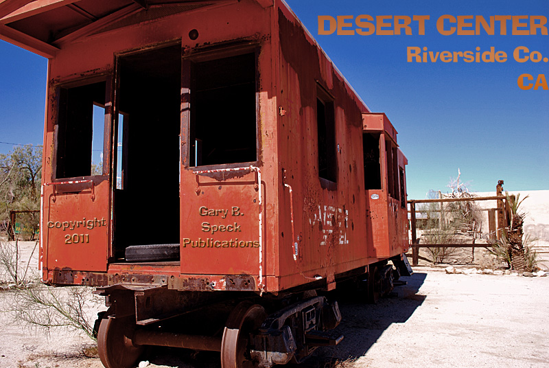
Café is an old, elevated swimming
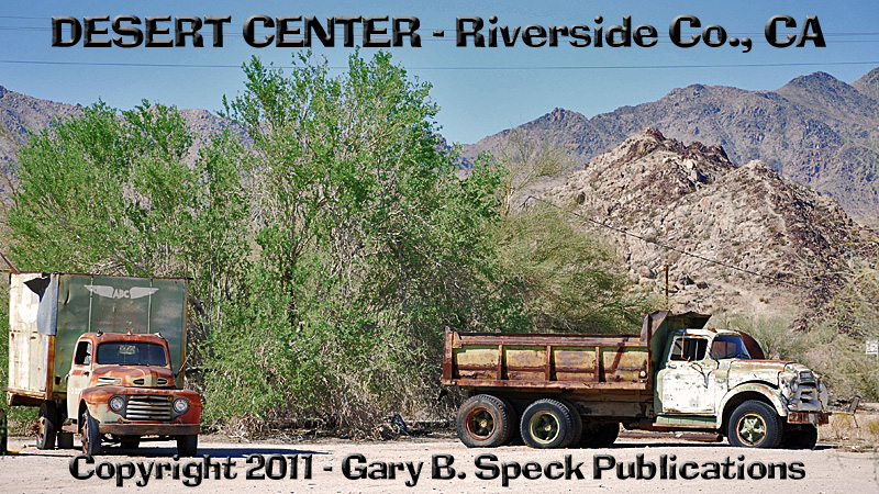
pool, a caboose
from the Kaiser Mine Railroad, some rusting equipment, a couple
of old trucks and a saggy-roofed cabin.
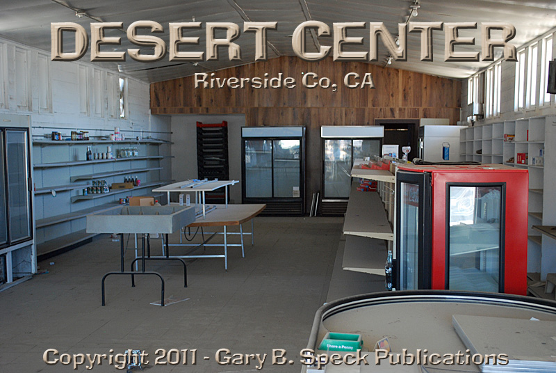
Only the DC Café and post office are still operating. Peeking through the windows of the old
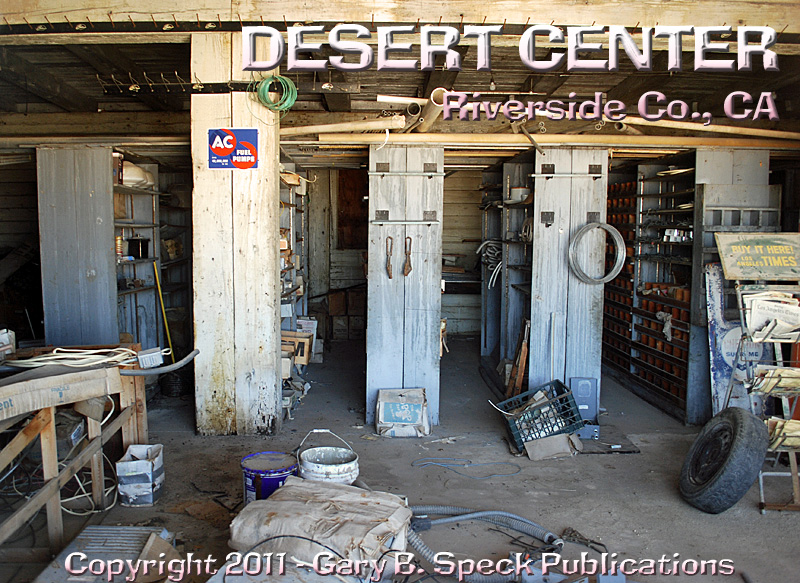
businesses reveals lots of surprises, such as an old sign for “ATOMIC
GAS”, the remains of an auto
parts store and empty
shelves in the old
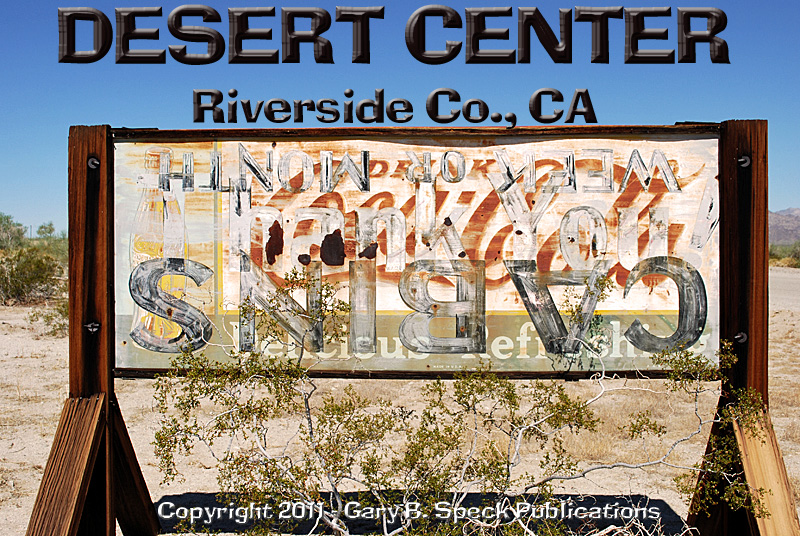
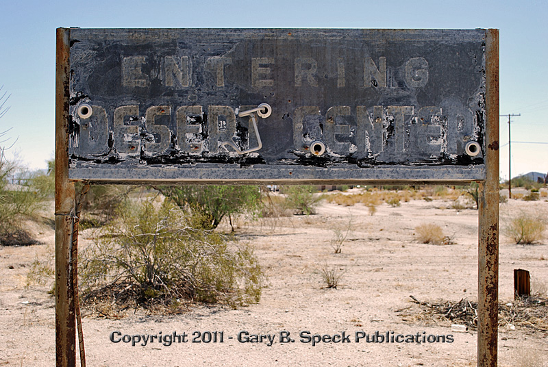
market. Old signs
dot the townsite.
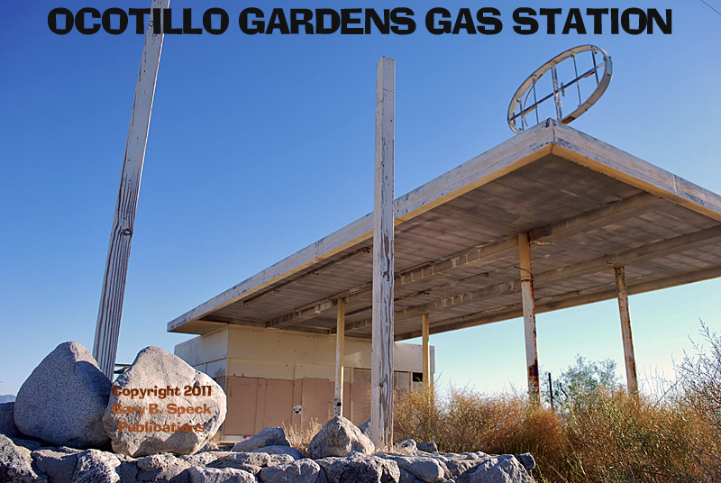
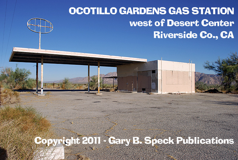
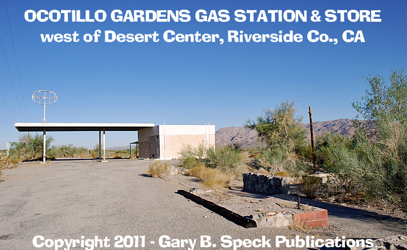
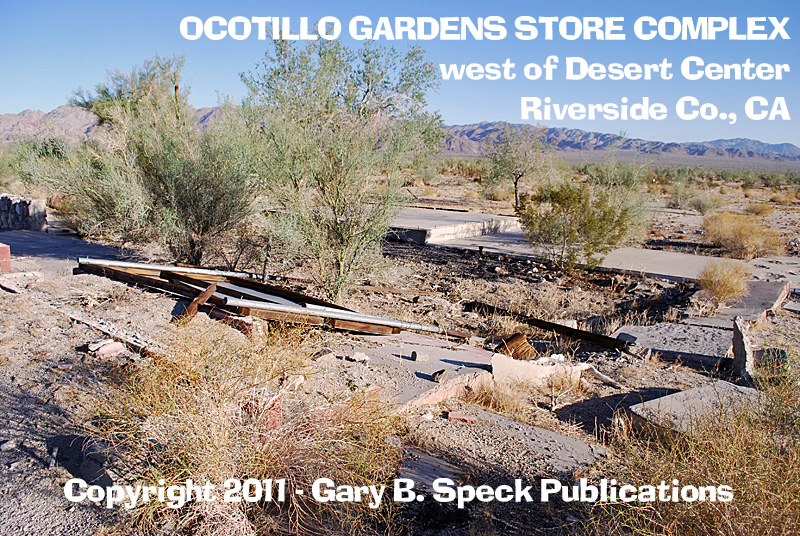
Off to the west,
along the old
US Highway 60 route (Ragsdale Road) is an abandoned
1950s-1970s era gas
station with foundation
& slabs ruins of what appears to have been a store
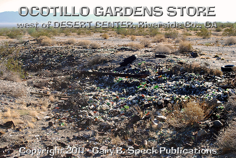
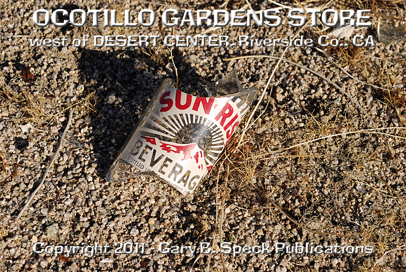
and possibly a cafe. There is a massive
dump out back. The dump looks
like it’s been picked through pretty well, but there are thousands of rusty
cans, broken
bottles, tires and misc. rusty car parts. The complex probably shut down when the
Interstate opened in 1971, isolating it from activity. I spent a little time here photographing it. From the remains, it appears there was also a
small store and café here also. The 1967
ACSC map indicates it as Ocotillo Gardens Store and shows it along US 60. On the Dec 1971 map it is still shown and
named along the frontage
road (old route) with the newly constructed I-10 running just south of
the site. It is still shown and named on
the ACSC maps until the 1981 edition. In
1982 it is NOT shown. I haven’t seen
anything else online about it, so the history is FUZZY. Anyone know for sure?
This was our Ghost
Town of the Month
for August/September 2011
Location:
·
N½
Sec 27, T5S, R15E, San Bernardino Meridian
·
Latitude:
33.7125191 / 33° 42’ 45” N
·
Longitude: -115.4022052 / 115° 24’ 08” W
Location
– Lake Tamarisk:
·
NE¼
Sec 15, NW¼ Sec 14, T5S, R15E, San Bernardino Meridian
·
Latitude:
33.7389072 / 33° 44’ 20” N
·
Longitude: -115.3897047 / 115° 23’ 23” W
Location
– Ocotillo Gardens Store/Gas Station:
·
Ctr
Sec 29, T5S, R15E, San Bernardino Meridian
·
Latitude:
33.7053397
·
Longitude: -115.4409027
***************
Visit Ghost Town USA’s CALIFORNIA
Ghost Town Pages
Also visit: Ghost Town
Home
Page | Site Map | Ghost Town Listings
| On
the Road Again | Photo Gallery
| Treasure
Legends
CURRENT Ghost Town of the
Month | PAST Ghost Towns
of the Month
Ghost Towner's
Code of Ethics | Publications | Genealogy
| License Plate
Collecting
A few LINKS to outside webpages:
Ghost
Towns | Treasure
Hunting | License
Plate Collecting | Genealogy
 ***
***
***
THIS
PAGE
FIRST
POSTED: July
16, 2011
LAST
UPDATED: October 03, 2011
**************
This
website and all information posted here-in is
copyright
© 1998-2015
by Gary B Speck Publications
ALL rights reserved