BAGBY
Mariposa Co., CA
AKA
Elevation 1000’
The gold mining and milling town of
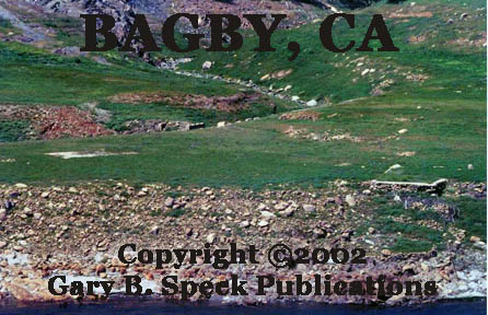
2 views of the north side ruins. PHOTOS! #1, #2
The community began as a ferry called Ridley’s
Ferry that operated between 1850 and 1852 at or near this
location. Then in 1859 Col. John C. FREMONT established a 16-stamp
ore-crushing mill here, and named the community that grew up at the milling
complex on the south side of the river BENTON MILLS, after his father in
law, Senator Thomas Hart Benton of Missouri.
That mill was quickly replaced by a 48-stamp mill.
In 1890 boarding houses, cabins, a mill building,
a post office and a store were established on the north side of the river. The community that grew up there was called BAGBY,
after B. A. BAGBY a local hotel owner.
In
1920 the last mill burned ending a legacy of gold milling here. Bagby continued to
operate as a river resort until the 1960s.
In 1930, the population was 36, and the decaying
town consisted of a handful of frame houses, a store and the railroad station
for the Yosemite
Valley Railroad. Those tracks
were pulled out during the World War II metal scrap drive.
During the 1960s, the buildings were razed to make
way for the expanding of
ALSO, if you are interested in flooded ghost
towns, check out our Flooded Ghost Towns page listing
hundreds of similar sites across the county and in Ontario, Canada.
On April 10, 2002, foundations and
ruins were visible on a bench along the north side of the river, just east of
the bridge. There were no ruins visible
on the south side, at least from the boat launching area.
·
SE¼ Sec
6, T4S, R17E, MDM
· Latitude: 37.6118777 / 37° 36’ 43” N
·
Longitude:
-120.1351839 / 120° 08’ 08”
Bagby/Benton
Mills was also the center for a gold mining district, some of whose mines
included:
·
HAYDEN DIVISION: SEE Great Johnson Vein
·
JOSEPHINE MINE: SEE Pine Tree &
Josephine Mine
·
JUNIPER
MINE
- LIVE
OAK MINE (#1)
·
MEXICAN
MINE (#1)
- MOUNTAIN
KING MINE
- OSO
MINE
- PINE
TREE & JOSEPHINE MINE
- PINE
TREE MINE: SEE
Pine Tree & Josephine Mine.
- QUEEN
SPECIMEN MINE
- RED
BANK MINE
- SPECIMEN
MINE
- SPRING
DIVISION: SEE
Great Johnson Vein
- YELLOWSTONE
MINE (#2)
…SEE Ferries
for a listing of the various ferries in
…SEE Lake
McClure for a listing of all the mining camps that have
been
inundated
by the waters of this reservoir.
…SEE Way
Stations for a listing of the various railroad stations in
Mariposa
County.
SOURCES: #1, 2, 6, 7, 8, 14, (WPA)
* * *
Return
to the GTs of
Mariposa Co., CA Index Page
Mariposa County
A | B | C | D | E | F | G | H | I | J | K | L | M | N | O | PQ | R | S |TUV
| W | XYZ
Detailed
information on individual locations:
AGUA
FRIA | BAGBY
| BEAR
VALLEY | COULTERVILLE
| HORNITOS | MARIPOSA
| MOUNT
BULLION
Also visit:
Ghost Town USA’s Ghost Towns of
California
Also visit: Ghost Town
Home
Page | Site Map | Ghost Town Listings
| On
the Road Again | Photo Gallery
| Treasure
Legends
CURRENT Ghost Town of the
Month | PAST Ghost Towns
of the Month
Ghost Towner's Code
of Ethics | Publications | Genealogy
| License Plate
Collecting
A few LINKS to outside webpages:
Ghost
Towns | Treasure
Hunting | License
Plate Collecting | Genealogy
First Posted:
December 10, 2001
Last Updated: April 30, 2015

This
website and all information posted here-in is
copyright
© 1998-2015
by Gary B Speck Publications
ALL rights reserved