By
LOCATED IN THE WESTERN FOOTHILLS of the Diablo Range about
eight miles northeast of Downtown San Jose, this is the crumbled remains of a
once-grand resort that capitalized on the mineralized waters and hot springs
that flowed from the sedimentary rocks along the bottom of Penitencia
Creek in Alum Rock Canyon. Some of the
springs included: sulfur, magnesia, iron and carbonated soda springs. The 720 acre park was established by the City
of
Right around the time the
park was established and deeded to the City of
In
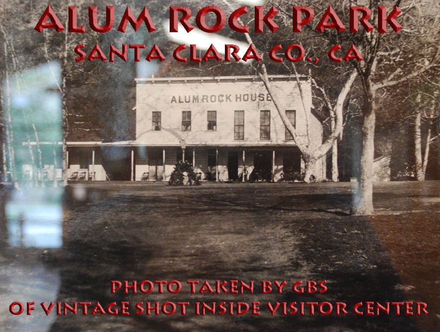
1891, the Parks Commission began development of a formal park, building a new
hotel called the Alum
Rock House, private mineral baths, a dance pavilion and picnic tables
were all added. The nasty, but
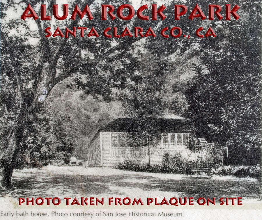
ever-present poison oak was temporarily eradicated. Other amenities included additional bathhouses
with tiled tubs, livery stable, mineral water dispensing pagoda,
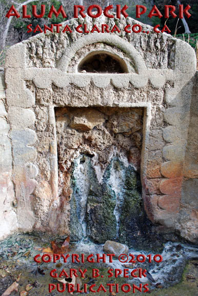
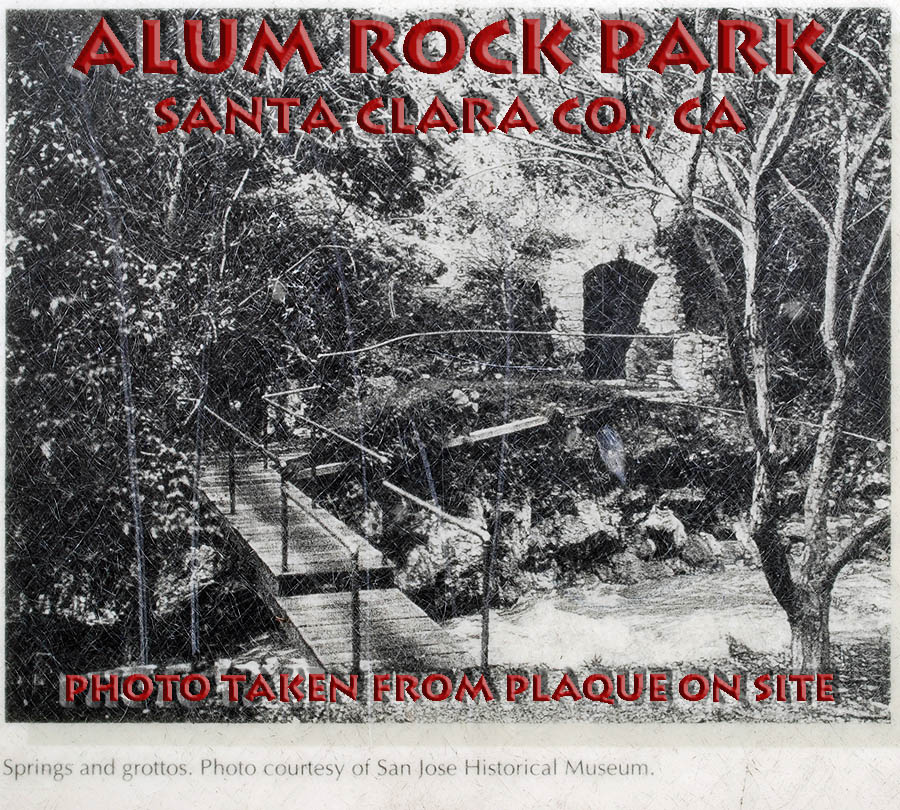
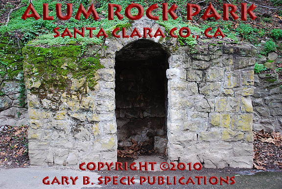
restaurant, a large outdoor swimming pool (the Open Air Plunge). Tunnels were dug and the springs
were fed into stone grottoes and basins
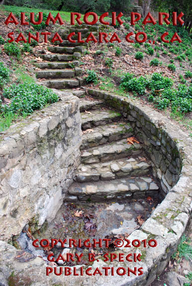
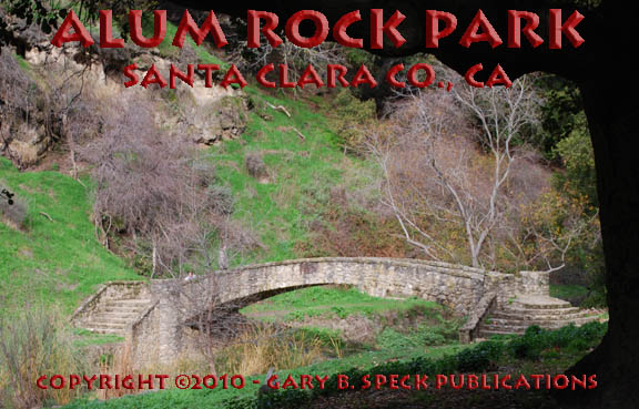
to showcase them. Steps
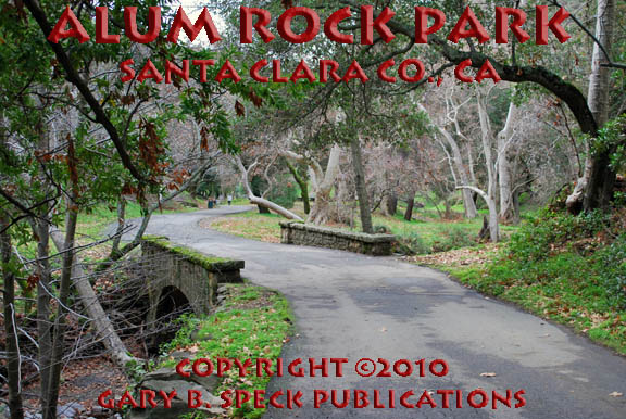
were built of native rocks, while stone bridges
crossed the creek, allowing access to springs
on the opposite side. All the rocks
and stones used to build these stonework
structures were collected from the canyon.
Water was piped from the grottoes
to the various bathhouses where it was heated and used by the patrons. A seven-mile long brick road was then built
from the city to the park.
By
the mid 1890s the resort had become a nationally known health spa. More people came, and it was affectionately
called “Little Yosemite.” As in that
larger park, it was nearly loved to death.
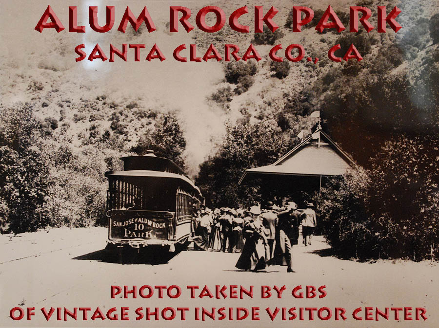
As people came, the natural beauty was affected. In 1896, a steam-powered, narrow gauge train
known as the Alum Rock Steam Railroad was brought in, trestles and tunnels
built, and a depot erected near the hotel.
In 1901, the steam trains gave way to an electric engine and the line
was extended deeper into the park, and a new depot was built in the flat grassy
area located near the present Youth Sciences Institute.
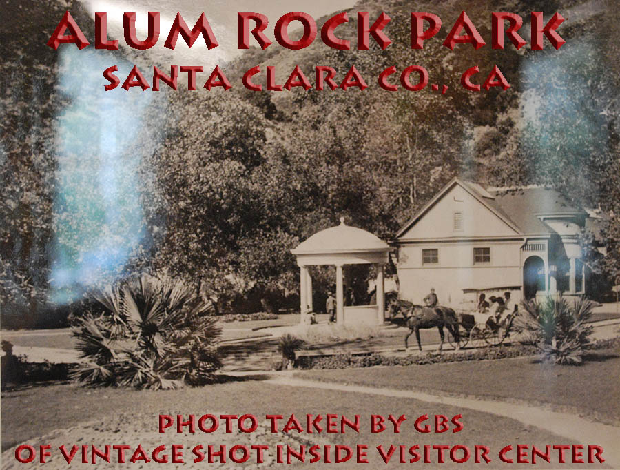
In 1904, a large stone
hotel, the Alum Rock Lodge, was built near the main entrance of the park to
house guests. It still remains, although
is privately owned. Through the early
1900s, the park was a popular place to stay and play, but washouts and cave-ins
plagued the railroad route, and a couple of fatal
accidents in 1903 and 1909 with the railroad made news. In 1911, a major flashflood decimated the
park’s buildings and railroad. This was
almost the death knell for the park, but by 1912, construction began on a new
standard gauge rail line to the park.
The Southern Pacific Railroad bought out the holdings of the previous
owner, and got to work, and the first train arrived in the park in 1913.
1913
was the year of rebuilding. Some of the
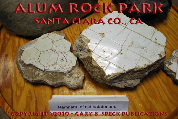
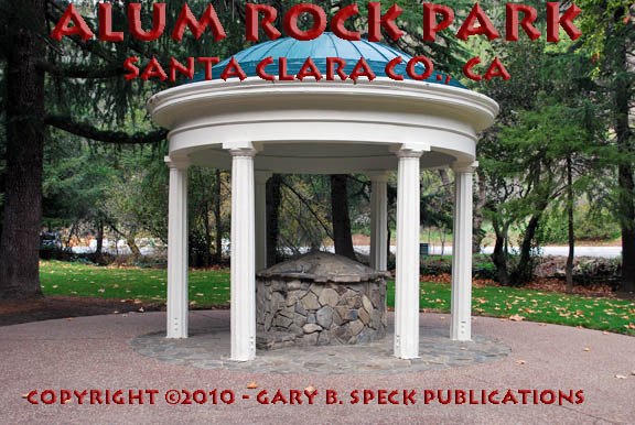
new accoutrements included: a new pavilion, a 45’ x 90’ heated pool with diving
boards and a large slide housed inside a Natatorium,
an aviary, café, a bandstand, a tea garden, men’s and women’s bathhouses and a
strong promise of a new hotel (which never did get built). Bridges,
grottoes and other rockwork
were rebuilt, and
Despite the demise of the
train, the park remained extremely popular, with as many as 10,000 people
trying to shoehorn into the narrow canyon on Sunday afternoons. A penny-arcade, log cabin, merry-go-round,
and a small zoo were added, bringing more people. The record seems to have been set on Easter
Sunday 1935, when 4400 cars were counted.
Through
the 1940s-1950s, many visitors still went to the park, but the heyday of the
spa was over. Overcrowding was frequent,
and the City moved towards showcasing the natural beauty, rather than the
multiple uses of the park. By the 1960s
most of the structures had been abandoned and rampant rumors of crime and other
nefarious acts helped the reputation of the park quickly deteriorate from a fun
place to a dangerous place. When I was a
student at
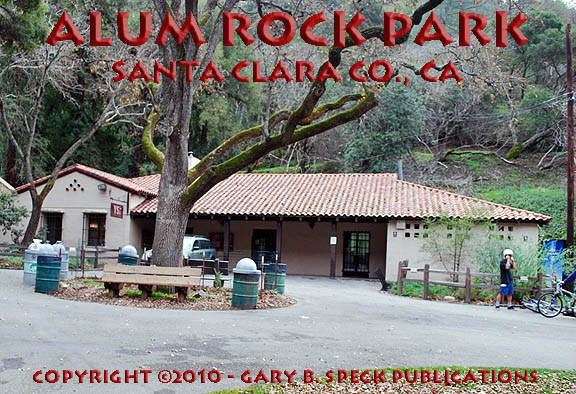
Today
picnic areas and 13 miles of unpaved and paved hiking/biking trails
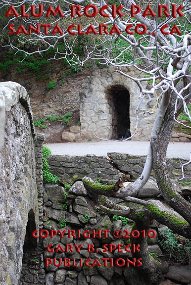
predominate, while visitors wander about the ruins
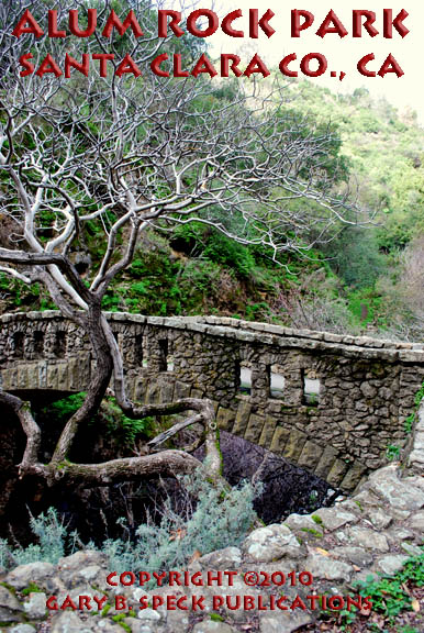
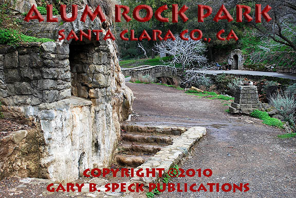
of the old resort, curious as to what the structures were. Portions of the railroad grade are still
visible along with its massive, concrete trestle abutments, bridges and
foundations. Also visible in the park
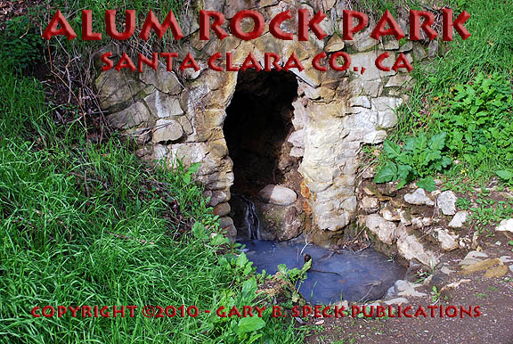
are several rock bridges,
grottoes
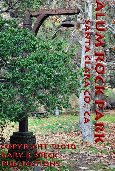
and rock tubs, old light
poles whose lights are shaped like bells,
the 1890s mineral water pagoda,
the 1916 log cabin and the 1930s era building now housing the Youth
Sciences Institute. On the day of our visit, only one other couple was
wandering the park, and a few runners and bicyclists passed us by: a far cry
from the days when 10,000 people a day would crowd into the area. Today all
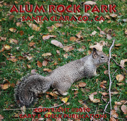
is quiet. Huge oaks and
sycamores are interspersed with smaller trees and bushes such as California Madrone and Buckeye, while the understory is colored with
wildflowers, ferns, moss and lichens.
Chattering squirrels
scamper amid the fallen leaves, numerous calling birds flit about the tree
branches and Penitencia Creek bubbles and burbles its
way down the canyon. The mineral waters
still seep, lending a slight sulfurous aroma to the natural vegetation smell.
NOTE: Access is via
Location:
·
Latitude: 37.3977168 / 37° 23' 52" N
·
Longitude:
-121.7996751 / 121° 47' 59" W
This was our Ghost Town of the Month for January, 2010.
***************
Visit Ghost Town USA’s CALIFORNIA Ghost Town Pages
Also visit: Ghost Town
Home
Page | Site Map | Ghost Town Listings
| On The Road Again | Photo Gallery
| Treasure
Legends
CURRENT Ghost Town of the
Month | PAST Ghost Towns
of the Month
Ghost Towner's
Code of Ethics | Publications | Genealogy
| License Plate
Collecting
A few LINKS to outside webpages:
Ghost
Towns | Treasure
Hunting | License
Plate Collecting | Genealogy
***

***
THIS PAGE
FIRST POSTED: January 04,
2010
LAST UPDATED: February 02, 2010
**************
This
website and all information posted here-in is
copyright
© 1998-2015
by Gary B Speck Publications
ALL rights reserved