ON THE ROAD AGAIN
With Ghost Town
A Tour Guide
to the Ghost Towns Along
From Bishop, California
to
Price, Utah
PART 6
The Tintic Mining District, to Price Ut
CONTINUED
from PART
5…
The Tintic
Mining District centers around EUREKA,
a dusty, crusty
old mining town that still functions as the seat of government
for Juab County. We won’t
explore the TINTIC on this page, but for details on this fascinating
mining district go to our Tintic
Mining District page for a lot more information and numerous
photos.
After passing through EUREKA,
the US Highway 6 swings to the east, descending towards Interstate 15, about 20
miles beyond. Two miles west of Goshen, is the junction with SH 68,
and the tiny, badly faded agricultural hamlet of…
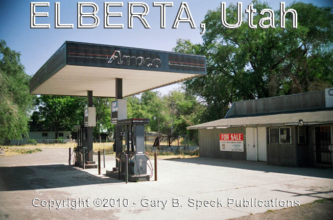
ELBERTA
Named after the Elberta
Peach, the faded crossroads hamlet of ELBERTA
is located at the junction of US 6/SH 68, midway between Eureka and the
Interstate. The 2000 census counted 278 people, and when we visited noted a
couple of abandoned buildings, including the Currant
Creek Convenience Store & Amoco gas station and an old Sinclair
gas station across the street.
Other structures include a dozen
or so homes, an old church and the newer post office. When Elberta
was established in 1896, it was originally known as called Mount Nebo. BUT, its
peak days seem to be behind it now, and this tiny agricultural community is going
nowhere, slowly.
A
couple miles east of ELBERTA, US 6 passes through the tiny town of Goshen (Milepost [MP]
153). Then three miles beyond
Goshen - at MP 156 - the magnificent ruin
of a mining company mill building clings to a steep, terraced red slope
just above the base of the hill to the south. This is the site of…
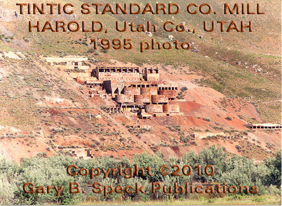
HAROLD
During
the 1921-1925 period the Tintic
Standard Company’s reduction
mill operated here, supported by a small company milling camp called HAROLD. Silver ore from the company’s mine
at DIVIDEND was processed here, but
in 1925 the mill closed after operating only a few years. Today, eight cyanide tanks remain atop
red-stained concrete foundations and walls. The site of the company town has been
completely obliterated.
Just west of Santaquin, US 6 skirts the north
side of some low hills, then at Santaquin we enter northbound
I-15. 13 miles later we exit at the
north end of Spanish Fork. Leaving the superslab
at Exit 258, we continue southeast on US 6/89 across town and up into the
mountains. The first half of the road is best described as urban-mountain
interface, a place where bustling urbanity battles with the quietude of the
mountains for dominance. Chaotic traffic, road construction
and people rushing to escape their urban environment makes for a tough area to
explore old sites now being usurped by suburbia. Old maps show a number
of sites along this portion of the route, but I wish you better luck than I had
in finding and exploring them.
CASTILLA HOT SPRINGS
Located along the north side of the
highway, one of the most prominent sites worth looking for is this old hot
spring spa. CASTILLA HOT SPRINGS was established in 1891 and operated on and
off until 1942 when it burned to the ground. Its central feature was a huge,
three-story, sandstone hotel located in the wide area on the north side of the
highway about 0.9 miles east of Covered Bridge Canyon Road and 1.4 miles west
of Diamond Fork Road. Because of
heavy road construction in that area, I saw nothing from the eastbound side of
the highway except road building equipment being stored at what I assume to be
the old site.
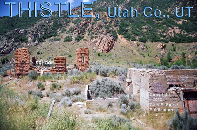
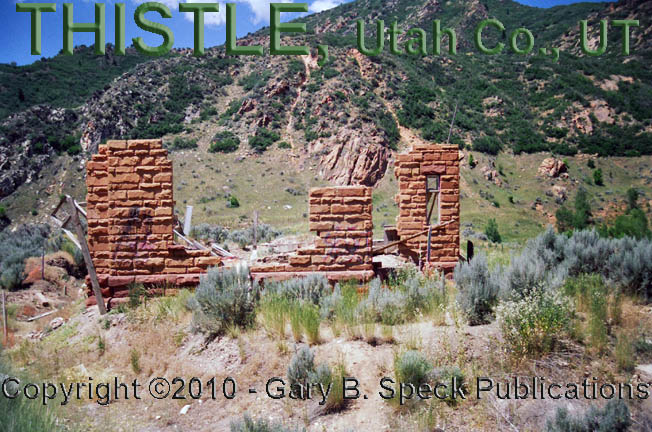
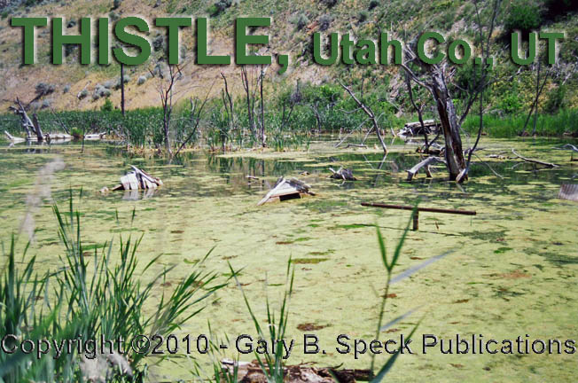
THISTLE
Continuing east, we reach the junction of
US 6/89, where the later highway separates itself and wends its way south. THISTLE
is located below that junction and is the now-pathetic remains of a once
bustling railroad junction town. It
is located about 14 miles southeast of Spanish Fork and has a truly forgotten
air about it. In April 1983, it was
heavily
damaged by flooding. Most
of the pre-1983 ghost town books picture it a whole lot differently! In 1930, back when it was very active,
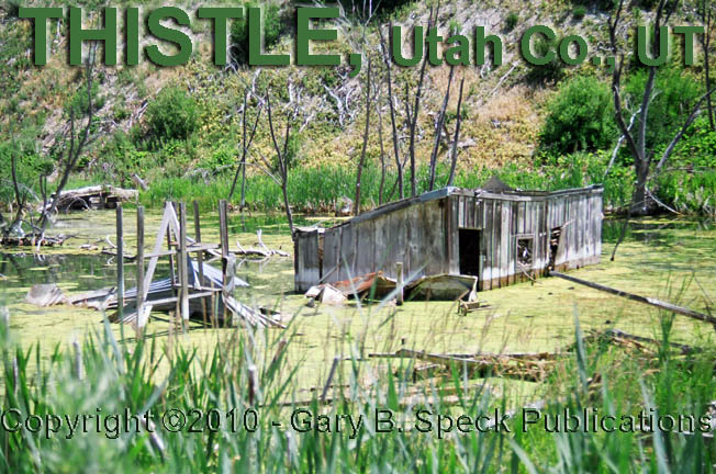
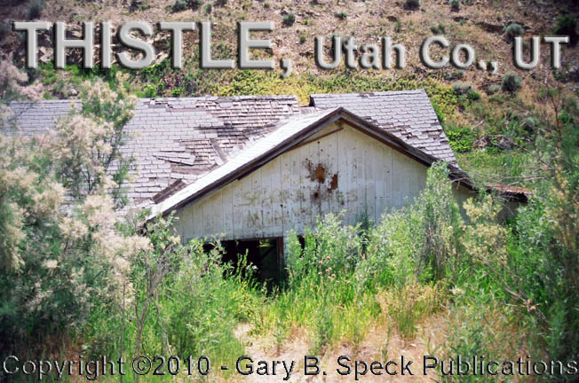
some 288 people lived here. Today, nobody lives here. A handful of picturesque buildings
remain, including the crumbling
walls of the old
school, foundations
and numerous flooded-out
buildings and old
homes, including some completely
submerged
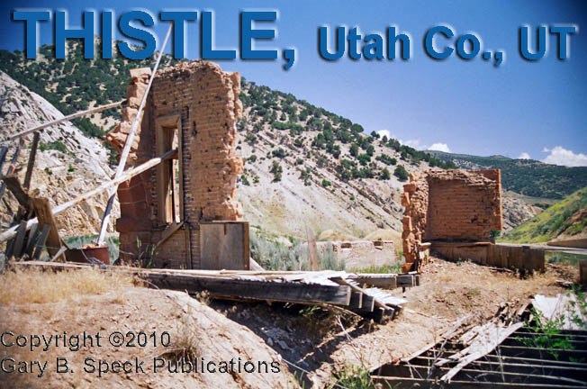
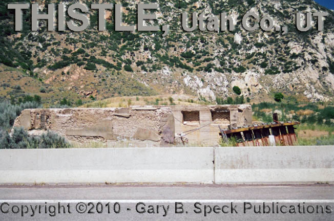
in the creek. THISTLE has a weird, desolate air about
it and a visit here can be problematic. The remains of the town can only be
accessed off US 89, and that highway is busy and VERY
narrow as it switchbacks off US 6 and unwinds
on its run to the south. There are
very few safe areas to park, so extreme caution MUST be exercised while in this
old townsite, much of which is posted. Please pay
attention to any signs, and observe the posted structures from a SAFE
location.
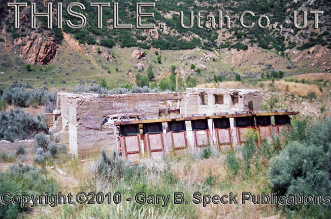
In the upper-east end of town, there are
several ruins and a large corrugated
metal building, the only intact, non-flooded structure in town. Unfortunately is has ZERO character, and
the only reason I photographed it is because it WAS the only intact structure.
The other major piece of eye-candy at that end of town is the rock
foundation of what appears to have been a hotel or motor hotel.
From THISTLE,
continue east on US 6 as it begins its 22-mile uphill run towards Soldier
Summit. Along this stretch of
highway are a handful of forgotten old railroad and road towns that I did not
explore as I didn’t know exactly where they were until after the
trip. This is an area where
researching the sites prior to going is a must. Many along the railroad can only be
accessed from a couple parking areas and a long hike. Others along the highway are so
forgotten, nothing remains to mark them.
A slow drive with a good, well-marked map IS a necessity to find these
sites.
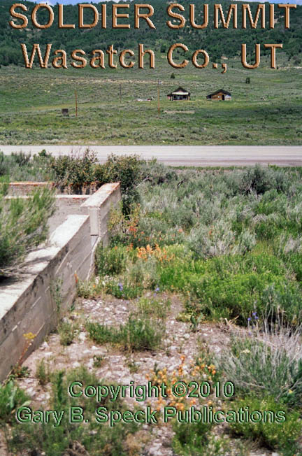
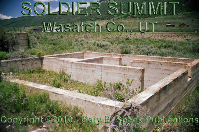
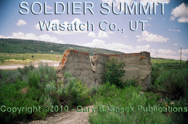
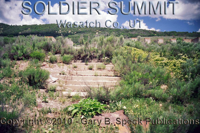
SOLDIER SUMMIT
Next up is SOLDIER
SUMMIT. It is shown on most
maps, and is definitely worth a stop.
This is one of those rare gems of a place that seldom makes press, yet
is located directly on, and is bisected by, a major
highway. The site is filled
with ruins
and abandoned
buildings, as well as a couple occupied ones. According to the store clerk, the
population in July 2008 was four.
In 1930 it was 319. Where rows
of houses once marched up and over the rolling hills on either side of
the railroad tracks, only concrete foundations
remain. Stores, a school and
numerous other buildings filled out this bustling railroad town plopped right
at the top of Soldier Summit, 7477’ above sea level. The empty shells and ruins
invite exploration. Just pay attention to any buildings that are posted and
abide by all signs. This is one of those wonderful little ghost towns that so
often get overlooked by most folks.
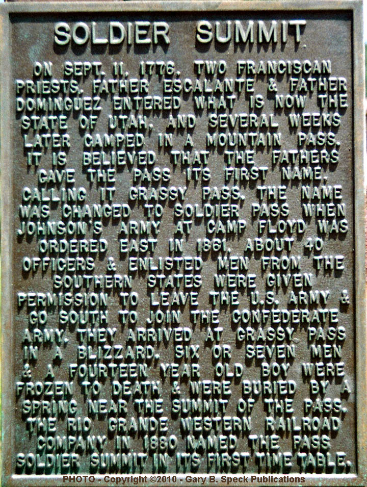
The name of SOLDIER SUMMIT is derived from the fate of a number of US
Army soldiers who were ill-prepared for blizzards in July 1861. Not being prepared, and especially not
expecting it, they perished in the freezing, summer blizzard. No folks; that is not a mistake - it
really was in JULY, not January! I
can believe it. When I stopped
there on July 6, 2008, it wasn’t hard to imagine how that could have
happened. During my visit, the wind was howling and the temperature was quite
chilly, probably in the low 50s. I didn’t have a thermometer, but even
with my windbreaker on, I was shivering so hard it was difficult to take
pictures.
The railroad town of SOLDIER SUMMIT was established in 1919 when the railroad company
moved all its yards, repair facilities and a roundhouse uphill from HELPER. Support businesses quickly
followed and SOLDIER SUMMIT
incorporated as a city in 1921.
Some of the businesses included: 130 homes (most of whose foundations
are still visible on the GNIS aerial photo), two automobile repair garages, a
billiard hall, two churches, a hotel, jail,
real estate office, restaurant, school
(closed in 1973), three or four stores, a swimming pool and a YMCA. In 1930 the railroad facilities were
moved back to HELPER, along with all
of the railroad-owned houses. With
nothing to support the town and busted flat by the start of the Great
Depression, the population quickly declined from its late 1920s era peak of
300+. Some sources claim the
population was as high as 2500, but I personally think that is a bit of a
stretch.
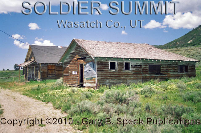
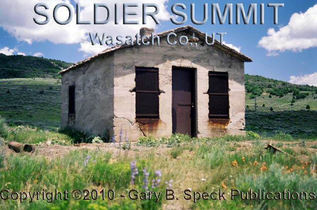
Today’s SOLDIER SUMMIT is way
smaller! Four
people, a combo gas station/store and a couple houses complete the active part
of town, while a handful of abandoned buildings, the remains
of the school and jail all sit north of the highway. Two of the best sit on a little knoll, overlooking
the site. Everywhere you
look are concrete foundation walls peeking out of the windblown greenery. South
of the highway, neat parallel rows of house foundations march up and down the
rolling hills. As the city of SOLDIER
SUMMIT faded, it took until 1984 for the remaining 12 residents to disincorporate the old town, over a half-century past its zenith.
Beyond Soldier Summit, the highway rolls
off downhill towards the south, passing several badly faded railroad
towns. Because of some pretty serious
road destruction - I mean construction – I couldn’t access
them. Oh well!
The highway continues to decrease in
elevation, winding its way through colorful hills and dropping right into
Carbon County, the heart of Utah’s Coal Country.
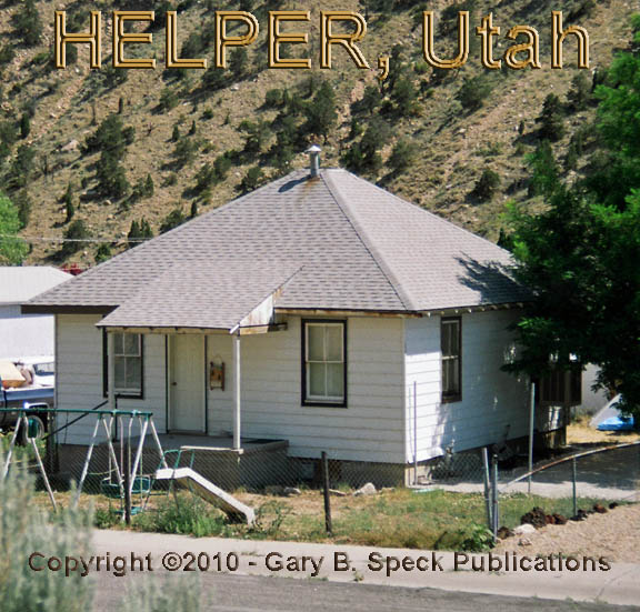
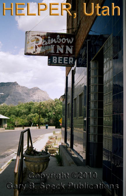
HELPER
Sitting just south
of the base of the mountains and unlike most old coal mining towns in the West,
HELPER still lives. Strings of company
houses dot the hills west of town, and the aura of railroads and coal
still hang thick in the air here. I didn’t spend a lot of time exploring
the gritty remains of HELPER, but it
was easy to see its industrial roots. What I did see did make me realize this
old town was worth another look-see, but I’ll leave it for you (for
now.) I did stop long enough to
capture an old bar
on film, but that’s about it.
During its peak years, Helper served a dual
role as a coal mining/shipping town AND a railroad town. It is just one of five knocked-together,
anonymously blended old towns lining the highway, the railroad and the Price
River. Today, some 14,000 people
live in these five towns. Only two
of the five have actually shown any growth since 1940. HELPER
is NOT one of those two. Even so, it’s far from ghostly,
but is filled with enough empty and picturesque buildings to warrant a return
trip – some day!.
PRICE
PRICE is the next town
on the menu. In 2000 it claimed a
population of 8229, and that may actually have increased by the census this
year. It is home to almost every
motel and fast food chain known to humanity, so food and accommodations are
plentiful. There is nothing ghostly
about this town, and it IS one of the two towns in the area that have actually
grown. Not only grown, but thrived.
This is actually the end of our journey on US 6, BUT, there are a couple canyons
to the west of PRICE filled with
fascinating old coal camps that we will visit in PART
7.
CONTINUED in PART
7
PART
1: Bishop, CA to CA/NV State Line
PART
2: CA/NV State line to
PART
3: Tonopah to Warm Springs,
NV
PART
4: Warm Springs, NV to NV/UT State Line
PART
5: NV/UT State Line to the Tintic Mining District, UT
PART 6: The Tintic Mining District
to Price, UT
PART
7: Coal Mining Camps west of Price, UT
GPS
and Standard Township/Range locations for the sites featured above
|
SITE NAME |
ELEV. |
LATITUDE |
LONGITUDE |
TOWNSHIP/RANGE |
|
Castilla |
4924’ |
40.0355115 /
40° 02' 08"
N |
-111.5260244 /
111° 31' 34"
W |
S½
Sec 18, T9S, R4E, SLM (Salt Lake Baseline and Meridian) |
|
Elberta (Utah Co.) |
4701’ |
39.9527303 / 39°
57’ 10” N |
-111.9563298 / 111° 57’ 23” W |
Corner
of Sec 8/9/16/17, T10S, R1W, SLM |
|
Eureka (Juab
Co.) |
6430’ |
39.9587016 / 39°
57’ 31” N |
-112.1148700 / 112° 06’ 54” W |
W2 Sec 18, T10S,
R2W, SLM E2 Sec 13, T10S,
R3W, SLM |
|
Harold (Utah
Co.) – site info Warm Springs (GNIS) |
4564’ |
39.9582870 / 39°
57’ 30” N |
-111.8557694 / 111° 51’ 21” W |
SW¼
Sec 8 , T10S, R1E, SLM |
|
Helper (Carbon
Co.) |
5892’ |
39.6898648 / 39°
41’ 24” N |
-110.8597000 / 110° 51’ 35” W |
SE¼
Sec 13, NE¼ Sec 24, T13S, R9E SW¼
Sec 18, NW¼ Sec 19, T13S, R10E, SLM |
|
Price (Carbon
Co.) |
5564’ |
39.5994095 / 39°
35’ 58” N |
-110.8107148 / 110° 48’ 39” W |
Sec
16, SE ¼ Sec 17, NE¼ Sec 20, Sec 21, T14S, R10E, SLM |
|
Soldier Summit (Wasatch Co.) |
7470’ |
39.9285694 /
39° 55' 43"
N |
-111.0779446 /
111° 04' 41"
W |
SE¼
Sec 24, NE¼ Sec 25, T10S, R7E, SLM |
|
Thistle (Utah
Co.) |
5043’ |
40.0371781 /
40° 02' 14"
N |
-111.5288024 /
111° 31' 44"
W |
Corner
Secs 28, 29, 32 & 33, T9S, R4E, SLM |
|
Historians estimate that
there may be as many as 50,000 ghost towns scattered across the These original guides
are designed for anybody interested in ghost towns. Whether you are a casual
tourist looking for a new and different place to visit, or a hard-core ghost
town researcher, these guides will be just right for you. With over 30 years
of research behind them, they will be a welcome addition to any ghost towner's library.
Thank you, and we'll see you out on the
Ghost Town Trail! For more information on
the ghost towns along this portion of E-mailers,
PLEASE NOTE: Due
to the tremendous amount of viruses, worms and “spam,” out there,
I no longer open or respond to e-mails with unsolicited attachments, OR
messages on the subject lines with “Hey”, “Hi”,
“Need help”, “Help Please”, “???”,
or blank subject lines, etc. If
you do send E-mail asking for information, or sharing information, PLEASE indicate the
appropriate location AND state name, or other topic on the
“subject” line. THANK
YOU! :o) |
IMPORTANT These listings and
historical vignettes of ghost towns, near-ghost towns and other historical
sites along this portion of US HIGHWAY 6 above are for informational
purposes only, and should NOT be construed to grant permission to trespass,
metal detect, relic or treasure hunt at any of the listed sites. If the reader of this
guide is a metal detector user and plans to use this guide to locate sites
for metal detecting or relic hunting, it is the READER'S responsibility to
obtain written permission from the legal property owners. Please be advised,
that any state or nationally owned sites will probably be off-limits to metal
detector use. Also be aware of any federal, state or local laws restricting
the same. When
you are exploring the ghost towns along Ghost Towner's
Code of Ethics. |
Also visit: Ghost Town
Home
Page | Site Map | Ghost Town Listings
| On
the Road Again | Photo Gallery
| Treasure
Legends
CURRENT Ghost Town of the
Month | PAST Ghost Towns
of the Month
Ghost Towner's
Code of Ethics | Publications | Genealogy
| License Plate
Collecting
A few LINKS to outside webpages:
Ghost
Towns | Treasure
Hunting | License
Plate Collecting | Genealogy
***
THIS PAGE
FIRST POSTED: July 17, 2010
***
This entire website, and all individual web pages
is
copyright
© 1998-2017
by Gary B Speck Publications
ALL rights reserved