ON THE ROAD AGAIN
With Ghost Town
A Tour Guide
to the Ghost Towns Along
From Bishop, California
to
Price, Utah
PART 3
Tonopah to Warm Springs, NV
CONTINUED from PART
2…
The highway climbs up a long slope and enters…
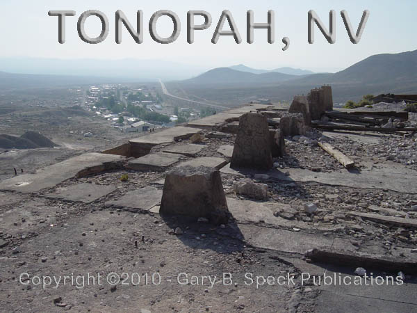
TONOPAH
TONOPAH is a
busy little road junction town, as well as the Nye County seat. Its 2500 citizens cater to tourists, and
the quiet, but still-living town sits at the eastern junction of US 6/US 95 in
the heart of Southern Nevada. It
has numerous colorful buildings filled with an aura of history. The Mizpah
Hotel, TONOPAH’s one-time
centerpiece is vacant as are a number of other larger buildings downtown. For more details on this magnificent,
century-old relic of the silver mining days, see our TONOPAH
page.
At the east end of town, US 95 divorces itself
from US 6, then wanders off towards GOLDFIELD and
points south. Our route, US 6
continues east down a long slope past numerous
mines and mill ruins. About
five miles to east it reaches a junction with State Highway (SH) 376. Straight ahead on US 6, off in the
distance on the south side of the highway, are some large, interesting-looking
buildings, but, before we check them out, a detour is in order first.
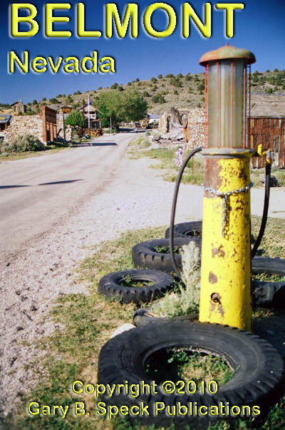
BELMONT
Heading north on SH 376, we take aim on the old silver mining town
of Belmont.
It is well
worth the 40-mile, one-way detour up SH 376 AND SH 82 . Ruins and a
few occupied buildings remain. As
with TONOPAH, no details will be presented here. Check it out on our BELMONT
page.
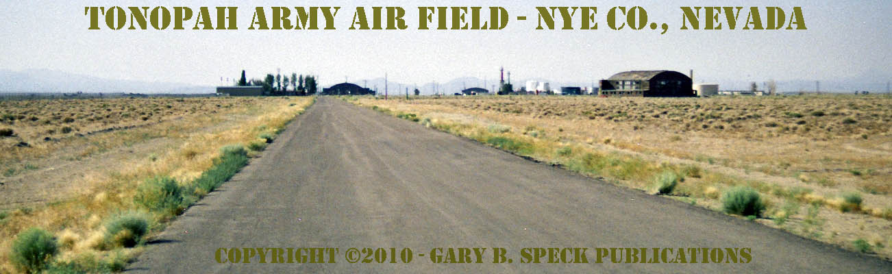
TONOPAH ARMY AIR FIELD
Sprawling across a large area south of US 6 and 1.5 miles east of
the junction with SH 376 is the former TONOPAH
ARMY AIR FIELD. From US 6,
several large wooden hangers are visible
in what is the still active TONOPAH
AIRPORT. But, what remains
makes it well worth a stop. The
present-day main entrance is graced with a faded
sign, and is open to the public.
(At least it was on July 6, 2008.)
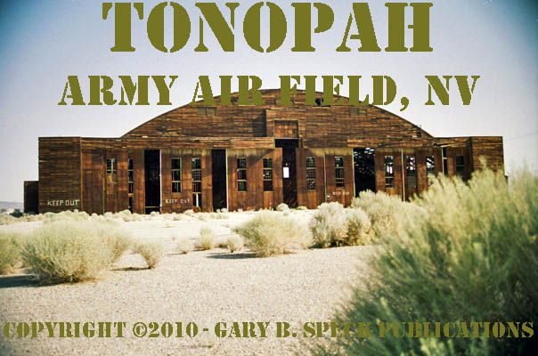
Visible
in the distance were a number of buildings, liquid storage tanks and a small
cluster of trees. West of the
still-used runway
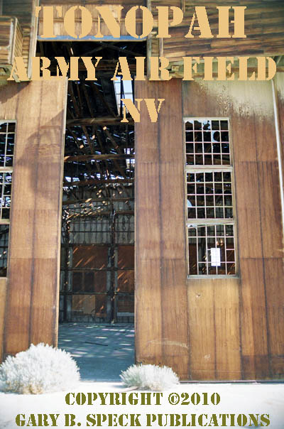
are three large, round-topped, wooden hanger buildings made of ancient
chocolate-brown wood, buildings, whose empty window sockets stare across the
Nevada desert dreaming of the “good old days.”
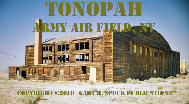
The
first of the hangers is just over a half mile into the site. Here a crumbling, paved road, lined with
encroaching sagebrush leads to the right, to the open doors of the northernmost
of the three remaining hangers.
Just to the east, several “modern” buildings supporting
current airport operations are located along the nearly mile-long concrete
apron abutting the runway. The hanger itself is about 90’ x 125’
and has huge sliding doors along the south side. Inside were a couple of modern private
airplanes. Outside, along the west side and semi-hidden in the weeds was the
hulk of a dead airplane.
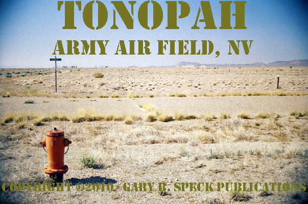
To the south, are a large water tank and a
late 20th Century trailer park with a dozen or so weathered, but
occupied mobile homes. West of the complex are a few fairly recent homes and a
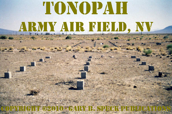
smattering of concrete foundations. Having spent a little time in the Army, I
quickly recognized the layout of what appeared to be the remains of barracks: latrine (bathroom) slab at one end, with
rows of pier foundations that supported the building down the middle. At the far end were concrete steps for
the front entry. Other
slabs and foundations remained of offices,
warehouses, mess halls, a hospital, the post exchange, a bakery, post
theater, sewage treatment plant and other structures that once
supported the thriving Tonopah Army Air Field from
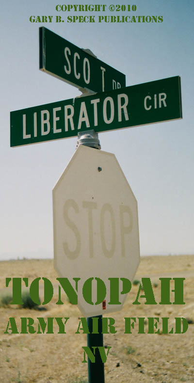
1942-1945. There were also faded street
signs (with the proud names of some of the fighters and bombers that
won that war for us: Bearcat,
Corsair, Liberator, Mustang.), rusting
fire hydrants, in what may have been the bases’ housing
area. There are also the remains of
hookup pedestals of what appeared to have once been a large mobile home park.
(A badly faded sign along the highway indicated the “Joshua
Country RV Park” with “Full Hookups.”) A secondary entrance near that sign led
people directly to the hookups, just beyond a couple of recent homes. My guess is that this part of the
development came long after the base closed. The entry monument MAY have been
the original
base entry and may have been protected with a guard shack. The layout indicates that as a distinct
possibility.
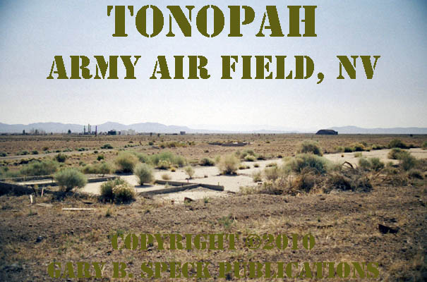
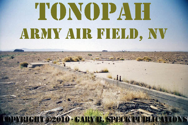
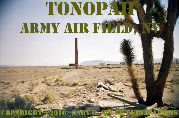
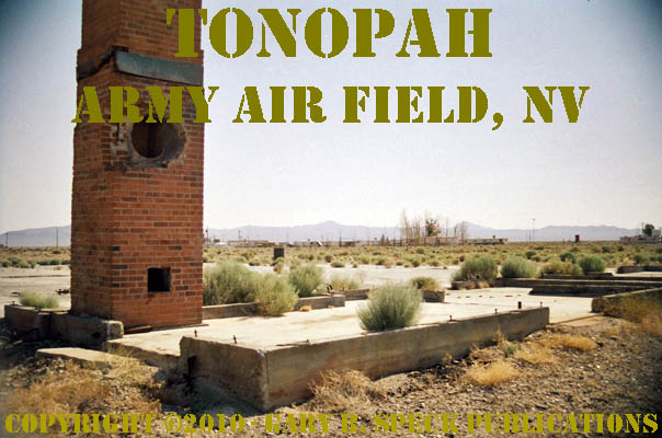
Right in the heart of the main part of the
former base, a tall
chimney and concrete slab the same size and layout as the three
existing hangers indicated another hanger, although this one had been burned in
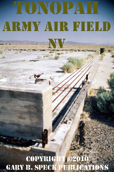
the not-too-distant past. Staggered door
tracks remained in the concrete slab, but the building was gone, with
only charred wooden plates remaining attached to the slab. The tracks really show how the staggered
wooden doors overlapped
to open the front of the hanger to allow airplanes access. (Photo is from the
eastern hanger.)
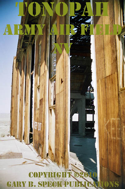
Further south, two other hangers still
stand, although the east
hanger in the center is looking a bit ragged. The southernmost
one is 1.8 miles south of the entry. Both are posted with “KEEP
OUT” signs, and I elected to obey them, although I did stick
my head through the open
doors on the center one for some photos.
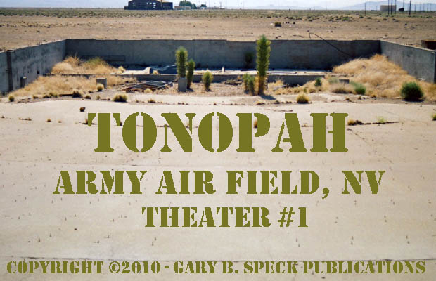
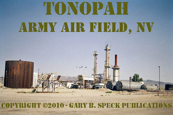
Other items of interest on the site include
a small refinery
near the present airport offices and several large, concrete, ammunition
bunkers on the northeast side of the airport, located behind an automobile
racetrack.
The TONOPAH
ARMY AIR FIELD was established in 1940 as a support base and administrative
center for a nearby gunnery range.
Actual construction began in 1941 and the Army moved-in in 1942. The
focus of the base quickly changed to training fighter crews. A year later,
around 2000 troops were training for overseas duty. B-24 bomber training was added, and from
September through November 1943 a major renovation and expansion of the base
coincided with the arrival of the B-24s.
In 1944, the base population reached about 6500 troops, about a quarter
of which were officers. Tonopah Army Air Field had become
one of Nevada’s largest military bases.
When the war ended in August 1945, the
troops and planes quickly disappeared, and the Tonopah Army Air Field
was placed on inactive status. It formally closed in 1948 and was deeded to
Tonopah for use as a civilian airport.
AUTHOR’S NOTE:
If any of you readers
were stationed here, or have family members that trained here, I’d love
to hear from you. Please E-mail me OR
contact me by regular mail at PO Box 1328, Moreno Valley, CA 92556-1328. I really want to learn more
about this fascinating place. Also,
I’d LOVE to post any contemporary photos or memories any of you may have
of this place.
Returning to US 6, we again head east. Now that US 95 traffic is no longer on
the road, the highway begins to appear totally vacant. US 50 claims to be the “Loneliest
Highway in America,” but I put my money on this segment of US 6: between
here and Ely! This is the TRUE
Loneliest Road! Here
US 6 arrows dead straight for 13 miles, until it curves out of view and
disappears in the distant mountains. In the Monitor Range, tucked off into side
washes near the highway are the barren sites of a number of old mining camps I
did not visit: HANNAPAH (gold-silver,
1902-1929), ELLENDALE (gold,
1909-1912, peak population of 350 people) or CLIFFORD (1905-1929). After passing over
Warm Springs Summit, the road curves north, and runs
downhill towards the junction
of US 6/SH 375 (The Extraterrestrial Highway). At that junction is a cluster of
abandoned buildings.
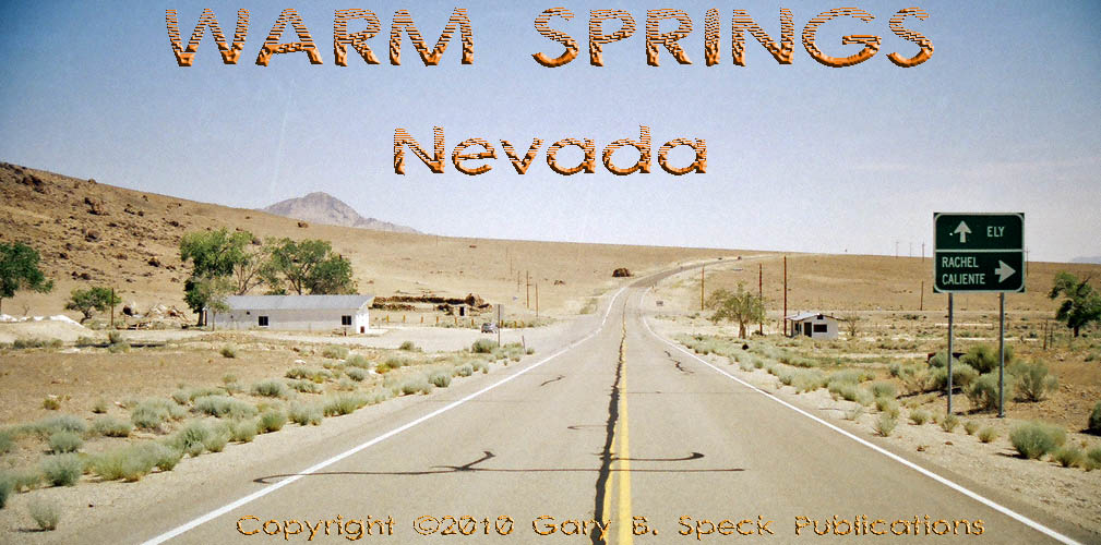
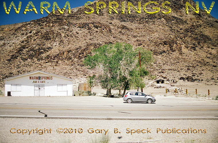
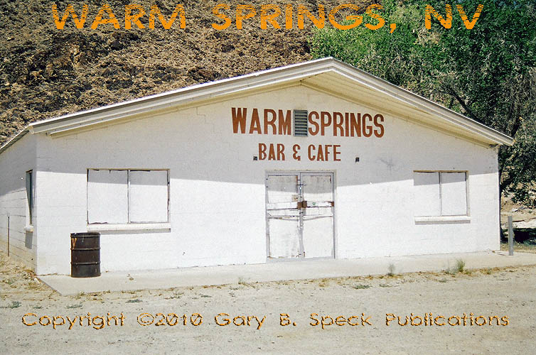
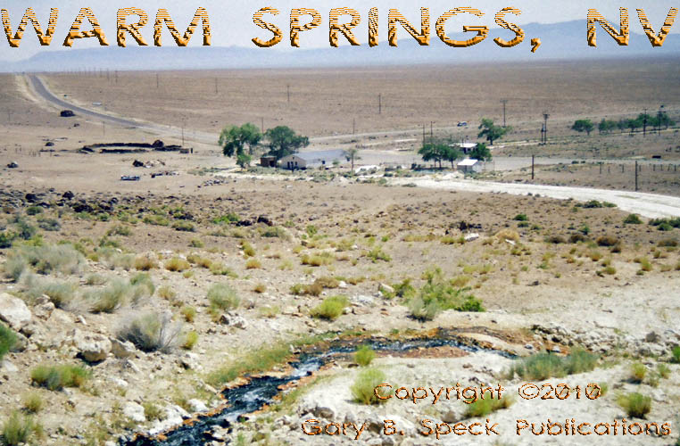
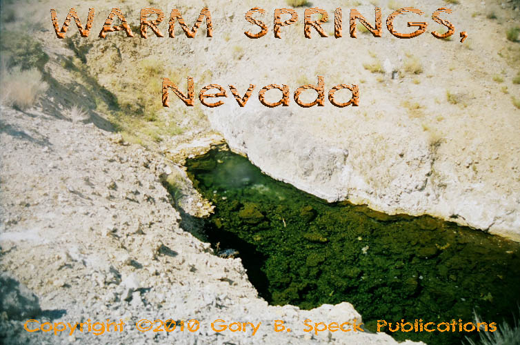
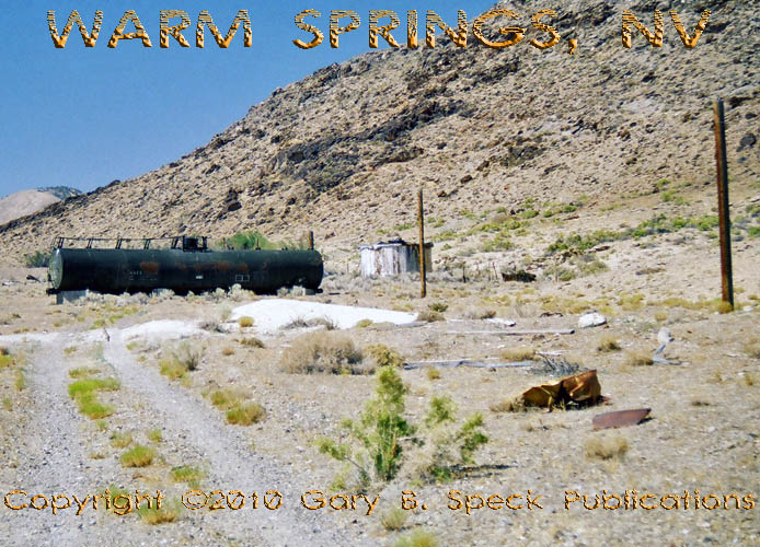
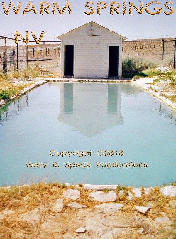
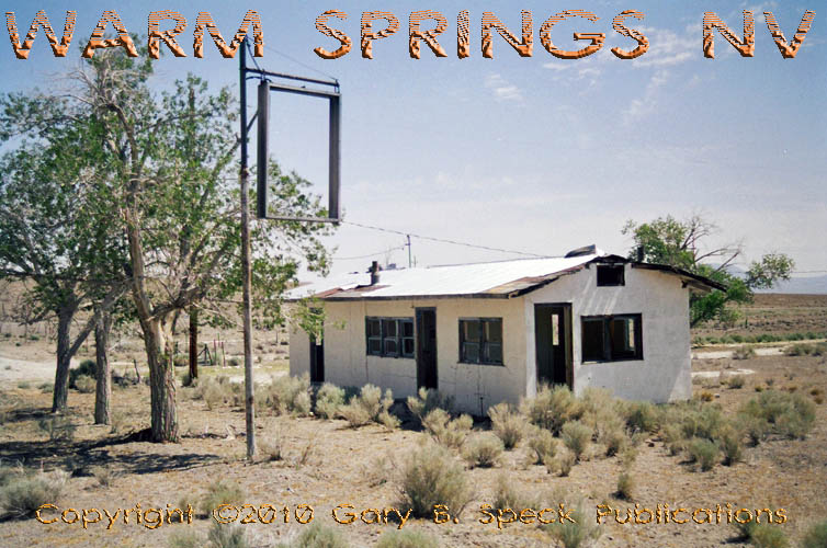
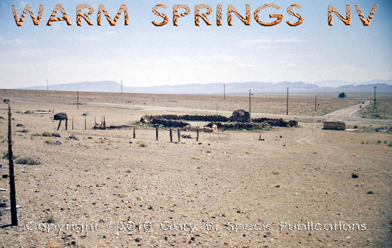
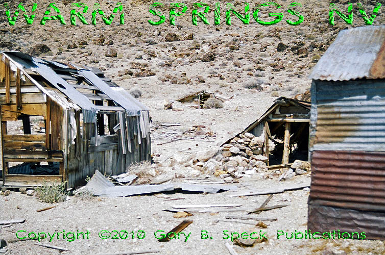
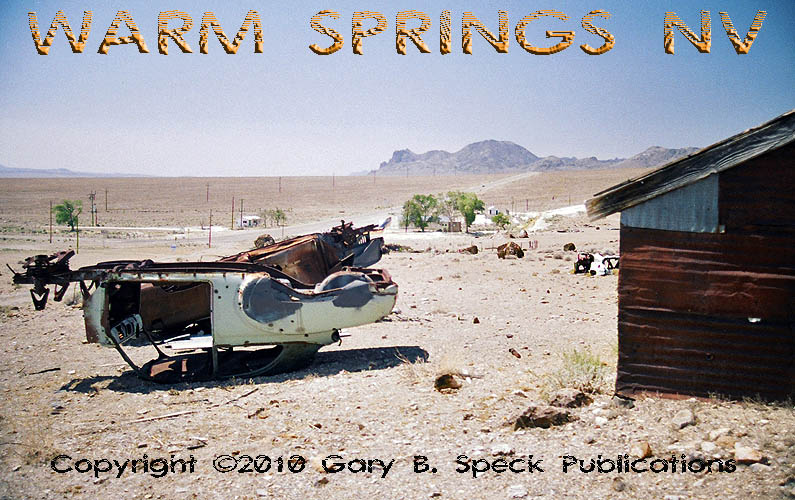
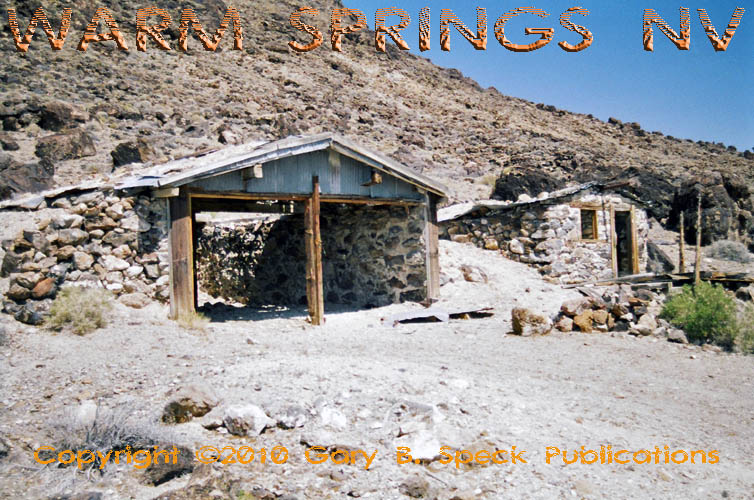
WARM SPRINGS
The little crossroads community of WARM
SPRINGS sits at that junction on the southeastern slope of the
Hot Creek Range. During the past 44
miles, US 6 was totally empty. I saw no cars, no towns, no ghost towns,
nothing of interest. After passing up and over Warm Springs Summit and making a
wide, sweeping, descending turn to the north, I burst upon this empty
townlet filled with abandoned buildings. It really reminded me of one of The
Twilight Zone television episodes where people disappeared
off the face of the earth. I parked
the Ghost Town Express on the wide
dirt pullout in front of the former Warm Springs bar
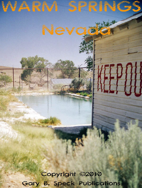
& café and started to explore the remains of WARM SPRINGS. I began at the small pool
house, hiking up the hill, following a stream of warm, stinky
water towards its source spring
up the hill. Reaching it, I had a great overview of the site. Spread
out below were the remains of this former travel stop, resort, RV park and road town – now all dead and nearly
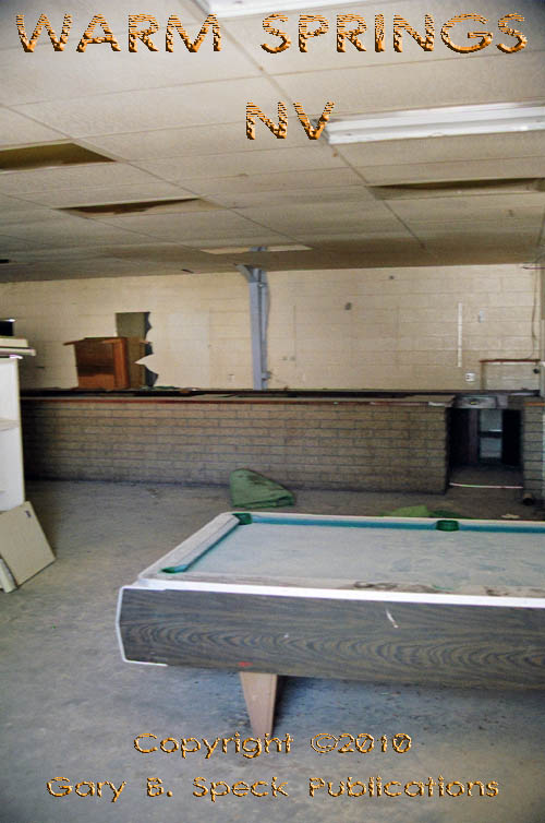
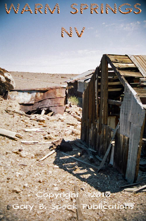
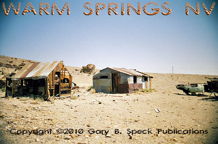
forgotten. Warm Springs consists
of a large water tank,
a small fenced-off pool house with its still-full swimming pool,
the old bar/café, a 1970s trailer
park without the trailers, a rock
corral, a small
rock building adjacent to it and
a handful of unidentifiable shacks,
older
wooden buildings, ruins
and dead
cars. There is also a rock
house and garage on the hill above all the others. GNIS lists an airport at the site, and
the aerial photo does show what
appears to be a runway running NW-SE to the east of the trailer park and south
of the creek running parallel to and south of SH 375.
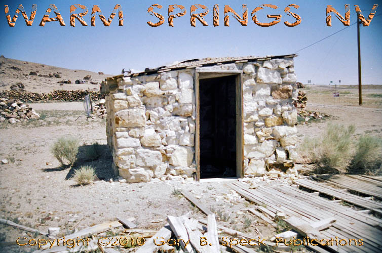
The spring was discovered in 1866 and a
rock house was built at the spring, above the current complex. It served as a travel stop along the
roads to Elko and Eureka. In the
early 1900s a store and “lodging house” were built. A post office
operated by Ethyl Allred was open here January 1924 – June 1929, during
the town’s zenith. This is a fascinating site, and worth a visit. I
wonder if Ethyl Allred was involved with the former town of ALLRED (in part 4)?
Leaving WARM SPRINGS in
the rearview mirror, we continue to head north…
CONTINUED in PART
4
PART
1: Bishop, CA to CA/NV State Line
PART
2: CA/NV State line to
PART 3: Tonopah to Warm Springs, NV
PART
4: Warm Springs, NV to NV/UT State Line
PART
5: NV/UT State Line to the Tintic Mining District, UT
PART
6: The Tintic
Mining District to Price, UT
PART
7: Coal Mining Camps west of
Price, UT
GPS
and Standard Township/Range locations for the sites featured above
|
SITE NAME |
ELEV. |
LATITUDE |
LONGITUDE |
TOWNSHIP/RANGE |
|
Belmont (Nye
Co.) |
7424’ |
38.5960444 / 38°
35’ 46” N |
-116.8742436 / 116°
52’ 27” W |
NW¼
Sec 25, NE¼ Sec 26 T9N, R45E, MDM (Mount Diablo Meridian) |
|
Clifford (Nye
Co.) |
6171’ |
38.1377133 / 38° 08' 16"
N |
-116.4781113 / 116° 28' 41"
W |
NE3 Sec 3, T3N,
R49E, MDM |
|
Ellendale (Nye
Co.) |
6601’ |
38.0985469 / 38° 05’ 55” N |
-116.7570077 / 116° 45’ 25” W |
Ctr
Sec 19, T3N, R47E, MDM |
|
Hannapah (Nye Co.) |
6417’ |
38.1271570 / 38° 07’ 38” N |
-116.9170147 / 116° 55’ 01” W |
NW3 Sec 32, T3N,
R45E, MDM |
|
Junction SH 376/SH 82 (Road to Belmont) |
5844’ |
38.256494 |
-117.078472 |
SE¼
Sec 30, T5N, R44E, MDM |
|
Junction |
5534’ |
38.071339 |
-117.127562 |
WCtr Sec 35, T3N, R43E |
|
Tonopah
(Nye Co.) - |
4823’ |
38.0671553 / 38°
04’ 02” N |
-117.2300825 / 117°
13’ 48” W |
S½
Sec 35, T3N, R42E, MDM / N½ Sec 2, T2N, R42E, MDM |
|
Tonopah
(Nye Co.) - Junction |
|
38.063103 |
-117.223263 |
NE¼
Sec 2, T2N, R42E, MDM |
|
Tonopah - Belmont Mine – milling
complex (Nye Co.) |
Approx. 6280’ |
38.070410 |
-117.215677 |
SW¼
Sec 36, T3N, R42E, MDM |
|
Tonopah - Mizpah Hotel (Nye Co.) |
|
38.068264 |
-117.230676 |
|
|
Tonopah |
|
38.072943 |
-117.100396 |
NE¼
Sec 36, T3N, R43E, MDM |
|
Tonopah |
|
38.064362 |
-117.098873 |
SE¼
Sec 36, T3N, R43E, MDM |
|
Tonopah |
|
38.058618 |
-117.101254 |
NE¼
Sec 1, T2N, R43E, MDM |
|
Tonopah |
|
38.053025 |
-117.093208 |
SW¼
Sec 6, T2N, R44E, MDM |
|
Tonopah |
|
38.045539 |
-117.093079 |
NW¼
Sec 7, T2N, R44E, MDM |
|
Tonopah |
|
38.060780 |
-117.106726 |
NW¼
Sec 1, T2N, R43E, MDM |
|
Tonopah |
|
38.065511 |
-117.109902 |
SW¼
Sec 36, T3N, R43E, MDM |
|
Tonopah |
|
38.064919 |
-117.107091 |
SW¼
Sec 36, T3N, R43E, MDM |
|
Tonopah |
|
38.069903 |
-117.110031 |
SW¼
Sec 36, T3N, R43E, MDM |
|
Tonopah |
|
38.071525 |
-117.084990 |
Ctr Sec 31, T3N,
R44E, MDM |
|
Warm Springs (Nye
Co.) |
5423’ |
38.1660461 /
38° 09' 58"
N |
-116.4447776 /
116° 26' 41"
W |
West-Central
Sec 20, T4N, R50E, MDM |
|
Historians estimate that
there may be as many as 50,000 ghost towns scattered across the The Ghost Town
Guru's Guide
to the Ghost Towns of “STATE”™ These original guides are
designed for anybody interested in ghost towns. Whether you are a casual
tourist looking for a new and different place to visit, or a hard-core ghost
town researcher, these guides will be just right for you. With over 30 years
of research behind them, they will be a welcome addition to any ghost towner's library.
Thank you, and we'll see you out on the
Ghost Town Trail! For more information on
the ghost towns along this portion of E-mailers,
PLEASE NOTE: Due
to the tremendous amount of viruses, worms and “spam,” out there,
I no longer open or respond to e-mails with unsolicited attachments, OR
messages on the subject lines with “Hey”, “Hi”,
“Need help”, “Help Please”, “???”,
or blank subject lines, etc. If
you do send E-mail asking for information, or sharing information, PLEASE indicate the
appropriate location AND state name, or other topic on the
“subject” line. THANK
YOU! :o) |
IMPORTANT These listings and historical
vignettes of ghost towns, near-ghost towns and other historical sites along
this portion of US HIGHWAY 6 above are for informational purposes
only, and should NOT
be construed to grant permission to trespass, metal detect, relic or treasure
hunt at any of the listed sites. If the reader of this
guide is a metal detector user and plans to use this guide to locate sites
for metal detecting or relic hunting, it is the READER'S responsibility to
obtain written permission from the legal property owners. Please be advised,
that any state or nationally owned sites will probably be off-limits to metal
detector use. Also be aware of any federal, state or local laws restricting
the same. When
you are exploring the ghost towns along Ghost Towner's
Code of Ethics. |
Also visit: Ghost Town
Home
Page | Site Map | Ghost Town Listings
| On
the Road Again | Photo Gallery
| Treasure
Legends
CURRENT Ghost Town of the
Month | PAST Ghost Towns
of the Month
Ghost Towner's
Code of Ethics | Publications | Genealogy
| License Plate
Collecting
A few LINKS to outside webpages:
Ghost
Towns | Treasure
Hunting | License
Plate Collecting | Genealogy
***
THIS PAGE
FIRST POSTED: February
22, 2010
***
This entire website, and all individual web pages
is
copyright
© 1998-2017
by Gary B Speck Publications
ALL rights reserved