Ghost Town
Guide to the Ghost Towns of
“The ♥ of
Do you have Gary’s Ghost Town books?
Dust in the Wind - A Guide to
American Ghost Towns GHOST
TOWNS: Yesterday & TodayTM Become a friend of the book on Facebook ***
You can also visit Ghost Town USA
on Facebook. *** Return to Ghost Town USA’s State Listings
*** Visit Ghost Town USA’s Ghost Town of
the Month *** Visit Ghost Town USA’s Home Page *** Visit Ghost Town USA’s Photo Gallery *** Ghost
Town USA’s Site Map
*** Send E-mail to Ghost Town USA. *** Western & Eastern Treasures Ghost Town USA Column Index for Alabama |
When most people think of ghost towns, Alabama
is NOT one of the states that comes to mind. Yet, here in the Heart of Dixie ghost towns
do exist. Many of these sites date back to the colonial,
territorial and early statehood era.
There were also numerous Native American communities that have also
fallen by the wayside. Many of the old
towns of Alabama were situated on rivers, or crossroads. Many old county seats have faded and
disappeared, commerce levels have dropped and transportation corridors have
changed. All created ghost towns. There
was also some gold mining in the state, and that in itself has created a
number of ghost towns. Alabama has a rich historical past, and many
ghost towns worth doing the research to try and find. Listed below are only a few of the hundreds of sites
that exist in this state. I have about
350 locations in my files. For those serious about looking for the ghost
towns of Alabama, there are a number of books out there dealiong
with the subject. Two sources that I
have in my library are excellent and have served as seeds for my own
research. I don’t know if either, or
both, are still in print or not, but look for the following two books: ·
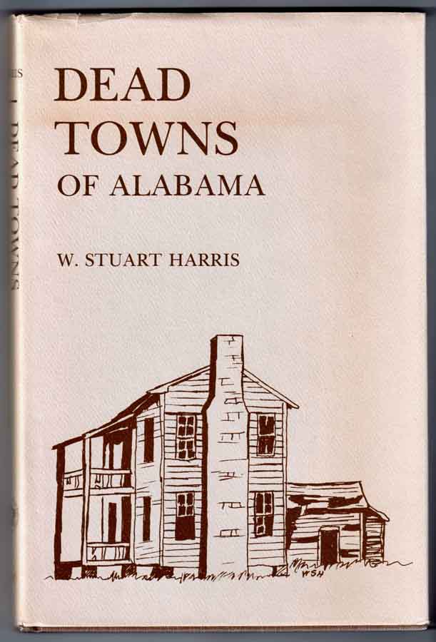
Dead
Towns of Alabama - W. Stuart Harris – 1977 - University of Alabama Press –
ISBN: 0-8173-5232-5 ·
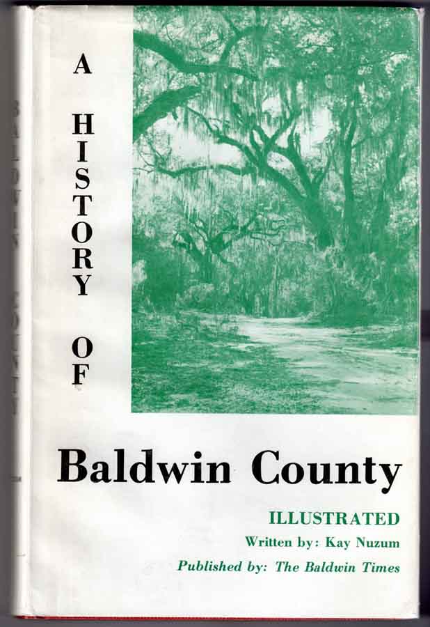
A
History of Baldwin County – Kay Nuzum – 1971 – The
Baldwin Times – ISBN (none) Some of the vignettes below contain specific
words that are listed on our Definitions page. If you are unfamiliar with the meaning of
the word in a ghost town sense, click on the link and scroll down to that
term. You can use the BACK button on
the browser to return to this page. HELP! (NEW FEATURE) Please check here to find a
list of ghost towns that various contacts are looking for. IF you have any information on these places
please e-mail
me and I can respond back to those looking for info on these ghosts. PLEASE NOTE: Where
photos are indicated thusly (PHOTO!), please use your
browser’s “BACK” button to return to this page. More photos will be added over time. |
|
ABINGDON /
ABINGTON
|
unknown |
HELP! Don’t know location, county, or history. I found an ABINGTON
GREEN (Jefferson Co.) on GNIS. It is located just south of the Birmingham
Reservoir and south of Birmingham, just below the junction of US 280 - State Highway (SH) 38/County Route (CR) 113. It appears to be a suburb of Birmingham, so
is probably not the same location being sought by the correspondent. (GBS). |
|||
|
ACMORE STEEL
& MINE CO.
|
Jefferson
Co. |
HELP! Outside of Bessemer,
AL - coal 1940's. |
|||
|
ARBACOOCHEE
|
Cleburne
Co. |
This is an old gold mining town on CR 42 between
SH 46 & SH 9, south of Interstate 20, nine miles southeast of
Heflin. The placer and lode gold mines were
discovered in the 1830s. In 1845, the
population was a reported 5000, and the town’s businesses included: two
churches, 20 general stores, two hotels, two mining equipment stores, five
saloons and a school. When gold was
discovered in California a mass exodus began.
Mining did continue until the 1930s.
In 1990 the population was listed as rural. ·
NE¼ Sec 6,
T17S, R11E, Huntsville Meridian ·
Latitude: 33.5781640 / 33° 34’ 41” N ·
Longitude: -85.5199558 / 85° 31’ 12” W |
|||
|
ARCOLA
|
Hale
Co. |
A French village and early river port along the
south bank of the Black Warrior River, 4.5 miles northeast of Demopolis. May
be under the waters of Lake Demopolis.
GNIS lists the ferry, post
office and school as historical, indicating they no longer exist. Arcola is
listed as a “populated place” and shows it just north of the junction of
Baker Road and SH 2, about two miles southwest of the lake. A church, school and cemetery are also
shown here. This community was active
in the 1830s and 1840s. ·
SE¼ Sec 4,
T18N, R3E, St. Stephens Meridian ·
Latitude: 32.5570792 / 32° 33’ 25” N ·
Longitude: -87.7675111 / 87° 46’ 03” W |
|||
|
ARCOLA FERRY
|
Hale
Co. |
Shown on GNIS just west of the western end of
Baker Road, on the Black Warrior River about a mile or so northwest of
Arcola. ·
NE¼ Sec 4, T18N, R3E, St. Stephens Meridian ·
Latitude: 32.5669014 / 32° 34’ 00” N ·
Longitude: -87.7852894 / 87° 47’ 07” W |
|||
|
BAINBRIDGE
( |
Colbert/Lauderdale
Co. |
An old river crossing on the bank of the Tennessee
River, several miles east of Florence. Now under the waters of Wilson
Lake. A post office, ferry and a
bridge were once located here. The
south bank side of the river is in Colbert County, and the north bank in
Lauderdale County. The ferry and post
office were on the south side. The
post office was located north of the junction of Pinegrove/Gray’s Landing
roads, southeast of Florence. This former community dates to 1819, and was
abandoned by the 1840s. ·
Sec 4, T3S, R10W, Huntsville Meridian ·
Latitude: 34° 49’ 15” N / 34.8209204 ·
Longitude: 87° 36’ 00” W / -87.6000270
POST OFFICE: ·
Latitude: 34.8209204 / 34° 48’ 03” N ·
Longitude: -87.5900270 / 87° 35’ 24” W |
|||
|
BERLSON
|
unknown |
HELP! The correspondent had
a family member die there in 1871, but the county is not listed. |
|||
|
(AKA-Bluff,
|
Morgan
Co. |
Early river town/ferry on south bank of
Tennessee River, four miles north of Somerville at the north end of Bluff
City Road. Once had a post office and a river landing. The post office was originally known as Monroe
Post Office. The town began
as Monroe
as early as 1818, but the name changed sometime after 1857. In 1874, the post office was reopened as
Bluff City. By 1881 the town was dead. Rand McNally in its Commercial Atlas &
Marketing Guide lists Bluff City as an alternate name for the rural community
of Echols
Crossroads. ·
Ctr Sec 6, T6S, R2W, Huntsville Meridian ·
Latitude: 34.5456482 / 34° 32’ 44” N ·
Longitude: -86.7813890 / 86° 46’ 53” W |
|||
|
BRINK
|
unknown |
HELP! Possibly in northern AL. |
|||
|
BURNT MILLS
|
unknown |
HELP! Any help?
Don’t know location, county, or history. I found a BURNT
MILL BRIDGE (Dale Co.), which is a modern bridge carrying US 84/SH 12 over the Little Choctawhatchee River just
southeast of Daleville and south of Fort Rucker. This could be the site of an old mill and
bridge, judging by the name. (GBS) |
|||
|
CAHAWBA
(AKA-Old
|
Dallas
Co. |
Established in
1819, this was the former state capital, and was located at the confluence of
Alabama & Cahaba Rivers, at end of SH 9, 3.5 miles southeast of a point
nine miles southwest of Selma on SH 22.
It faded and died out by 1865, mostly due to the continued flooding of
the town’s site along the river bottoms. This was our Ghost Town of the Month for February
2005. This is one of the towns featured in my
newest book, GHOST
TOWNS: Yesterday & TodayTM. This historic
site also has its own website at: Old Cahawba.com ·
SW¼ Sec 32, T16N, R10E, St. Stephens Meridian ·
Latitude:
32.3168056 / 32°
19’ 01” N ·
Longitude:
-87.1013793 / 87° 06’ 05” W |
|||
|
CARPENTER / CARPENTER STATION
|
Baldwin
Co. |
“Am looking for a town called Carpenter
or Carpenter’s
Station. It's located in Baldwin County, Ala. It goes back to
around 1800 and still has a few residents living there now. Most of them are
families of those early settlers. It had a post office, a stage stop, a
railroad stop, an early horse race track (very popular then) with a large
boarding house or hotel. The track opened around 1820 and closed just before
the Civil War. It's been said it was a favorite spot for the well to do, of
the time. It was supposed to be one of the hot spots the elite, very famous.
I am looking for additional information; if you have it. If not, where can I
find out more?” (Aaron C., Apr
2005) (The correspondent’s E-mail
address has changed, so the info is posted here.) There is a current rural community located at
the junction of SH 225 and the railroad about five miles west-southwest of
Bay Minette and two miles east of the Tensaw
River. The GNIS topo map and aerial photo
show a scattering of buildings. Don’t
know if this is the same place or not.
I have the book – A History of Baldwin County, by Kay Nuzum, and it’s not listed therein – OR - I didn’t see
it. (GBS) ·
Latitude:
30.8571299 / 30°
51’ 26” N ·
Longitude: -87.8661053 / 87° 51’ 58” W |
|||
|
CHULAFINNEE PLACERS
|
Cleburne
Co. |
In the southwest corner of the county along Carr
& Chulafinnee Creeks. Chulafinnee Creek
is to the north of the town of Chulafinnee, while
Carr Creek is to the south. The mines were
active from 1835 until the late 1840s. TOWN: ·
Ctr
Sec 17, T17S, R10E, Huntsville Meridian ·
Latitude:
33.5453860 / 33°
32’ 43” N ·
Longitude:
-85.6488479 / 85° 38’ 56” W |
|||
|
CUNNINGHAM
|
Perry
Co. |
“Do you have any information on Cunningham,
Perry County, AL? On the 1880 Federal Census, my
relatives Robert and Sarah Brooks appear as living in Cunningham, AL. I
cannot find Cunningham on any Alabama map so I assume it must be a
"ghost town". Any information you have would be greatly appreciated.”
(The correspondent’s E-mail address has changed,
so the info is posted here.) GNIS lists a place called VAIDEN with a variant name of CUNNINGHAM. It is not listed in Rand McNally. On the
GNIS maps is it shown at the junction of SH 5/CR 15, about five miles north
of US 80, at a point midway between Demopolis and Selma. It’s just west of Washington Creek. A handful of buildings are shown on the
GNIS topo map and aerial photo. (GBS) VAIDEN: ·
SW¼ Sec 32, T16N, R10E ·
Latitude:
32.5198561 / 32°
31’ 11” N ·
Longitude: -87.3711102 / 87° 22’ 16” W |
|||
|
DUMPHRIES
|
Washington
Co. |
This former Tombigbee River landing, was located
along the west bank 18 miles south of St. Stephens, just north of the
confluence with Bilbo Creek, about five AIR miles southeast of McIntosh and
the same northeast of Malcolm. It was
active from 1819-1839 or so. This is
in the same area that Bilbo’s Landing (Historical) is
shown on the GNIS map. BILBO’S
LDG: ·
Sec 38, T3N, R1E, Saint Stephens Meridian ·
Latitude: 31.2201724 / 31° 13’ 13” N ·
Longitude: -87.9452762 / 87° 56’ 43” W |
|||
|
|
Hale
Co. |
Early county seat located four miles southwest
of Sawyerville (Hale Co.) on the west bank of the
Black Warrior River. Just northwest of
the junction of SH 49/50 and Walnut Hill.
It was established in 1819 and incorporated in 1820. In 1838 the county seat was voted to be
removed and Erie died slowly.
By 1855 it was abandoned. GNIS
shows it on the southeast side of Martin Lake which puts it in Hale Co. ·
SE¼ Sec 13, T20N, R3E, St. Stephens Meridian ·
Latitude: 32.7154078 / 32° 42’ 55” N ·
Longitude: -85.8041249 / 85° 48’ 15” W |
|||
|
FINCHBURG
AKA – Finchburgh, Finchberg
|
Monroe
Co. |
This old town is located just 2.5 miles east of
the Alabama River and a little over a mile west of Wainwright, south of the
main road, 20 AIR miles northwest of Monroeville. It once had a post office
and a river landing (to the northwest).
In 2000 it had a population of 60. ·
SW¼ Sec 19, T8N, R6E, St Stephens Meridian ·
SW¼ Sec 10, T8N, R5E, St Stephens Meridian
(LANDING) ·
Latitude: 31.6426574 / 31° 38’ 34” N ·
Longitude: -87.5108251 / 87° 30’ 39” W |
|||
|
|
Baldwin
Co. |
Erected in
1812, this old wooden fort was destroyed by a hurricane in 1819. In 1833, Fort Morgan was
built on the same site. …SEE Ft. Morgan for location
details. |
|||
|
|
Mobile
Co. |
This historic, old, pentagonal-shaped coastal
defense fort sits on Pelican Point, south of Bienville Blvd, on the east end
of Dauphin Island, at the west side of the entrance to Mobile Bay. It was designed and built to protect Mobile
Bay from any enemy incursions. ·
Latitude: 30.2480556 / 30° 14’ 53” N ·
Longitude: -88.0755556 / 88° 04’ 32” W |
|||
|
|
Baldwin
Co. |
This star-shaped coastal
defense fort was built in 1833 to protect Mobile
from Spanish or French ships. It is
located on the east
side of the entrance to Mobile Bay, at the tip of the peninsula jutting west
from Gulf Shores. It is a popular tourist destination. The famous Chiricahua
Apache warrior, Geronimo, was also incarcerated here for 18 months prior to
being sent to Fort Sill, Oklahoma. The only time this fort was attacked was
by Union forces in 1864, during the Civil War, at which time it fell to
them. It remained an active military
post until 1945. ·
Latitude: 30.2285373 / 30° 13’ 43” N ·
Longitude: -88.0230530 / 88° 01’ 23” W |
|||
|
GOLD LOG MINE
|
Talladega
Co. |
This was a gold-mining camp located on the west side of
Talladega Creek, 7.5 miles southeast of Talladega, just west of Waldo
and west of SH 77 in the Talladega National Forest. ·
NW¼ Sec 17, T19S, R6E, Huntsville Meridian ·
Latitude: 33.3784435 / 33° 22’ 42” N ·
Longitude: -86.0430250 / 86° 02’ 35” W |
|||
|
GUM POND
|
Morgan Co.? Lawrence Co? Winston Co.? |
HELP! Any help?
Don’t know location, county, or history. Rand McNally lists a rural community called GUM POND in Morgan County. GNIS also shows it. GNIS lists a GUM POND cemetery and church in Lawrence County, which is about
five miles north of the county line. GNIS also lists a GUM POND (Historical), and a GUM POND POST OFFICE (Historical) in
Winston County, about a quarter mile south of the Lawrence County line. These last two may be related. (GBS) |
|||
|
HILLSBORO
|
Shelby
Co. |
HELP! “Do you have any information on the Civil War era town of
Hillsboro? It would have been south of
Birmingham and north of Montevallo which would have put it in either
Jefferson or Shelby County. Thanks for any help or suggestion of resources
that would have a location of this ghost town.” Helena, Shelby County is listed by GNIS with a
variant name of HILLSBORO and HILLSBOROUGH. There is also a listing for a HILLSBOROUGH POST OFFICE, location
unknown. This looks like the
place. Helena is the county seat of
Shelby County and is an active town of 4000 or so people. (GBS) |
|||
|
HOUSTON |
Winston
Co. |
From 1850-1882, this was the county seat. It is located on CR 63, two miles south of
US 278 at a point five miles southwest of Addison. Had 190 people in 2000.
The post office was established in 1853 and was still active in 2002. ·
SE¼ Sec 27, T10S, R7W, Huntsville Meridian ·
Latitude: 34.1414925 / 34° 08’ 29” N ·
Longitude: -87.2580686 / 87° 15’ 29” W |
|||
|
HUGHES |
Tuscaloosa
Co. |
HELP! “Greetings
from an old War Horse searching for the ghost town, (or old community of
HUGHES), Alabama, We think it was southeast of Tuscaloosa. Grandparents had a
farm, or "Sharecropped" a farm called "BIG SANDY",
Grandmother told stories of how the "YANKEES STOLE THE FARM", after
the WAR. We know of the BIG SANDY
CREEK and BEAR CREEK which
flow southwest to the (Black) WARRIOR RIVER, and are pretty sure it was in that area.
Some sources say it was near the OLD
SARDIS CHURCH which was purported to be on or near the BEAR CREEK/ BEAR
CREEK ROAD. RELATIVES/ FAMILY were
also in the FOSTERS SETTLEMENT
areas, on or near the WARRIOR RIVER CROSSING and in the northwest areas of
Tuscaloosa County near NORTHPORT/BROWNSVILLE.
Our g-g-grandparents - REV. JOHN HINTON - (b. JOCO, NC-circa-1790-1843) &
EASTER (MONTGOMERY) HINTON - (b. GA-circa- 1797-1870) - were married - (1823)
- in TUSCALOOSA COUNTY. THANKS &
GOD BLESS - SEMPER FI” (From BA
4/30/2007) Gary’s
Note: Places mentioned in BA’s E-mail are highlighted above and shown
below. I did find a HUGHES MILL on GNIS. It is located south of the BROWNVILLE/SARDIS CHURCH area and
might be the area BA was looking for. BROWN(S)VILLE: (Located on
the former railroad about a mile east of the Sipsey
River, and about 18 AIR miles northwest of Tuscaloosa.) ·
SE¼ Sec 14,
T19S, R12W, Huntsville Meridian ·
Latitude: 33.3926155 / 33° 23’ 33” N ·
Longitude: -87.7533462 / 87° 45’ 12” W CONFLUENCE BEAR CREEK/BIG
SANDY CREEK: (0.3 miles south
of US 82 at Duncanville, which had 150 people in 2000.) ·
Ctr Sec 14, T24N, R6EW, St. Stephens Meridian ·
Latitude: 33.055868 ·
Longitude: -87.442117 FOSTERS (SETTLEMENT): (Southwest of Tuscaloosa on the west side of the Black
Warrior River. It had 300 people in 2000.) ·
NE¼ Sec 32,
T22S, R11W, Huntsville Meridian ·
Latitude: 33.0948441 / 33° 05’ 41” N ·
Longitude: -87.6858428 / 87° 41’ 09” W HUGHES
MILL:
(Located on Wards Mill Creek, about a ¼ mile east of the junction of
Upper Columbus Road-CR 21/Jackson Trace Rd-CR90, and about a ¼ mile northeast
of the junction of CR 21/Preacher Lee Road, northwest of Lake Lurleen State Park and southeast of BROWNVILLE. It is also just east of the Bethany Church
and Cemetery.) ·
SW¼ Sec 8, T20S,
R11W, Huntsville Meridian ·
Latitude: 33.3926155 / 33° 23’ 33” N ·
Longitude: -87.7533462 / 87° 45’ 12” W SARDIS FREEWILL BAPTIST CHURCH
& CEMETERY: (Located on Cooper Road, a mile west of
the junction with Boyd Road, about three miles west of BROWNVILLE) ·
SW¼ Sec 21,
T19S, R12W, Huntsville Meridian ·
Latitude: 33.3817827 / 33° 22’ 54” N ·
Longitude: -87.8019592 / 87° 48’ 07” W |
|
|||
|
JONESVILLE |
Jackson
Co. |
DEAD NAME. This was the original name for Bridgeport
(2000 population - 2728). The name was
changed in 1854 or so. Information contributed by Karen H in November
2004. |
|||
|
LARISSA |
Winston
Co. |
I have moved this
ghost from the HELP! page to here. (GBS) “Hi, I saw where you’re looking for proof of Larissa in Winston Co. I have a claim filed by my g-g-grandfather
to the US for property and provisions taken by General Wilson in 1865. His
witnesses were listed as living in Larrissa (sic), Winston County. James Wilson, Emily Wilson,
Jonathan Barton, and William Bush.” Contributed by
Debbie, August
27, 2006 DEAD NAME. This was an early name
for Lynn. The post office was
originally established as Larissa
May 6, 1857. On August 1, 1888 the
name changed to Lynn. Lynn had 597
people in 2000 and is NOT a ghost town. (GBS) |
|||
|
LILE COLLEGE |
Morgan
Co. |
HELP! In November 2005, Jeremy T contacted me for info
on this old college. “I live in
Morgan Co. AL on Trinity Mountain. I have been told by many people that there
use to be an old college up here named Lile College. Do you
have any information on anything of the sort.” Can anyone help Jeremy out? The only LILE
I can find in GNIS are two LILE
CEMETERIES. There are quite a few schools listed as historical schools
(meaning they do not exist any longer) in the area of Trinity Mountain. Any one of them could have been it. (GBS) |
|||
|
|
Dallas
Co. |
On the railroad, just south of US 80, 14 miles
west of Selma. In 1990 it was listed
with a population of 0. ·
NW¼ Sec 20, T17N, R8E, St Stephens Meridian ·
Latitude: 32.4379137 / 32° 26’ 16” N ·
Longitude: -87.2958297 / 87° 17’ 45” W |
|||
|
MONTEZUMA (AKA
– |
Covington Co. |
“Montezuma
was an early settlement in our County. It was first designated as Covington Courthouse, then in 1823 it was named Montezuma. This location was our
first County Seat. The County Seat was moved to a new (location) on July 18,
1844 (sic) and called Andalusia.” Contributed by G. Sidney Waits, Aug 26, 2005 It is east of the Conecuh River and west of SH 12/55/US
84, about a mile northwest of the Andalusia Country Club, about three miles
northwest of Andalusia. It served as
the county seat from 1822-1847 at which time is was flooded out by the
Conecuh River. The county seat was
then relocated to New Site, which became Andalusia. (GBS) ·
SW¼ Sec 11, T4N, R15E, St Stephens Meridian ·
Latitude: 31.3223923 / 31° 19’ 21” N ·
Longitude: -86.5249594 / 86° 31’ 30” W |
|||
|
NADAWA |
Monroe Co. |
“My Father
was born and grew up in Nadawa I would love to know
where in Monroe County Alabama it was located. Any information as to where it
was located or history of Nadawa would be greatly
appreciated.” (The correspondent’s
E-mail address has changed, so the info is posted here.) “Nadawa is (was) a large sawmill town in the northern part
of Monroe County, near the Wilcox County line. It is at the head or beginning
of Flat Creek and next to the L&N railroad. It had a sawmill, school, post office,
hotel, stores and etc. It is approximatly six to
eight miles northeast of Beatrice, Alabama. I have a couple of tokens from
there with Shoal Creek Merc. Co. on them. Also have
a couple of copies of an ad by the same company offering to buy cotton and
produce, and a ad offering Pure Drugs from Nadawah
Drugs owned by R.A.Smith, M.D., Prop. Hope this helps.” Contributed by Clifford Manning, Jr., Jan 12,
2009 NADAWA is listed by Rand
McNally as a rural community, located on a railroad spur just south of the
county line midway between the east and west ends. GNIS lists NADAWAH and NADAWAH POST
OFFICE (historical). It is shown
where Nadawah Road crosses the railroad about seven
miles northeast of Beatrice and about a mile south of the county line. (GBS) ·
S-Ctr Sec 21,
T10N, R9E, St Stephens Meridian ·
Latitude: 31.8143197 / 31° 48’ 52” N ·
Longitude: -87.1722083 / 87° 10’ 20” W |
|||
|
|
Talladega
Co. |
A paper town
that actually
had a few buildings. It was located a mile northeast of Alpine, five miles
southwest of Talladega where the railroad crosses Talladega Creek. It was “founded” as a steel town in the
1880s, and by 1890 had a restaurant, storehouses and 15 duplex dwellings, all
built on speculation. By 1895 it was
dead, the iron furnaces having never been built. ·
SE¼ Sec 21, T19S, R4E, Huntsville Meridian ·
Latitude: 33.3623327 / 33° 21’ 44” N ·
Longitude: -86.2227522 / 86° 13’ 22” W |
|||
|
ODENA
|
Talladega
Co. |
This class
A community
was located about four miles northwest of Sylacauga, and at one time had
about a dozen stores and a post office, elementary school, a couple churches,
sawmill and grist mill. Odena
means "village" in the Algonquian Indian tongue. There may be just some archaeological
evidence beside the train tracks of where the town was, west of Odena Road. The land was first purchased in 1835 by the
Taylor family, who called it Shirtee
Plantation. In 1854 it was sold to
Capt. John Oden.
He called it Odena Plantation. The original site of the town of Odena is now on the property owned by Tekside
Industries, adjoining the Oden-Sanford Farm. There ARE some later buildings, built in the 1920s-50s, located down
the road, and others near the 1904 church, which was not
"downtown," and most people today think of those as Odena, but the original pre-1910 town site was around the
train depot. All above information contributed by Ray Isbell,
May 2003 GNIS shows it along the east side of the railroad just north of Shirtee Creek. NEW ODENA: ·
SE¼ Sec 12, T21S, R3E, Huntsville Meridian ·
Latitude: 33.2109483 / 33° 12’ 39” N ·
Longitude: -86.2785860 / 86° 16’ 43” W |
|||
|
|
Dallas
Co. |
On the south side of the Alabama River, about
five AIR miles west of the junction of SH 41/89, and Elm Bluff, about 22 AIR miles southwest
of Selma. It once had a post office. ·
SE¼ Sec 28, T14N, R9E, St Stephens Meridian ·
Latitude: 32.1545876 / 32° 09’ 17” N ·
Longitude: -87.1686007 / 87° 10’ 07” W |
|||
|
RIVER RIDGE
|
Monroe
Co. |
It is along the railroad six AIR miles east of
Franklin. It also once had a post office. ·
SE¼ Sec 25, NE¼ Sec 36, T9N, R7E, St.
Stephens Meridian ·
Latitude: 31.7137668 / 31° 42' 50" N ·
Longitude: -87.3130436 / 87° 18' 47" W |
|||
|
ROCKCASTLE
(AKA – Davis Creek) |
Tuscaloosa
Co. |
On the Abernant Loop
Road, west of SH 216 (Old Birmingham Highway), 1.5 miles southwest of Abernant, nine miles east of Brookwood,
about 25 miles east of Tuscaloosa (midway between Tuscaloosa and Birmingham).
It once had a post office. ·
SE¼ Sec 24, T20S, R7W, Huntsville Meridian ·
Latitude: 33.2790041 / 33° 16' 44" N ·
Longitude: -87.2174978 / 87° 13' 03" W |
|||
|
RODINBURG
|
unknown |
HELP! (GARY’s note: I found a RODENTOWN in DeKalb Co., 2000 pop
of 150. It is located in the southwest corner of the county, 15 AIR miles
north of Gadsden, in the SW corner of the county. It once had a post office.) |
|||
|
RUSSELLS
CAMP
|
Russell
Co. |
HELP! Russell Co. mid 1800s. |
|||
|
SPANISH FORT
|
Baldwin
Co. |
Old Spanish era fort, and later a Confederate fort on the east bank of the Blakeley River, on the northeastern point of
Mobile Bay, north of I-10,
on the outskirts of the town of Spanish Fort, east of Mobile. ·
NW corner Sec 30, T4S, R2E, St. Stephens Meridian ·
Latitude: 30.6757460 / 30° 40' 33" N ·
Longitude: -87.9186058 / 87° 55' 07" W |
|||
|
TANNEHILL IRON
WORKS
|
Jefferson
Co. |
This massive old iron works was located on Tannehill Parkway, 2.5 miles east of I-59/I-20 at Exit 100.
At the southern point of the county, 23 miles southwest of Birmingham. It is now a state historic park. ·
SW¼ Sec 33, T20S, R5W, Huntsville Meridan ·
Latitude: 33.2487264 / 33° 14’ 55” N ·
Longitude: -87.0694386 / 87° 04’ 10” W |
|||
|
unnamed
|
Etowah
Co. |
HELP! In Dec 2004 Brandon D contacted me. (edited slightly for length) “I'm an individual researcher from Indiana and have (recently)
relocated to Oneonta, Alabama and have gained knowledge of a ghost town in
Etowah County Alabama said to have 50-500 individuals (who) abandoned the
town for some unknown reason. I've done a lot of research and still can't
discover where the location of the settlement could be. There is an old mill,
a cemetery, foundations of homes and still some clear trails there. It was an
old Indian settlement before, but there’s still no evidence of where it could
possibly be.” Can anyone help Brandon? Please let me know |
|||
|
VALHERMOSO SPRINGS (AKA - Chunn Springs, Manning Springs, Valhermosa Springs, White Sulphur Springs) |
Morgan
Co. |
Old health resort located on SH 36, 20 miles northeast
of Hartselle, 12 miles south of Huntsville. Some population remains. The hotel was built in 1818 and opened in
1823. A short-lived post office
operated from May 1834 to Jun 1835.
The property sold in 1856 and the new proprietor renamed it from Chunn
Springs to Valhermoso Springs. The three-story hotel reopened and operated
until 1920. It burned in 1950 after
being damaged by a tornado. ·
SE¼ Sec 24, T6S, R2W, Huntsville Meridian ·
Latitude: 34.5012035 / 34° 30’ 04” N ·
Longitude: -86.6858295 / 86° 41’ 09” W |
|||
|
WALDO
|
Talladega
Co. |
This class
D
gold-mining town is located on SH 77, five miles southeast of Talladega. In the 1830s, Waldo was the center for hardrock mining in the county. Some of the mines included: Gold Log (SEE above), May Virginia Mine and the
Riddles Mine. In 2000 it still had 281
folks, but is a sleepy semi-ghost that
has faded from its glory days ·
NW¼ Sec 16, T19S, R6E, Huntsville Meridian ·
Latitude: 33.3803879 / 33° 22’ 49” N ·
Longitude: -86.0269173 / 86° 01’ 37” W |
|||
|
WELDONTOWN
|
Shelby
Co. |
HELP! “I think it is near or north of Wilsonville,
Alabama. I am doing research on the Weldon
family ancestors from that area and need to find the exact location. Possibly
in T 19 S, R 1 E, Sec. 6 but the town does not seem to be anywhere except in
older records as to death, etc. Any ideas?” All I could find on GNIS was a town called WELDON (historical), and a WELDON POST OFFICE (historical). Weldon is located at the junction of CR 32
(Pumpkin Swamp Road)/Shaw Lane, about three miles southwest of Westover and
nine northwest of Wilsonville. It
looks like there are scattered modern buildings and homes in the area. This is probably it. (GBS) ·
SE¼ Sec 31, T19S, R1E, Huntsville Meridian ·
Latitude: 33.3326110 / 33° 19’ 57” N ·
Longitude: -86.5733167 / 86° 34’ 24” W |
|||
MORE INFORMATION
|
Historians estimate that there may be as many as
50,000 ghost towns scattered across the The Ghost Town
Guru's Guide to the Ghost Towns of “STATE”™ These original guides are designed for anybody
interested in ghost towns. Whether you are a casual tourist looking for a new
and different place to visit, or a hard-core ghost town researcher, these
guides will be just right for you. With over 30 years of research behind
them, they will be a welcome addition to any ghost towner's
library. Thank
you, and we'll see you out on the Ghost Town Trail! For
more information on the ghost towns of ALABAMA, contact us at Ghost
Town E-mailers, PLEASE NOTE: Due
to the tremendous amount of viruses, worms and “spam,” out there, I no longer
open or respond to e-mails with unsolicited attachments, OR messages on the
subject lines with “Hey”, “Hi”, “Need help”, “Help
Please”, “???”, or blank subject lines, etc. If you do send E-mail asking for
information, or sharing information, PLEASE
indicate the appropriate location AND
state name, or other topic on the “subject” line. THANK
YOU! :o) |
IMPORTANT These listings and historical vignettes of ghost
towns, near-ghost towns and other historical sites in ALABAMA above
are for informational purposes only, and should NOT be construed to grant permission to
trespass, metal detect, relic or treasure hunt at any of the listed sites. If the reader of this guide is a metal detector
user and plans to use this guide to locate sites for metal detecting or relic
hunting, it is the READER'S
responsibility to obtain written permission from the legal property owners.
Please be advised, that any state or nationally owned sites will probably be
off-limits to metal detector use. Also be aware of any federal, state or
local laws restricting the same. When you are exploring the ghost towns of Ghost Towner's
Code of Ethics. |
Also visit: Ghost Town
Home
Page | Site Map | Ghost Town Listings
| On The Road Again | Photo Gallery
| Treasure
Legends
CURRENT Ghost Town of the
Month | PAST Ghost Towns
of the Month
Ghost Towner's
Code of Ethics | Publications | Genealogy
| License Plate
Collecting
A few LINKS to outside webpages:
Ghost
Towns | Treasure
Hunting | License
Plate Collecting | Genealogy
***
THIS PAGE
FIRST POSTED: January 12, 2001
***
This entire website, and all individual web pages
is
copyright
© 1998-2015
by Gary B Speck Publications
ALL rights reserved